Community Mapping For A Resilient Bamako

From OpenStreetMap Wiki
Jump to navigation Jump to search

The Community Mapping for a Resilient Bamako project focuses on specific challenges facing Bamako city, Mali, such as rapid urban growth, increased prevalence and risk of flooding and associated challenges with solid waste disposal and collection, access to clean water and sanitation, and access to key services such as public transport, health and education. Focus areas for this project will be determined by a combination of interviews with stakeholders, Focus Group Discussions, and in coordination with the World Bank Task team.

In this project HOT builds on proven approaches for community-based flood mapping and monitoring developed under the World Bank Ramani Huria (Tanzania) program, Open Cities Africa programs, as well as the GFDRR/DfID Challenge Fund global open exposure data project. HOT, the OpenStreetMap Mali community (OSM Mali) and the Croix-Rouge Malienne (CRM) have teamed up for all phases of the project and will build upon relationships with multiple government agencies and civil society stakeholders in Bamako.

Data collected as part of Community Mapping for a Resilient Bamako project conforms to a model. The Data Model specifies what types of attributes are collected, what answers are possible, and the style in which they are displayed on the OpenStreetMap website's rendering and the Community Mapping for a Resilient Bamako's own atlases (essentially QGIS styles). The model consists of three basic layers:

  1. Items that appear in the OpenStreetMap standard rendering, and therefore conform to an essentially universal schema - they should look, by and large, identical in the street map in any country. Examples include the usual classifications of roads and buildings; the usual elements of the street map.
  2. Items that conform to OpenStreetMap standard tagging, but don't necessarily render on the standard map style. These should nevertheless be invariant across multiple countries and contexts. Examples include drainage, which does not appear in detail as part of the usual street map style, but is nevertheless universal and should be tagged consistently regardless of the local context.
  3. Items that are specific to the local context, which do not (fully) appear in the OpenStreetMap standard rendering and are not particularly universal, but which are useful to support the specific goals of the local project and community. Examples include local health-care infrastructure which is organized in a context-specific fashion by the national Ministry of Health, or administrative divisions that don't easily fit into an Adm1, Adm2, Adm3 schema.

OpenStreetMap core features

Streets

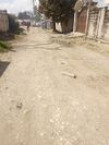
During the field mapping activities, our team will not map roads as these have already been mapped in a previous project and the data has been published here and here. Our team will provide latest photos that represent these roads in Bamako.

Key Value Comment OSM style Street Map Atlas style Drainage Atlas style Flood Extent Atlas style Photo
highway trunk Major arteries, always paved and double-lane with median. Rendering-highway trunk L3005 MF.png Rendering-highway trunk L3005 MF.png Rendering-highway trunk L3005 MF.png Rendering-highway trunk L3005 MF.png Nyere road.jpg
primary Major roads in the city. Always paved. Usually double-lane. Rendering-highway primary neutral.png Rendering-highway primary neutral.png Rendering-highway primary neutral.png Rendering-highway primary neutral.png Kilwa Road.jpg
secondary Connecting roads in the city. Paved, usually single-lane. Rendering-highway secondary neutral.png Rendering-highway secondary neutral.png Rendering-highway secondary neutral.png Rendering-highway secondary neutral.png Kigogo Road.jpg
tertiary Roads connecting the primary and secondary roads into neighbourhoods. Often paved, but not universally so. Rendering-highway tertiary neutral.png Rendering-highway tertiary neutral.png Rendering-highway tertiary neutral.png Rendering-highway tertiary neutral.png Tertiary road.jpg
unclassified Mostly small residential roads in informal neighborhoods. Sometimes paved for the first few meters off the larger roads, but otherwise unpaved. Not usually gridded, rather meandering. Rendering-highway unclassified.png Rendering-highway unclassified.png Rendering-highway unclassified.png Rendering-highway unclassified.png Unclassified road in Kivulini.jpg
residential Small residential roads in planned neighbourhoods. Usually arranged in a recognisable grid. Sometimes paved for the first few meters off the larger roads, but otherwise unpaved. Rendering-highway residential.png Rendering-highway residential.png Rendering-highway residential.png Rendering-highway residential.png Residential road.jpg
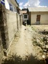
footway Walking (or in a pinch, cycling or motorcycling) paths through neighbourhoods. Tend to meander between buildings. Too narrow and rough for car traffic. Path osm.png Path osm.png Path osm.png Path osm.png Footway.jpg
Key Value Comment Example image
name [Name of Street] Street name. If formal, recorded as: Lukuledi street.jpg
name:informal [Name of Street] Used in case there is no formal name allocated to the street, but the residents have an informal name or descriptor (usually a well-known landmark or the name of a high-profile family or resident of the street).
surface asphalt Tarmac, blacktop pavement. Chestnut Mt Rd, asphalt.jpg
concrete Cement mixed with rocks and sand.
unpaved Dirt, gravel, or sand. Unpaved road, Tanzania.jpg
cobblestones Small squared stones arranged in a relatively level surface
smoothness good Possible to drive consistently at the speed limit without worrying about imperfections Smoothness-Good.jpg
intermediate Occasional imperfections requiring caution or slow passage Smoothness Intermediate.jpg
bad Many imperfections, not possible to drive consistently at the speed limit
very_bad Impossible to ever drive at the speed limit, better to use 4-wheel drive Horrible road.jpg
horrible You'll know it when you see it. Horrible.jpg
width [dimension in meters] The distance in meters from one side of the driving surface to the other. N/A
ele:relative [elevation in meters] The elevation of the road surface above the surrounding land N/A
oneway yes (direction of traffic, NOT the number of lane)
no Cars may proceed in either direction
bridge yes Elevated pathway over watercourse
viaduct (add layer=1)
description [text] Optional field; if there is some important attribute of the road not captured in the above fields, this field should be used to briefly describe it. N/A

Solid waste management related infrastructure

Key Value Comment OSM Style Drainage Atlas style Flood Extents Atlas style Government of Mali style
addr:city Bamako
addr:commune Commune I, Commune II, Commune III, Commune IV, Commune V, Commune VI
addr:quartier [Name of quartier]
addr:street [Name of street]
name [Name of facility]
amenity waste_disposal
recycling
waste_basket A single small container for depositing garbage that is easily accessible for pedestrians.
waste_transfer_station
sanitary_dump_station
waste trash For trash/rubbish
organic Compost or food waste
oil For motor oil, diesel and emulsions
plastic
landuse landfill
access yes Indicates a general public access
no Indicates a restricted access
fees yes Indicates payment of fees before dumping of waste
no Indicates no payment of fees for dumping
dump:official yes official
no unofficial
operator <name of operator> Name of operator of facility
operator_type The operator type can be government, private, community, or religious.

Buildings

Key Value Comment OSM style Street Map Atlas style
addr:city Bamako
addr:commune Commune I, Commune II, Commune III, Commune IV, Commune V, Commune VI
addr:quartier [Name of quartier]
addr:street [Name of street]
building residential Functions exclusively or primarily as a residence, without other permanent activities associated with it such as small-scale trading. Many residences have a small kiosk attached to them selling inexpensive items; these should be tagged 'commercial;residential'. Residential building.jpg Makazi.jpg
commercial Functions exclusively or primarily as a place of business, without a permanent resident (a guard sleeping overnight does not count as a residence, even if a mattress is present) Commercial building.png Jengo la Biashara.jpg
commercial;residential Functions as both a residence and a permanent place of business. A common example is a fairly home with a small kiosk out front selling small items. Commercial residential.jpg Jengo la Biashara na makazi.jpg
apartments Contains multiple self-contained units, each with a discrete entry and locks. Distinct from a large family dwelling with multiple rooms, kitchens, etc. Apartment building.jpg Jengo la kupanga kwa makazi.jpg
industrial A business that is primarily engaged in production rather than sales, such as a factory, mill, or workshop. Jengo la kiwanda.jpg Industrial building.jpg
public Belongs to some level of government and is open to the public. Example: city hall, a Ward Office, or the Ministry of Lands office. Public building.jpg Public Building.jpg
school Where children go to learn. Jengo la shule.jpg School building.jpg
utility A public infrastructure site such as a power station or water tower. Jengo.jpg Utility.jpg
construction Any building that is currently incomplete, not in use, and under construction. Does not include a building that is in full use, even if construction appears to be ongoing (many Malian buildings are left incomplete more or less permanently, and are fully occupied despite still having rebar stubs on the roof where construction may resume at some time in the future) This tag should be reviewed after several months (or whenever new imagery is available or a site visit is done) to update if construction is finished. Construction building.jpg Ujenzi.jpg
hospital Where sick people go for treatment. Hospital building.jpg Hospital Building.jpg
clinic Where outpatients are given medical treatment or advice
kitchen Used for cooking or food preparation
service
roof
shed Simple roofed structure used for garden storage, to shelter animals, or as a workshop
office Building used as a place for commercial, professional, or bureaucratic work
church A building used for public Christian worship
chapel A small building or room used for Christian worship in a school, prison, hospital, or large private house
temple Devoted to the worship of a god or gods
cathedral The principal church of a diocese, with which the bishop is officially associated
synagogue Where a Jewish assembly or congregation meets for religious worship and instruction
supermarket Large self-service shop selling foods and household goods
mosque Muslim place of worship
warehouse For storing goods
abandoned deserted or unoccupied
none Not a building

See building:material=* how material of building can be tagged.

Key
building:levels [Number of levels in the building] The ground floor is 1
min_height Height of building from ground to start of floor 1 (In cm)
tourism attraction A building in a very bad or poor condition.
guest_house A building in a good condition, mostly modern buildings.
hotel
others
religion <if a place_of_worship; christian, muslim>
name [Name of Building] N/A
description [Description of Building] Optional: if there is some attribute of the building that is not captured by the above tags, it should be described here.

Flood Risk Management Infrastructure

Drainage segment features

Key Value Comment OSM style Drainage Atlas style Flood Extends Atlas Government of Mali style Photo
addr:city Bamako
addr:commune Commune I, Commune II, Commune III, Commune IV, Commune V, Commune VI
addr:quartier [Name of quartier]
addr:street [Name of stree
geotrace drain_line A geotrace of the feature being mapped
refence_feature_present yes
no
feature_type highway
bridge
highway primary
secondary
tertiary
trunk
residential
service
path
name <name of highway or bridge>
surface asphalt
concrete
gravel
unpaved
smoothness good
intermediate
bad
very_bad
horrible
oneway (direction of traffic, NOT the number of lanes!)
width (in meters of street width)
elevation_from_road <number>
drain_type drain
ditch
culvert
decommisioned
problem_decomissioned_drain <text> Problem with the drain
distance_from_road <number> If the drain is parallel to the road
profile_open open_rectangular For drains
trapezoid
elliptical_trapezoid
rectangular_elliptical
tabulated
profile_closed round For culverts
boxed_rectangular
other ( describe and take photo
multiple_channels yes
no
number_channels <number>
covered yes For drains and ditches
no
cover_type concrete
grating
wood
other
depth <number> in cm, from the lip of the lowest side to the bottom of the drain.
width_boxed <number> For rectangular
bottom_width <number> For trapezoid, tabulated, elliptical_trapezoid
top_width <number> For trapezoid, tabulated, elliptical, elliptical_trapezoid
diameter <number> For closed_round
elliptical_portion_depth <number> For elliptical portion of the drain
covered yes
no
width <number> of meters wide For ditches, drains
depth <number> of meters deep For ditches drains
diameter # of meters in diameter For culverts
material concrete For drains, culverts
rock
steel
plastic
asphalt
other
concrete_smoothness normal For material=concrete
rough
very rough
steel_type corrugated For material=steel
flat
image <photograph of the feature>
comment <text> Anything special or problematic about thedrain

Ditch

This refers to unlined trenches that are part of, or connect to, the city's drainage system.

Key Value Comment OSM style Drainage Atlas style Flood Extents Atlas style Government of Mali style Photo
waterway ditch A small man-made draining waterway, often found along roads. N/A Drain ditch open.jpg
covered yes Ditch is covered by either concrete, wood, steel or grating. N/A N/A
no Ditch is not covered. N/A
blockage dirt Ditch blocked by dirt such as mud or dust. N/A
concrete Ditch blocked by cement concrete. N/A
rubbish Ditch blocked by rubbish such as waste material; refuse or litter. N/A Waste material blockage.jpg
no Ditch flows without any blockage. N/A
width [Number of meters wide] Width of ditch in meters. N/A N/A
depth [Number of meters deep] Depth of ditch in meters. N/A N/A

Drain

The dimensions here are measured using tapes and staffs. Surveyors collect most dimensions in cm, which are then converted into decimal meters prior to placement in OSM in order to maintain consistent units.

Key Value Comment OSM style Sketch Photo
waterway drain Drains are ubiquitous in Dar es Salaam, and are not well-mapped. Challenged include placing drains correctly parallel to roads (GPS tracks tend to meander in and out of the roadway) and identifying various point features (vertical pipes/pools, connections, culverts, incoming building drains, blockages, etc). N/A 2D&3D.png Drain open trapezoid clean.jpg
covered yes Drain covered with either steel, concrete, wood, etc. such that water flows beneath it. N/A Concrete covered drain.png Drain cover concrete panel handles.jpg
no Drain is not covered such that water flowing is visible. N/A Uncovered trapezoid drain.png Drain open trapezoid 3.jpg
covered:material concrete Concrete slab covering drain N/A Concrete Covering Slab.png Concrete covering slab missing.jpg
grating Metal grating or grill; can be seen through but not fallen through N/A Sketch Grating drain Cover.png Drain grating metal covered.jpg
metal Solid metal covering N/A Material covered metal.jpg
wood Wood covering over drains, often made by local residents or businesses N/A Wood cover.jpg
material concrete A building material made from a mixture of broken stone or gravel, sand, cement, and water, which can be spread or poured into moulds and forms a mass resembling stone on hardening. N/A Concrete Material.jpg
steel A hard, strong grey alloy of iron with carbon and usually other elements, used as a structural and fabricating material. N/A
asphalt A mixture of dark bituminous pitch with sand or gravel, used for surfacing the floor of the drain. N/A
sand A substance that consists of very small grains of rock, found on beaches and in deserts. N/A Sand material drainage.jpg
plants Include grasses, rushes, etc. used as covering material or as a base. N/A
trees Usually wood; is a product of trees, and sometimes other fibrous plants, used for construction purposes when cut or pressed into lumber and timber. N/A
gravel A loose aggregation of rock fragments usually used to make concrete. N/A
blockage grass Drain blocked by grass. N/A Grass blockage.jpg
concrete Drain blocked by concrete. N/A Concrete blockage drainage.jpg
solid_waste Drain blocked by waste such as waste material; refuse or litter. N/A Point blockage solid waste.jpg
no Drain flows without any blockage. N/A Drain no blockage.jpg
width [Number of meters wide] If profile is rectangular or boxed_rectangular N/A N/A N/A
width_top [Number of meters wide at top] If profile is trapezoidal or elliptical N/A N/A N/A
width_bottom [Number of meters wide at bottom] If profile is trapezoidal N/A N/A N/A
depth [Number of meters deep] Depth of drain from the from top to bottom in meters N/A N/A N/A
profile open_rectangular A drain profile that is rectangular in shape and is open. The top and bottom width are always the same. N/A Rectangular drain profile.png Drain rectangular concrete.jpg
tabulated A drain profile with multiple angles; to measure the cross-sectional area several widths are necessary along with depth. N/A Tabulated drains.png Tabulated drain.jpg
trapezoid A drain profile with a flat bottom where the top width is larger than the bottom width. N/A Trapezoid profile.png Drain trapezoid silted high sides.jpg
elliptical A drain profile which appears as an elongated circle, stretched into an oval. An elliptical drain has a concave, curved bottom (usually made from curved concrete slabs). N/A Elliptical drain profile 2.png Elliptical drain.jpg
trapezoid_elliptical Not very common in Dar es Salaam; essentially a trapezoidal drain with a concave, curved bottom (usually made from curved concrete slabs). To measure the cross-sectional area the top and bottom width of the trapezoidal section must be measured (the bottom width being along the imaginary line across the top of the elliptical section), and two depth measurements: the overall depth and the depth of the elliptical section only (from the imaginary line across the top of the elliptical section to the bottom of the drain). N/A Trapezoid elliptical drain profile.png
Trapezoid with elliptical base.png
ele [Elevation - Number of meters above sea level] Cannot be reliably assessed by OSM mappers, therefore we use ele:relative_to_road (see below). If and when a Digital Elevation Model (DEM) is available, elevation will be calculated. N/A N/A N/A
ele:relative_to_road [elevation difference to nearest road surface in meters] As OSM mappers do not usually have a method of measuring absolute elevation with the precision required for a drain, we measure the elevation difference to the nearest road surface. If and when a Digital Elevation Model (DEM) is available, the road surfaces tend to be fairly accurate and can then be used to calculate the absolute elevation of the nearby drain using this difference. N/A N/A N/A

Underground drain

Note: it may not be obvious that an underground drain can be mapped! However, often a culvert or a short segment of drain that passes through an obstacle can be mapped by looking at the start and endpoints. In the event that the trajectory of an underground drain cannot be reliably assessed, only the start and endpoints will be taken as point features (see next table).

Key Value Comment OSM style Sketch Photo
waterway drain it is complex N/A N/A
tunnel yes N/A
culvert If feature is a culvert N/A Culvert Tunnel.png Culvert2.jpg
layer -1 If feature is underground and is below the ground level which is usually 1. N/A N/A N/A
profile round Culvert profile is round and diameter width measured in meters. N/A Round profile.png Round culvert entrance.jpg
boxed_rectangular Culvert profile is rectangular and width is measured in meters N/A Boxed Rectangular.png Rectangular culvert.jpg
channels [integer number of channels - only needed if more than 1 channel] Often rather than a single culvert pipe, large drains widen out before passing through a roadway, and have multiple pipes/channels. If they are identical in profile and size, it is easier for hydrologists to manage if the crossing is simply labelled as multi-channel, rather than attempting to map all channels as separate lines. N/A Multipe channel.png Drain culvert multichannel.jpg
diameter [Number of meters in diameter] if profile is round N/A N/A N/A
width [Number of meters width] if profile is boxed_rectangular N/A N/A N/A
height [Number of meters height] if profile is boxed_rectangular N/A N/A N/A
material concrete A building material made from a mixture of broken stone or gravel, sand, cement, and water, which can be spread or poured into moulds and forms a mass resembling stone on hardening. N/A Concrete culvert.jpg
steel_corrugated A building material composed of sheets of hot-dip galvanised mild steel, cold-rolled to produce a linear corrugated pattern in them. N/A Culvert metal blockage partial.jpg
steel_smooth N/A
blockage dirt Underground drain blocked by dirt such as mud or dust. N/A
concrete Underground drain blocked by cement concrete. N/A
solid_waste Underground drain blocked by waste such as waste material; refuse or litter. N/A
no Underground drain flows without any blockage. N/A
ele [Elevation - Number of meters above sea level] Cannot be reliably assessed by OSM mappers, therefore we use ele:relative_to_road (see below). If and when a Digital Elevation Model (DEM) is available, elevation will be calculated. N/A N/A N/A
ele:relative_to_road [elevation difference to nearest road surface in meters] As OSM mappers do not usually have a method of measuring absolute elevation with the precision required for a drain, we measure the elevation difference to the nearest road surface. If and when a Digital Elevation Model (DEM) is available, the road surfaces tend to be fairly accurate and can then be used to calculate the absolute elevation of the nearby drain using this difference. N/A N/A N/A

Drainage point feature

There are a number of features along drains in Bamako that occur at a specific point rather than along the whole line segment. These include features such as silt traps, small-diameter entry pipes from nearby buildings, bridges, pump sites, culvert entries, or areas in need of repair. These are nodes, rather than lines, and may or may not be rendered in the street map or atlas styles.

Key Value Comment Photo
addr:city Bamako
addr:commune Commune I, Commune II, Commune III, Commune IV, Commune V, Commune VI
addr:quartier [Name of quartier]
addr:street [Name of street]
waterway drain:silt_trap Vertically-walled pools, somewhat deeper than the drains themselves, where water slows down and silt settles in a single spot where it is easily removed. Silt trap.jpg
drain:culvert_entrance Point where a drain goes underground - to be used where the culvert cannot be mapped as a line segment (as when the culvert is too long to reliably know where it goes underground). If the culvert can be reliably mapped as a line segment, that should be done instead of using this tag. Drain Culvert entrance.jpg
drain:outflow Point where a drain empties into a water body such as a stream, river, lake, or ocean. Drain Outflow.jpg
drain:ends A place where a drain appears to stop without any outflow (on the downhill side)
drain:begins A place where a drain or ditch begins (on the uphill side)
drain:pipe_inflow Drains frequently have small-gauge pipes entering them from nearby buildings. Pipe inflow.jpg
drain:building_drain A place where a building's drainage outflow (a drain, not a pipe) enters the drain Building drain.jpg
drain:bridge A small pedestrian bridge where people can cross the drain. This tag specifically refers to a bridge that is not part of an existing road or track (if the bridge is part of an existing road or footway trace, it does not need to be rendered as a point feature). May be concrete, as in the case of those installed by the drain installers, or a wooden structure placed by local residents or businesses. Walkway over drain concrete.jpgWalkway wooden bridge pedestrian.jpg
drain:crossing Any crossing that hasn't been identified in some other way (i.e. not a culvert or ditch).
drain:needs_repair A damaged or blocked drain that needs to be repaired.
ele:relative_to_road [elevation difference to nearest road surface in meters] As OSM mappers do not usually have a method of measuring absolute elevation with the precision required for a drain, we measure the elevation difference to the nearest road surface. If and when a Digital Elevation Model (DEM) is available, the road surfaces tend to be fairly accurate and can then be used to calculate the absolute elevation of the nearby drain using this difference. N/A

Water points

Key Value Comment OSM style Atlas style
addr:city Bamako
addr:commune Commune I, Commune II, Commune III, Commune IV, Commune V, Commune VI
addr:quartier [Name of quartier]
addr:street [Name of street]
amenity drinking_water Provides potable water consumption Drinking-water-16.svg
water_point Provides water used for other domestic purposes, not drinking Water point OSM.png
name [name of water point]
facility_nature man_made Man made water point
natural Natural water point
man_made water_tower Structure with a water tank at an altitude to increase pressure in water network. Water-tower-16.svg
water_well A structural facility to access ground water, created by digging or drilling. N/A
water_tap Is a man-made construction providing access to water, supplied by centralized water distribution system. Publicly usable press button water tap. N/A
bore_hole Mechanically drilled borehole providing water by a motorized engine or hand pump N/A
protected_spring A spring with construction to protect it from external dirt N/A
water_works A place where drinking water is found and applied to the local waterpipes network. N/A
pump powered A well that has a powered pump where water is drawn using a electric or gasoline powered pump. These wells are usually either drilled or bored and fitted with a pipe that the pump can draw from. N/A
manual A well that has a human powered pump. These wells are usually either drilled or bored and fitted with a pipe. N/A
no A generic open hand-drawn well where water is drawn without a pump. Typically dug wells where water is drawn using buckets that are pulled by hand. N/A
natural creek N/A
stream A naturally-forming waterway that is too narrow to be classed as a river. N/A
spring A place where ground water flows naturally from the ground Spring-14.svg
water A broad category covering the cosatline, the marine environment including marine navigation; also waterways and water management. N/A
drinking_water yes Indicates whether a feature provides drinking water, respectively whether water is drinkable for humans and animals. Drinking-water-16.svg
no Indicates that a feature does not provide drinking water, respectively whether water is drinkable for humans and animals. N/A
operational_status operational Current status of a feature is operational/operating.
needs_maintenance Current status of a feature is in need of maintenance.
closed Current status of a feature is closed.
out_of_order Current status of a feature is out of order.
fee yes, no Whether a fee is charged to use the facility

Sanitation facilities (toilets in public facilities)

Key Value Comment OSM style Atlas style Government of Mali style
addr:city Bamako
addr:commune Commune I, Commune II, Commune III, Commune IV, Commune V, Commune VI
addr:quartier [Name of quartier]
addr:street [Name of street]
amenity toilets A publicly accessible toilet. Toilets-16.svg
toilets:disposal flush
pitlatrine A hole or pit into which human excrement is deposited. Known as an outhouse or privy when sheltered by a small building. N/A
toilets:access public explicitly public and open to whoever walks up N/A
permissive(private but access is not restricted) while nominally private, no visible attempt is made to restrict access, and casual use appears to be tolerated by the owners. N/A
customers while open to the public, the clear policy is to require a purchase prior to use. N/A
wheelchair yes Wheelchairs have full unrestricted access N/A
no Wheelchairs have no unrestricted access (e.g. stair only access). N/A
limited Wheelchairs have partial access (e.g some areas can be accessed and others not, areas requiring assistance by someone pushing up a steep gradient). N/A
fee yes a fee is usually charged N/A
no no fee usually charged N/A
name [Name of facility]
operator [Name of operator] For example: "Ilala Municipal Council" or "Tandale Saccos"
opening_hours [Opening hours of toilet] In a 24 hours, ranged format: 08:30­15:45
toilets:handwashing yes
no
toilets:position squat
seated
urinal
seated;
Status of WASH facilities / services  [all questions must have a “I don’t know” item] SDGs definitions / JMP metrics
sanitation yes existence of toilets/latrines

If yes, how many total…/functional

no
facilities yes If yes, type:

IMPROVED: select from list

UNIMPROVED: everything that is not improved

no
level_of_service yes Usable
no
yes Designated for women
no
yes Designated for Menstrual Hygiene Management (MHN)
no
yes Meeting needs for limited mobility
no
handwashing yes Existence of handwashing post/station(s)
no
facilities yes Facility with water and soap
no
water yes Existence of water point
no
facilities improved Type of water point
unimproved
level_of_service yes Available when needed
no
wash_management _package yes Existence of Management Committee dealing with management of WASH issues
no
yes
no
operation_and_maintenance yes Dedicated operator in charge of maintenance and cleaning
no
financing yes Payment of fees (by customer) to access facilities
no
latrine_emptying By whom: manual emptier / truck emptier / other

’How often: …. (in months, could be well above 12)

TO ADD = TRANSPORTATION OF SLUDGE BY EMPTIERS Throughout the District of Bamako. Parking points for trucks waiting for customers

Green space and leisure areas

Key Value Comment OSM style Atlas style Government of Mali style
addr:city Bamako
addr:commune Commune I, Commune II, Commune III, Commune IV, Commune V, Commune VI
addr:quartier [Name of quartier]
addr:street [Name of street]
name <Name of the area>
landuse brownfield Brownfield is a piece of land that has been previously built up and then cleared (a good example is the large field in Ndugumbi where they have been launching the drones).
greenfield Greenfield describes undeveloped land scheduled for development
cemetery Used to mark a cemetery area .
grass A smaller area of mown and managed grass.
park Is an area of open space provided for recreational use, usually designed and in semi-natural state with grassy areas, trees and bushes.
playground These are outdoor (sometimes indoor) areas for children to play. Often they provide equipment such as swings, climbing frames and roundabouts. Playground-16.svg
recreation_ground Often part of a larger park, but are also found in residential areas.
natural water Any body of water, from natural such as a lake or pond to artificial like moat or canal
wetland Ramani Huria's focus is flood resilience, and therefore emphasises mapping historical flood extents. For the moment, we include these in the database as wetlands.
leisure park park, pitch, sport_centre, stadium, nature_reserve, playground, garden,
pitch
sport_centre
stadium
nature_reserve
playground
garden
operator <operator of leisure area>
name <name of open area>
access yes
permissive
opening_hours Example: “Mo-Fr 9:00-17:00”, “Sa, Su 10:00-17:00”
phone_number <phone number of the leisure area>

Education facilities

Key Value Comment OSM style Atlas style Government of Mali style
addr:city Bamako
addr:commune Commune I, Commune II, Commune III, Commune IV, Commune V, Commune VI
add:quartier <name of quartier>
addr:street <name of street>
name <name of facility>
amenity kindergarten A place for looking after preschool children and (typically) giving early education.
school A place where pupils, normally between the ages of about 6 and 18 are taught under the supervision of teachers. This includes primary and secondary schools. School icon.svg
college A place for further education, usually a post-secondary education institution. Maki-college-11.svg
university An educational institution designed for instruction, examination, or both, of students in many branches of advanced learning.
opening_hours <days/time of opening> N/A N/A
location gps coordinate An unique identification number of the facility
contact:phone N/A N/A
operator <name of school operator(operating authority> N/A N/A
operator:type government An education facility that is owned and/or operated by the government.
ngo An education facility that is owned and/or operated by a Non-Governmental Organization.
community An education facility or institution that is owned and/or operated by the community members.
religious An education facility that is owned and/or operated by a religious institution such as church, mosque, etc.
public An education facility that is publicly owned.
private An education facility that is owned and/or operated by a private individual.
religion christian Classify a religious feature (e.g. church) as Christian Christian-16.svg
muslim Classify a religious feature (e.g. a mosque) as Islamic. Muslim-16.svg
sikh Classify a religious feature (e.g. temple) as Sikhism Sikhist-16.svg
hindu Classify a religious feature (e.g. temple) as Hindu Hinduist-16.svg
capacity <number of student/pupills> Disaggregate of boys to girls N/A N/A
fee yes Indicates that this facility charges money for its services or access. N/A N/A
no Indicates that this facility does not charge money for its services or access. N/A N/A
Status of WASH facilities / services  [all questions must have a “I don’t know” item] SDGs definitions / JMP metrics
sanitation yes Existence of toilets/latrines: yes/no

If yes, how many total…/functional

no No existence of toilets/latrines
facilities yes If yes, type: IMPROVED: select from list

UNIMPROVED: everything that is not improved

no No facility
level:service yes Separated boys/girls
no Not separated boys/girls
yes Usable
no Not usable
yes Accessible to handicap
no Not accessible
yes Latrine equipped for menstrual hygiene management
no Latrine not equipped for menstrual hygiene management
yes Practice of open defecation [latrine present but not used]
no No practice of open defecation [latrine present but not used]
handwashing yes Existence of handwashing post/station(s):

How many?

no No handwashing
facilities yes Facility located on school premises
no No facility located on school premises
yes Facility with water and soap
no Facility without water and soap
yes School has daily hand cleaning activities for students
no School do not have daily hand cleaning activities for students
water yes Existence of water point, how many?.
no No existence of water point
facilities improved Type of water point: IMPROVED: select from list

- Piped into facility (SOMAGEP); - Piped onto facility grounds (SOMAGEP); - Public tap/standpipe (SOMAGEP); - Tubewell/Bohole; protected well; rain water; tanker truck

unimproved UNIMPROVED: everything else
level:service yes Water located on school premises
no
yes Water available when needed during school hours [in the last two weeks]
no
WASH_package_management yes Existence of Management Committee dealing with management of WASH issues


no
yes Existing student hygiene club in school
no
maintenance yes Dedicated person for maintenance/cleaning facilities


no
yes Frequency of cleaning: Once a day / at least once a week / less than once a week
no
latrine_emptying By whom: manual emptier / other

’How often: …. (in months, could be well above 12)

financing yes Dedicated fees for WASH regular maintenance
no
yes Latrine emptying when needed
no
yes Major repairs, construction of a new facilities
no
yes ** Financial support by NGO or other partners for: maintenance / major repairs / construction of new facilities: yes/no [for each item]
no
contact:phone <phone number for the school if available>

Health facilities (Hospitals and related health centers)

Key Value Comment OSM style Atlas style Government of Mali style
addr:city Bamako
addr:commune Commune I, Commune II, Commune III, Commune IV, Commune V, Commune VI
addr:quartier [Name of quartier]
addr:street <Name of street>
name <name of facility>
amenity hospital Where sick people go for treatment. Hospital-14.svg Hospitali.png
clinic Provides primary healthcare services. Doctors-14.svg Clinic amenity.jpg
community_health_center
doctors A place you can go to get medical attention or a check up. Doctors-14.svg
dentist A place where a professional dental surgeon who specializes in the diagnosis, prevention, and treatment of diseases and conditions on oral care is stationed. Dentist-14.svg
pharmacy A shop where a pharmacist sells medications. Pharmacy.png
traditional A place that provides traditional medical services. N/A N/A
nature clinic_no_beds Clinic that does not admit patients. N/A N/A
clinic_beds Clinic that admits patients. N/A N/A
first_referral_hospital N/A N/A
second_referral_hospital A hospital which can support licensed physicians in pediatrics, obstetrics, and gynecology, general surgery and other supporting medical services. N/A N/A
tertiary_hospital A hospital that provides tertiary care, which is health care from specialists in a large hospital after referral from primary care and secondary care. N/A N/A
scope all N/A N/A
specialized A hospital that specializes in a certain type of patients to care for example children, cancer, etc. N/A N/A
general_acute_care a branch of secondary health care where a patient receives active but short-term treatment for a severe injury or episode of illness, an urgent medical condition, or during recovery from surgery. In medical terms, care for acute health conditions is the opposite from chronic care, or longer term care. N/A N/A
rehabilitation_care Health care services that helps keep, get back, or improve skills and functioning for daily living that have been lost or impaired because you were sick, hurt, or disabled. N/A N/A
hospice_care Care designed to give supportive care to people in the final phase of a terminal illness and focus on comfort and quality of life, rather than cure. The goal is to enable patients to be comfortable and free of pain, so that they live each day as fully as possible. N/A N/A
ancillary_services operating_theater A room in a hospital in which surgical operations are performed. N/A N/A
laboratory Is where clinical pathology tests are carried out on clinical specimens to obtain information about the health of a patient to aid in diagnosis, treatment, and prevention of disease. N/A N/A
imaging_equipment An equipment used for creating visual representations of the interior of a body for clinical analysis and medical intervention, as well as visual representation of the function of some organs or tissues (physiology). N/A N/A
intensive_care_unit A special department of a hospital or health care facility that provides intensive treatment medicine for patients who are seriously ill, very badly injured, or who have just had an operation. N/A N/A
emergency_department A medical treatment facility specializing in emergency medicine, the acute care of patients who present without prior appointment. Its purpose is to treat critically ill patients and to prevent cardiac arrest in patients presenting with signs of physiological instability. N/A N/A
activities medicine The science or practice of the diagnosis, treatment, and prevention of disease (in technical use often taken to exclude surgery). N/A N/A
surgery The treatment of injuries or disorders of the body by incision or manipulation, especially with instruments. N/A N/A
maternal_care The health of women during pregnancy, childbirth, and the postpartum period. It encompasses the health care dimensions of family planning, preconception, prenatal, and postnatal care N/A N/A
pediatric_care Deals with the health and medical care of infants, children, and adolescents from birth up to the age of 18. N/A N/A
mental_care Relating to services devoted to the treatment of mental illnesses and the improvement of mental health in people with mental problems. N/A N/A
social_care Provides social work, personal care, protection or social support services to children or adults in need or at risk, or adults with needs arising from illness, disability, old age or poverty. N/A N/A
bed_count (for hospitals,clinics;the number of beds) The number of beds in a hospital, clinic, dispensary, etc. N/A N/A
patients <number of patients per day - average> The number of patients per day, disaggregated (male/female)
emergency yes Used to indicate to indicate whatever given hospital is equipped to deal with emergencies. N/A N/A
no Used to indicate to indicate whatever given hospital is not equipped to deal with emergencies. N/A N/A
dispensing yes A pharmacy with a dispensing pharmacist able to sell prescription drugs as well as over the counter drugs. Pharmacy nondispensing.png N/A
no A pharmacy with a pharmacist that does not fill prescriptions, but does sell pharmacist-only drugs. N/A N/A
opening_hours <days/times of opening> N/A N/A
location (gps coordinate) <GPS Coordinates> Identification number
operator <name of operator (operating authority)> N/A
operator:type government A healthcare center that is operated by the government. N/A N/A
ngo A healthcare center that is operated by an NGO. N/A N/A
community A healthcare center that is operated by the community. N/A N/A
religious A healthcare center that is operated by a religious facility such as church or mosque. N/A N/A
public A healthcare center that is operated by the public. N/A N/A
private A healthcare center that is privately owned. N/A N/A
healthcare:specialty community The healthcare facility that provides services to a specific community. N/A N/A
emergency A healthcare facility that deals with emergency services. N/A N/A
general A healthcare facility that has generalized its services N/A N/A
women A healthcare facility that specializes its services to women. geriatrics, mental_health, social_care N/A N/A
traditional A traditional healthcare facility. N/A N/A
geriatrics Relating to old people, especially with regard to their healthcare.
mental_health A mental healthcare facility
social_care A social healthcare facility
paediatrics A health care facility that specializes in providing services to children. N/A N/A
emergency yes
no
staff_count:doctors <number of doctors at the facility>
staff_count:nurses <number of nurses at the facility>
contact:phone
Status of WASH facilities / services  [all questions must have a “I don’t know” item] SDGs definitions / JMP metrics
sanitation yes Existence of toilets/latrines, how many total…/functional
no
facilities yes If yes, type:

IMPROVED: select from list

UNIMPROVED: everything that is not improved

no
level:service yes Usable
no Not usable
yes Designated for women
no
yes Designated for Menstrual Hygiene management(MHN)
no
yes Designated for staff
no
yes Meeting needs for limited mobility
no
sludge_management By whom: manual emptier / truck emptier / other

‘How often: ... (in months, could be well above 12)

handwashing yes Existence of handwashing post/station(s) at point of care

If yes, how many?

no
facilities yes Station with basin, soap and water / OR with alcohol-based hand rub
no
yes Station within 5 meters of toilets (yes/no)
no
water yes Existence of water point: yes/no
no
facilities IMPROVED Type of water point: IMPROVED: select from list
UNIPROVED Everything else
level:service yes Located on healthcare premise
no
yes Available when needed: yes/no
no
WASH package management, O&M and financing Existence of Management Committee including WASH issues: yes/no

** Committee own funding for major repairs, construction of new facilities: yes/no

*** Financial support by NGO or other partners for: maintenance / major repairs / construction of new facilities: yes/no [for each item]

Cleaning of toilets yes Dedicated staff in charge of cleaning (yes/no) / maintenance (yes/no)

Frequency of cleaning: everyday / at least once a week / less than once a week

no
Latrine emptying - By whom: manual emptier / truck emptier / other

’-How often: …. (in months, could be above 12)

Description <additional comments about the facility if any>

Places of worship

Key Value Comment OSM style Atlas style Government of Mali style
addr:city Bamako
addr:commune Commune I, Commune II, Commune III, Commune IV, Commune V, Commune VI
addr:quartier <Name of quartier>
addr:street <Name of street>
name <name of the place_of worship>
amenity place_of_worship This covers mosques, churches, cathedrals, synagogues, temples, etc.
religion christian Classify a religious feature (e.g. church) as Christian Christian-16.svg
muslim Classify a religious feature (e.g. a mosque) as Islamic. Hinduist-16.svg
buddhist Describes that a feature is related to buddhism Buddhist-16.svg
jewish Classify a religious feature (e.g. church) as Jewish Jewish-16.svg
hindu Classify a religious feature (e.g. temple) as Hindu Hinduist-16.svg
sikh Classify a religious feature (e.g. temple) as Sikhism Sikhist-16.svg
denomination catholic Classify a Christian facility under the Roman Catholic denomination. N/A N/A
orthodox Classify a Christian facility under the Orthodox denomination. N/A N/A
protestant Classify a Christian facility under the Protestant denomination. N/A N/A
pentecostal Classify a Christian facility under the Pentecostal denomination. N/A N/A
sunni Classify a Muslim facility under the Sunni denomination. N/A N/A
shia Classify a Muslim facility under the Shia denomination. N/A N/A
sufi Classify a Muslim facility under the Sufi denomination. N/A N/A
building cathedral A building that was built as a cathedral. which contains the seat of a bishop.
mosque A building that was built as a mosque.
chapel A building that was built as a chapel often pretty small. One can enter in it to pray or meditate..
church A building that was built as a church.
shrine
temple
santuary
synagogue
service_times <time of services>
phone_contact <phone_contact of the place_of_worship>

Shops / business centers

See this page for an overview

Offices

Key Value Comment OSM style Atlas style Government of Mali style
addr:city Bamako
addr:commune Commune I, Commune II, Commune III, Commune IV, Commune V, Commune VI
addr:quartier <Name of quartier>
addr:street <Name of street>
name <Name of office>
office government An office of a national, regional or local government agency or department. N/A N/A
company An office of a private company. N/A N/A
political_party An office of a political party. N/A N/A
ngo An office for a non-government organisation. N/A N/A
charity An office of a charitable organization. N/A N/A
estate_agency Arranges the selling, renting, or management of properties and other buildings. N/A N/A
telecommunication An office for a telecommunication company N/A N/A
travel_agent An office providing travel related products and services N/A N/A
lawyer An office for a lawyer, solicitors, notaries, attorneys and many other local variations. N/A N/A
insurance An office at which you can take out insurance policies. N/A N/A
operator <operator of office>
opening_hours
contact:phone
website text Website of office if available
description

Financial facilities

Key Value Comment OSM Style Atlas style Government of Mali style
addr:city Bamako
addr:commune Commune I, Commune II, Commune III, Commune IV, Commune V, Commune VI
addr:quartier <Name of quartier>
addr:street <Name of street>
name <Name of facility>
amenity mobile_money_agent Uses e-money in cashing out money for customers. N/A N/A
bureau_de_change An office that exchanges foreign currency and travellers cheques. Bureau de change-14.svg
bank Business that lends money at interest and provides interest on deposits, as well as providing other financial services. Bank-16.svg Bank.png
microfinance_bank Provides microloans to poor entrepreneurs and small businesses lacking access to bank and related services. N/A N/A
atm Automated Teller Machine where people can withdraw cash using a card or mobile money account. Atm-14.svg ATM.png
saccos Savings and Credit Co-Operative Society - save money and to make loans to each other in the group at reasonable rates of interest. N/A N/A
money_transfer A place that offers money transfers, especially cash to cash N/A N/A
post_office A place where letters and parcels may be sent or collected. N/A N/A
operator Banque Centrale des Etats de l’Afrique de l’Ouest (BCEAO) "Central Bank of African States" N/A N/A
Banque de Développement du Mali (BDM) “Development Bank of Mali” N/A N/A
Banque Internationale pour le Mali (BIM) “International Bank for Mali” N/A N/A
Banque Malienne de Crédit et de Dépôts (BMCD) “Malian Bank for Credit and Deposits” N/A N/A
Bank of Africa (BOA) N/A N/A
Banque Nationale de Développement Agricole (BNDA) “National Bank of Agriculture Development” N/A N/A
Banque de l’Habitat du Mali (BHM) “Bank of Housing of Mali” N/A N/A
network Visa Processes payments between the banks of merchants and the card issuing banks or credit unions of the purchasers who use the "Visa" brand debit, credit and prepaid to make purchases. N/A N/A
MasterCard Processes payments between the banks of merchants and the card issuing banks or credit unions of the purchasers who use the "Mastercard" brand debit, credit and prepaid to make purchases. N/A N/A
Maestro A multi-national debit card service owned by Mastercard, its cards are obtained from associate banks and can be linked to the cardholder's current account, or they can be prepaid cards N/A N/A
Interswitch A provider of secure electronic payment solutions (e-payment) N/A N/A
Western Union It provides various options to receive funds including cash at an agent location, direct to a bank account or to a mobile phone, where available. For transactions to a bank account or to a mobile phone Western Union will transfer the funds to the account information provided by the Sender. N/A N/A
MoneyGram A money transfer service similar to Western Union and it uses cash, credit or debit card, or a bank account to give MoneyGram the money. There are also fees added on depending on the method of transaction and also the location of the money's destination. N/A N/A
<if atm>

visa,mastercard,maestro,interswitch, other?

N/A N/A
mobile money Orange, malitel
opening_hours Example: “Mo-Su 08:00-22:00”, “24/7”, “Mo-Fr 08:30-20:00; Sa,Su 08:00-15:00”

Entertainment centers

Key Value Comment OSM style Atlas style Government of Mali style
addr:city Bamako
addr:commune Commune I, Commune II, Commune III, Commune IV, Commune V, Commune VI
addr:quartier <Name of quartier>
addr:street <Name of street>
amenity arts_center Centre is a functional community centre with a specific remit to encourage arts practice and to provide facilities such as theatre space, gallery space, venues for musical performance, workshop areas, educational facilities, technical equipment, etc. N/A N/A
casino A public room or building where gambling games are played
cinema A theatre where films are shown for public entertainment
lottery Form of gambling that involves the drawing of numbers at random for a prize
studio Where cinema film, musical or sound recordings are made or produced
theatre Where plays and other dramatic performances are given
social-center
community_center
operator <name of operator>
opening_hours
phone_contact

Hotels

Keys Value Comment OSM style Atlas style Government of Mali style
addr:city Bamako
addr:commune Commune I, Commune II, Commune III, Commune IV, Commune V, Commune VI
addr:quartier <Name of quartier>
addr:street <Name of street>
tourism hotel Establishment that provides paid lodging on a short-term basis. Facilities provided inside a hotel room may range from a modest-quality mattress in a small room to large suites with bigger, higher-quality beds, a dresser, a refrigerator and other kitchen facilities, upholstered chairs, a flat screen television, and en-suite bathrooms. N/A
guest_house
motel
name <name of hotel> N/A
opening_hours Example: “24/7”, “Su-Sa 8:00-22:00” N/A
rooms <number of rooms>
beds <number of beds>
star <rating of the hotel>
internet_access yes
no
swimming_pool yes
no
gym yes
no
service:rental shutlle
website <hotel website> Hotel website, if available
operator <name of operator>

Restaurant and bars

Key Value Comment OSM style Atlas style Government of Mali style
addr:city Bamako
addr:commune Commune I, Commune II, Commune III, Commune IV, Commune V, Commune VI
addr:quartier <Name of quartier>
addr:street <Name of street>
amenity restaurant Business that prepares and serves food and drinks to customers. Meals are generally served and eaten on the premises, but many restaurants also offer take-out and food delivery services. N/A N/A
bar A place, sometimes within a restaurant, where alcoholic drinks are served, or a long, high table in such a place along which people stand or sit while drinking N/A N/A
pub An establishment for the sale of beer and other drinks, and sometimes also food, to be consumed on the premises. N/A N/A
fast_food Mass-produced food designed for commercial resale and with a strong priority placed on "speed of service" versus other relevant factors involved in culinary science N/A N/A
operator <name of operator>
opening_hours
seating_capacity “0-15”, “15-25”, “25-50”, “50 or above”
cuisine african
western
specialty
brewery
delivery:service yes
no
takeaway yes
no
payment:method cash
atm
mobile_money
internet:connection yes
no
out_door:seating yes
no
phone_contact <phone_contact of restaurant or bar>

Marketplaces

Key Value Comment OSM style Atlas style Government of Mali style
addr:city Bamako
addr:commune Commune I, Commune II, Commune III, Commune IV, Commune V, Commune VI
addr:quartier <Name of quartier>
addr:street <Name of street>
amenity marketplace Public marketplace where goods and services are traded daily or weekly. This kind of market is very old, and countless such markets are still in operation around the whole world. In some places markets are held in buildings called market halls N/A
name <name of marketplace>
operator <name of operator>
organic yes
no
only
opening_hours

Historic heritage (cultural facilities)

Key Value Comment OSM style Atlas style Government of Mali style
addr:city Bamako
addr:commune Commune I, Commune II, Commune III, Commune IV, Commune V, Commune VI
addr:quartier <Name of quartier>
addr:street <Name of street>
historic:heritage building Unspecified historic building.
site
area
monument A memorial object, which is especially large, built to remember, show respect to a person or group of people or to commemorate an event.
name <Name of heritage>
heritage:operator <operator of heritage>
heritage:website
inscription:date <when the object was added to the preservation list>

Electrical Installation

Electrical stations

Transformers

Key Value Comment OSM style Atlas style Government of Mali style
addr:city Bamako
addr:commune Commune I, Commune II, Commune III, Commune IV, Commune V, Commune VI
addr:quartier <Name of quartier>
addr:street <Name of street>
power transformer A passive electrical device that transfers electrical energy from one electrical circuit to another, or multiple circuits
line
substations
plant
generator
terminal
tower
compensator
converter
voltage <operating voltage>
operator <cable operator>
cable <number of conductors>
circuits <number of circuits>

Telecommunication facilities

Key Value Comment OSM style Atlas style Government of Mali style
addr:city Bamako
addr:commune Commune I, Commune II, Commune III, Commune IV, Commune V, Commune VI
addr:quartier <Name of quartier>
addr:street <Name of street>
name <name of facility>
man_made mast A tall upright post on land, especially a flagpole or a television or radio transmitter.
communication_tower
telescope An optical instrument using lenses, curved mirrors, or a combination of both to observe distant objects, or various devices used to observe distant objects by their emission, absorption, or reflection of electromagnetic radiation
antenna
telecom data_center
service_device
distribution point
connection_point
exchange
communication television television, radio, microwave, mobile_phone, gsm
radio
microwave
mobile_phone
gsm
operator <operator of facility>

Fire brigade facilities

Key Value Comment OSM style Atlas style Government of Mali style
addr:city Bamako
addr:commune Commune I, Commune II, Commune III, Commune IV, Commune V, Commune VI
addr:quartier <Name of quartier>
addr:street <Name of street>
amenity fire_station A structure or other area for storing firefighting apparatus such as fire engines and related vehicles, personal protective equipment, fire hoses and other specialized equipment. Fire stations frequently contain working and living space for the firefighters and support staff.
name <name of facility>
operator <operator of facility>
emergency_phone <text>