File:Christmas Island.png
Jump to navigation
Jump to search


No higher resolution available.
Christmas_Island.png (531 × 469 pixels, file size: 38 KB, MIME type: image/png)
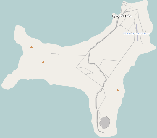
OSM map of Christmas Island
This is a Featured image, which means that it has been identified as one of the best examples of OpenStreetMap mapping, or that it provides a useful illustration of the OpenStreetMap project. If you know another image of similar quality, you can nominate it on Featured image proposals.
Front-page image for week 52 of 2012 (24–30 Dec.).
- Image descriptions
- dansk : OSM kort over Christmas Island (Juleøen) i det Indiske Ocean.
- Deutsch : OSM-Karte der Weihnachtsinsel
- English : OSM map of Christmas Island.
- français : Carte de OpenStreetMap de l'île Christmas
- italiano : La mappa OSM dell'Isola di Natale.
- 中文(简体) : 圣诞岛的开放街图地图。
- 中文(繁體) : 聖誕島的開放街圖地圖。
Licensing
![]()
![]()
![]()
This screenshot contains OpenStreetMap Carto rendering.
The OpenStreetMap Carto map style is made available under the Creative Commons CC-0 1.0 Universal Public Domain Dedication.
- Attribution to the map data:
![]()
Contains map data © OpenStreetMap contributors, made available under the terms of the Creative Commons Attribution-ShareAlike 2.0 (CC-BY-SA-2.0).
File history
Click on a date/time to view the file as it appeared at that time.
| Date/Time | Thumbnail | Dimensions | User | Comment | |
|---|---|---|---|---|---|
| current | 23:03, 24 December 2012 | | 531 × 469 (38 KB) | Wynndale (talk | contribs) | trim |
| 16:28, 24 December 2012 | 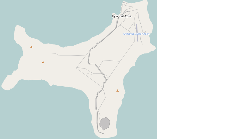 | 768 × 469 (30 KB) | Wynndale (talk | contribs) | OSM map of Christmas Island |
You cannot overwrite this file.