File:DE biergarten - 3D barplot.png
Jump to navigation
Jump to search


Size of this preview: 800 × 545 pixels. Other resolutions: 320 × 218 pixels | 640 × 436 pixels | 988 × 673 pixels.
Original file (988 × 673 pixels, file size: 530 KB, MIME type: image/png)
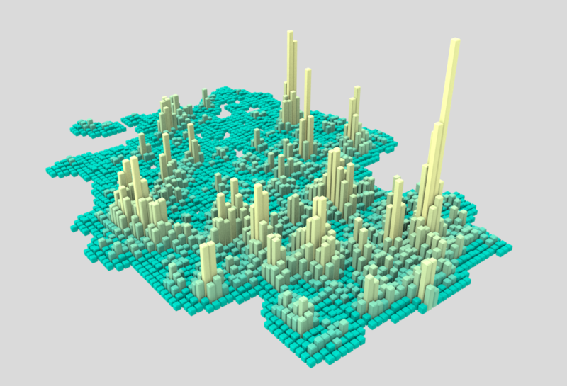
A 3D barplot showing occurrences of biergartens within the OpenStreetMap data for Germany. This and a range of other visualisations were created with this Blender/Python project by Nikolai Janakiev
This is a Featured image, which means that it has been identified as one of the best examples of OpenStreetMap mapping, or that it provides a useful illustration of the OpenStreetMap project. If you know another image of similar quality, you can nominate it on Featured image proposals.
Front-page image for week 22 of 2018 (28 May – 3 Jun.).
- Image descriptions
- English : A 3D barplot showing occurrences of biergartens within the OpenStreetMap data for Germany. This and a range of other visualisations were created with this Blender/Python project by Nikolai Janakiev.
- français : Un graphique à barres 3D montrant les occurrences des biergartens dans les données OpenStreetMap pour l’Allemagne. Ceci fait partie d’une gamme de visualisations créées avec ce projet Blender/Python par Nikolai Janakiev.
- italiano : Un grafico a barre 3D che mostra il numero di biergarten nei dati di OpenStreetMap per la Germania. Questa e una gamma di altre visualizzazioni sono state create con questo progetto Blender/Python di Nikolai Janakiev.
- 中文(简体) : 这张3D 长条图显示德国开放街图的露天酒吧分布状况,这张图和其他图片由openstreetmap-heatmap#gallery Nikolai Janakiev 用Blender/Python 制作的专案
- 中文(繁體) : 這張 3D 長條圖顯示德國開放街圖的 露天酒吧分佈狀況,這張圖和其他圖片由 Nikolai Janakiev 用 Blender/Python 製作的專案
License
![]()
![]()
This work is licensed under the Creative Commons Attribution 4.0 License.
File history
Click on a date/time to view the file as it appeared at that time.
| Date/Time | Thumbnail | Dimensions | User | Comment | |
|---|---|---|---|---|---|
| current | 23:01, 29 May 2018 | | 988 × 673 (530 KB) | Harry Wood (talk | contribs) | Blender/ Python 3D barplot from here https://github.com/njanakiev/openstreetmap-heatmap#gallery |
You cannot overwrite this file.
File usage
The following 10 pages use this file:
- Featured images/Apr-Jun 2018
- Featured images/DE:Apr-Jun 2018
- List of featured images/2018
- Zh-hans:Featured images/Apr-Jun 2018
- Zh-hant:Featured images/Apr-Jun 2018
- Template:Iotw image/2018-22
- DE:Featured images/Apr-Jun 2018
- FR:Featured images/Apr-Jun 2018
- ES:Featured images/Apr-Jun 2018
- IT:Featured images/Apr-Jun 2018