File:Example for Control Zone and reporting points at EDVE.png
Jump to navigation
Jump to search

No higher resolution available.
Example_for_Control_Zone_and_reporting_points_at_EDVE.png (580 × 417 pixels, file size: 27 KB, MIME type: image/png)
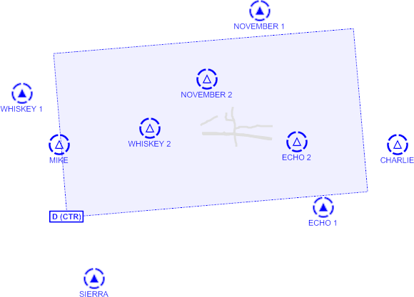
An example for an adapted Kosmos render style to be used for aviation maps with control zones and reporting points
File history
Click on a date/time to view the file as it appeared at that time.
| Date/Time | Thumbnail | Dimensions | User | Comment | |
|---|---|---|---|---|---|
| current | 21:55, 23 May 2009 | | 580 × 417 (27 KB) | TobiBS (talk | contribs) | An example for an adapted Kosmos render style to be used for aviation maps with control zones and reporting points |
You cannot overwrite this file.
File usage
The following 3 pages use this file: