File:London-20061121-bounded.png
Jump to navigation
Jump to search


Size of this preview: 647 × 599 pixels. Other resolutions: 259 × 240 pixels | 518 × 480 pixels | 829 × 768 pixels | 1,105 × 1,024 pixels | 1,280 × 1,186 pixels.
Original file (1,280 × 1,186 pixels, file size: 1.21 MB, MIME type: image/png)
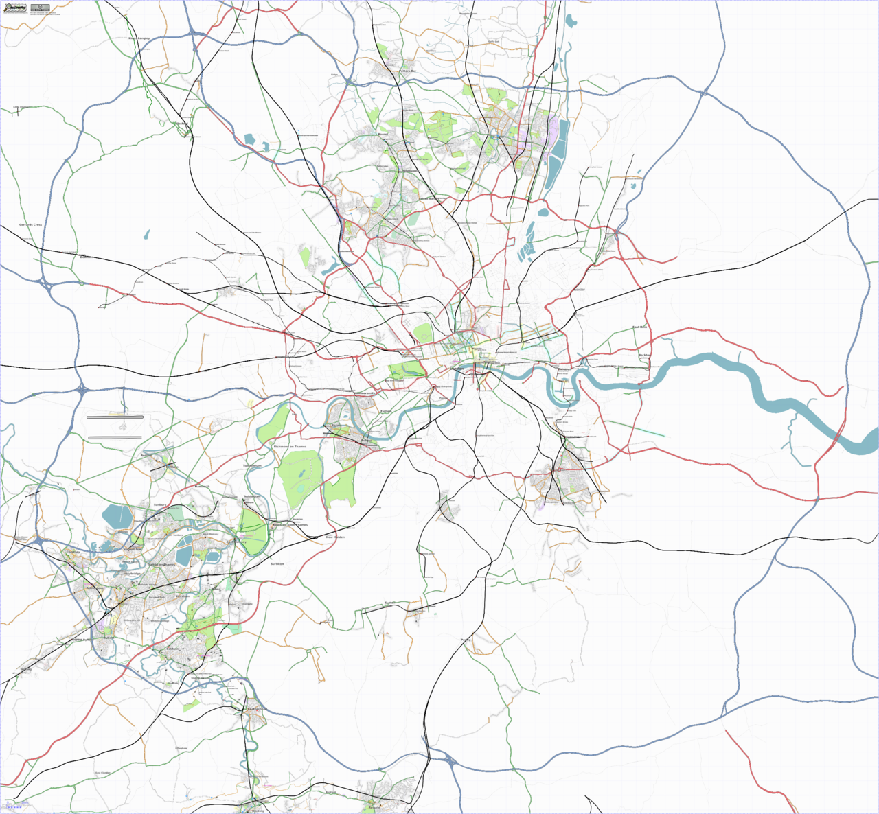
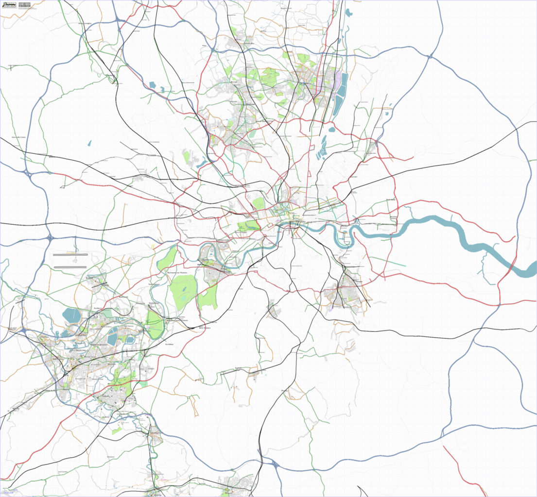
Osmarender of London as at 21/11/2006
Map of London
This map and others like it, were created by OpenStreetmap contributors, and are licensed as Creative Commons CC-BY-SA 2.0 (https://creativecommons.org/licenses/by-sa/2.0/) (see OpenStreetMap licence).
Use {{mapof|PlaceName}} to add this template to your images.
This map and others like it, were created by OpenStreetmap contributors, and are licensed as Creative Commons CC-BY-SA 2.0 (https://creativecommons.org/licenses/by-sa/2.0/) (see OpenStreetMap licence).
Use {{mapof|PlaceName}} to add this template to your images.
This is a Featured image, which means that it has been identified as one of the best examples of OpenStreetMap mapping, or that it provides a useful illustration of the OpenStreetMap project. If you know another image of similar quality, you can nominate it on Featured image proposals.
Front-page image on 25 Nov 2006
![]()
Contains map data © OpenStreetMap contributors, made available under the terms of the Creative Commons Attribution-ShareAlike 2.0 (CC-BY-SA-2.0).
File history
Click on a date/time to view the file as it appeared at that time.
| Date/Time | Thumbnail | Dimensions | User | Comment | |
|---|---|---|---|---|---|
| current | 22:44, 24 November 2006 | | 1,280 × 1,186 (1.21 MB) | 80n (talk | contribs) | Osmarender of London as at 21/11/2006 |
You cannot overwrite this file.
File usage
The following 3 pages use this file: