File:NiceServicesDiversity.jpg
Jump to navigation
Jump to search


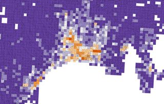
Size of this preview: 800 × 511 pixels. Other resolutions: 320 × 204 pixels | 640 × 409 pixels | 1,200 × 766 pixels.
Original file (1,200 × 766 pixels, file size: 192 KB, MIME type: image/jpeg)
Summary
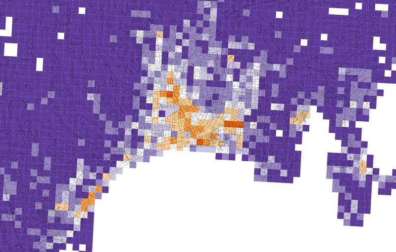
Statistical map of the diversity of retail and services represented on OpenStreetMap in Nice, Alpes-Maritimes, Provence-Alpes-Côte d'Azur, France.
Orange tiles indicate a high diversity of retail and services, while purple tiles indicate a low diversity.
Produced by Alessandro Venerandi: https://twitter.com/dooluoz/status/966658592546881536
This is a Featured image, which means that it has been identified as one of the best examples of OpenStreetMap mapping, or that it provides a useful illustration of the OpenStreetMap project. If you know another image of similar quality, you can nominate it on Featured image proposals.
Front-page image for week 12 of 2018 (19–25 Mar.).
- Image descriptions
- Deutsch : Vielfalt von Einzelhandels- und Dienstleistungsbetrieben in OpenStreetMap in Nice, Alpes-Maritimes, Provence-Alpes-Côte d'Azur, France. Orange Kacheln weisen eine hohe Vielfalt auf während violette Kacheln auf eine geringe Vielfalt hinweisen. Das Bild wurde erstellt von Alessandro Venerandi.
- English : Diversity of OpenStreetMap retail and services in Nice, Alpes-Maritimes, Provence-Alpes-Côte d'Azur, France. Orange tiles indicate a high diversity, while purple tiles indicate a low diversity. Image produced by Alessandro Venerandi.
- français : Diversité sur OpenStreetMap des commerces et services à Nice (Alpes-Maritimes, Provence-Alpes-Côte d'Azur, France). Les carreaux oranges indiquent une diversité élevée, alors que les carreaux violets indiquent une faible diversité. Image produite par Alessandro Venerandi.
- italiano : Diversità di negozi e servizi in OpenStreetMap a Nizza, Alpes-Maritimes, Provence-Alpes-Côte d'Azur, Francia. I quadrati arancioni indicano diversità elevata, mentre quelli viola indicano diversità bassa. Immagine prodotta da Alessandro Venerandi.
- 中文(简体) : 法国普罗旺斯-阿尔卑斯-蔚蓝海岸大区滨海阿尔卑斯省尼斯开放街图零售和服务的多样性,橘色色块显示高密度,白色色块显示低密度,图片由Alessandro Venerandi 制作。
- 中文(繁體) : 法國普羅旺斯-阿爾卑斯-蔚藍海岸大區濱海阿爾卑斯省尼斯開放街圖零售和服務的多樣性,橘色色塊顯示高密度,白色色塊顯示低密度,圖片由 Alessandro Venerandi 製作。
Licensing
![]()
![]()
![]()
This work is licensed under the Creative Commons Attribution-ShareAlike 4.0 License.
Attribution not specified as a parameter! THIS LICENSE ALWAYS REQUIRES ATTRIBUTION! Use {{CC-BY-SA-4.0|Attribution, typically name of author}} See Template:CC-BY-SA-4.0 for full description this template should be used.
Attribution not specified as a parameter! THIS LICENSE ALWAYS REQUIRES ATTRIBUTION! Use {{CC-BY-SA-4.0|Attribution, typically name of author}} See Template:CC-BY-SA-4.0 for full description this template should be used.
File history
Click on a date/time to view the file as it appeared at that time.
| Date/Time | Thumbnail | Dimensions | User | Comment | |
|---|---|---|---|---|---|
| current | 15:46, 23 February 2018 | | 1,200 × 766 (192 KB) | Wille (talk | contribs) | Diversity of OpenStreetMap retail and services in Nice, France. Orange means high diversity of services and purple represents low diversity. |
You cannot overwrite this file.
File usage
The following 10 pages use this file:
- Featured images/Jan-Mar 2018
- List of featured images/2018
- Zh-hans:Featured images/Jan-Mar 2018
- Zh-hant:Featured images/Jan-Mar 2018
- Template:Iotw image/2018-12
- DE:Featured images/Jan-Mar 2018
- FR:Featured images/Jan-Mar 2018
- ES:Featured images/Jan-Mar 2018
- IT:Featured images/Jan-Mar 2018
- JA:Featured images/Jan-Mar 2018