File:OpenMapSurfer-england-2012.png
Jump to navigation
Jump to search

Size of this preview: 800 × 525 pixels. Other resolutions: 320 × 210 pixels | 640 × 420 pixels | 1,024 × 672 pixels | 1,180 × 774 pixels.
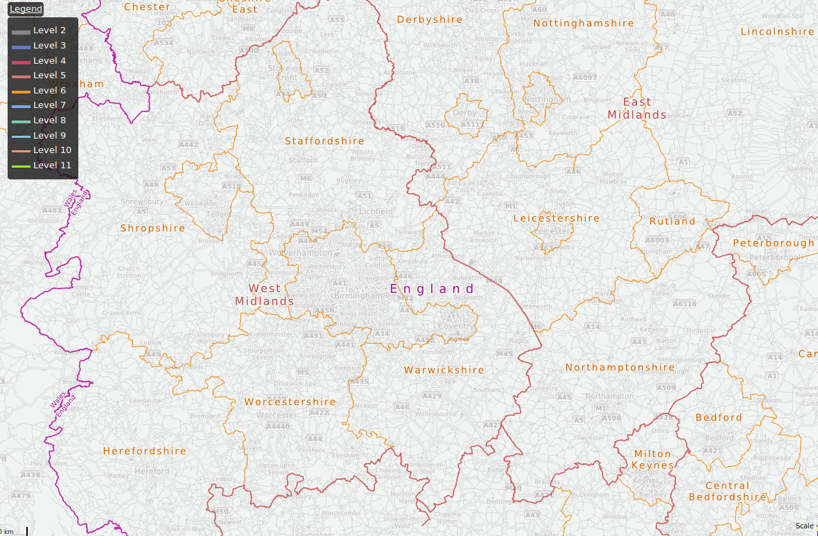
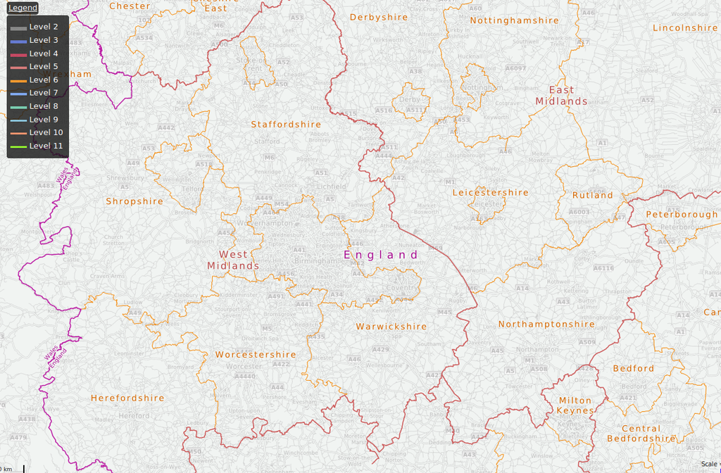
Original file (1,180 × 774 pixels, file size: 1.21 MB, MIME type: image/png)
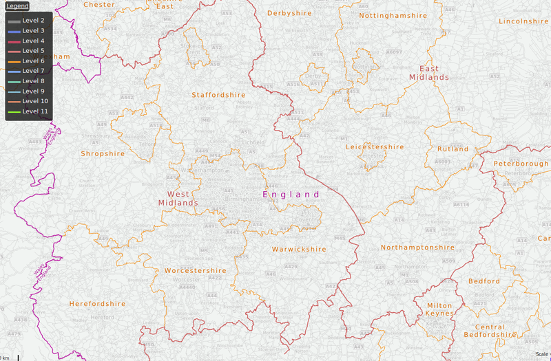
This is a Featured image, which means that it has been identified as one of the best examples of OpenStreetMap mapping, or that it provides a useful illustration of the OpenStreetMap project. If you know another image of similar quality, you can nominate it on Featured image proposals.
Front-page image for week 28 of 2012 (9–15 Jul.).
- Image descriptions
- Deutsch : Verwaltungsgrenzen in England , Ansicht von OpenMapSurfer
- English : Administrative boundaries in England view by OpenMapSurfer
- français : Limites administratives en Angleterre affichées par OpenMapSurfer.
- italiano : Confini amministrativi dell'Inghilterra visualizzati da OpenMapSurfer
- русский : Карта административных границ Англиии, сгенерированная при помощи OpenMapSurfer
- 中文(简体) : OpenMapSurfer 呈现的英格兰行政边界
- 中文(繁體) : OpenMapSurfer 呈現的英格蘭行政邊界
File history
Click on a date/time to view the file as it appeared at that time.
| Date/Time | Thumbnail | Dimensions | User | Comment | |
|---|---|---|---|---|---|
| current | 08:42, 9 July 2012 | | 1,180 × 774 (1.21 MB) | Ojw (talk | contribs) |
You cannot overwrite this file.