OpenMapSurfer
Jump to navigation
Jump to search
| This service was discontinued in June 2020. |
OpenMapSurfer (https://maps.openrouteservice.org) - was a web map service with a couple of maps rendered with MapSurfer.NET. This web map service was developed by Maxim Rylov User:Runge and hosted by the Heidelberg Institute for Geoinformation Technology (a spin-off from GIScience (Geoinformatics) Research Group, Heidelberg University)
Examples
-
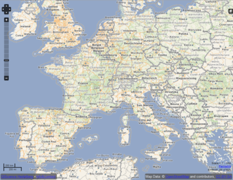 Roads layer (zoom 5)
 -
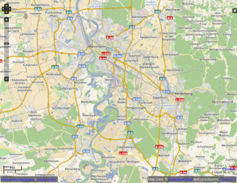 Roads layer (zoom 12)
 -
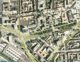 Hybrid layer (zoom 17)
 -
![Roads + hillshade layer (zoom 10) ([1])](/w/images/thumb/3/34/OpenMapSurfer_HillshadeLayer.png/340px-OpenMapSurfer_HillshadeLayer.png) Roads + hillshade layer (zoom 10) ([1])
Roads + hillshade layer (zoom 10) ([1]) -
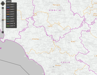 Administrative boundaries (zoom 9)


![Roads + hillshade layer (zoom 10) ([1])](/wiki/File:OpenMapSurfer_HillshadeLayer.png)

Info
- 2020-05-13: The tile API of OpenRouteService (api.openrouteservice.org) will be discontinued in June 2020.
- 2018-02-04: Users of the old API via Heidelberg university need a token to access their data,[1] new users needed to sign up already (free plan available)[2]
- 2012-02-09: Hillshading layer based on ASTER GDEM was added.
- 2012-04-13: A layer with administrative boundaries was added.
Data
The OSM Data of the maps was not been updated after mid 2018.
Help
More information (updates, terms of use) can be found at the forum.