File:SOTM Scotland 2015 drone group photo.png
Jump to navigation
Jump to search

Size of this preview: 765 × 600 pixels. Other resolutions: 306 × 240 pixels | 612 × 480 pixels | 941 × 738 pixels.
Original file (941 × 738 pixels, file size: 1.13 MB, MIME type: image/png)
Summary
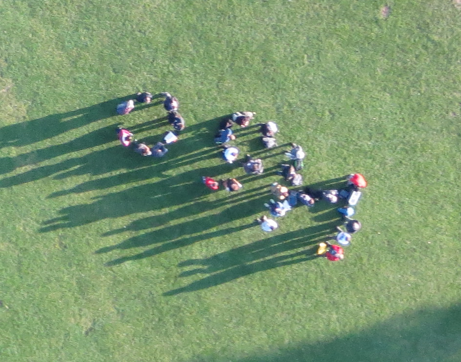
State of the Map Scotland 2015 group photo taken e-bee UAV. Aimee the ebee to be precise. And by Paul Georgie of wearespatial.
Photo (& permission) on twitter: https://twitter.com/wearespatial/status/650765094557773824
Licensing
![]()
![]()
![]()
This work is licensed under the Creative Commons Attribution-ShareAlike 2.0 License.
Attribution not specified as a parameter! THIS LICENSE ALWAYS REQUIRES ATTRIBUTION! Use {{CC-BY-SA-2.0|Attribution, typically name of author}} See Template:CC-BY-SA-2.0 for full description how this template should be used.
Note, there is
There is also
Attribution not specified as a parameter! THIS LICENSE ALWAYS REQUIRES ATTRIBUTION! Use {{CC-BY-SA-2.0|Attribution, typically name of author}} See Template:CC-BY-SA-2.0 for full description how this template should be used.
Note, there is
{{CC-BY-SA-2.0 OpenStreetMap}} for files based on old OSM map data, before the license change made on 2012-09-12.There is also
{{OSM Carto screenshot||old_license}} for files based on old OSM map data, before the license change made on 2012-09-12, created using OSM Carto map style.
File history
Click on a date/time to view the file as it appeared at that time.
| Date/Time | Thumbnail | Dimensions | User | Comment | |
|---|---|---|---|---|---|
| current | 22:33, 4 October 2015 | | 941 × 738 (1.13 MB) | Harry Wood (talk | contribs) | State of the Map Scotland 2015 group photo taken e-bee UAV. [https://twitter.com/eBeeAimee Aimee the ebee] to be precise. And by Paul Georgie of wearespatial. Photo (& permission) on twitter: https://twitter.com/wearespatial/status/650765094... |
You cannot overwrite this file.
File usage
There are no pages that use this file.