File:Rutland Map.png
Jump to navigation
Jump to search


Size of this preview: 632 × 599 pixels. Other resolutions: 253 × 240 pixels | 506 × 480 pixels | 714 × 677 pixels.
Original file (714 × 677 pixels, file size: 656 KB, MIME type: image/png)
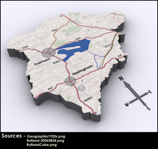
Rutland (14 October) will be the scene of OpenStreetMap's 8th mapping event in the UK, where people from all over the country gather to map a specific area
Merging of the data from the out of date maps, The Current OSM data from the area, and the Schematic Map.
This is a Featured image, which means that it has been identified as one of the best examples of OpenStreetMap mapping, or that it provides a useful illustration of the OpenStreetMap project. If you know another image of similar quality, you can nominate it on Featured image proposals.
Front-page image on 30 Sep 2006
File history
Click on a date/time to view the file as it appeared at that time.
| Date/Time | Thumbnail | Dimensions | User | Comment | |
|---|---|---|---|---|---|
| current | 20:24, 7 September 2006 | | 714 × 677 (656 KB) | Ben (talk | contribs) | Merging of the data from the out of date maps, The Current OSM data from the area, and the Schematic Map. |
You cannot overwrite this file.
File usage
The following 4 pages use this file: