JA:OSMTracker (Android)
![]()
英語版の記事の内容が分かる方は、翻訳の完成にご協力ください。このウィキの翻訳方法についての説明をお読みください。
現時点では、誰もこの記事の翻訳に取り組んでいないようですので、あなたが取り組めます。
![]()
| OSMTracker for Android | |
|---|---|
| 作者: | nguillaumin |
| ライセンス: | GNU General Public License v3 |
| 動作環境: | Android |
| 版数: | 0.6.11 (2015-08-22) |
| 言語: | アラビア語、 デンマーク語、 ドイツ語、 ギリシャ語、 スペイン語、 バスク語、 英語、 フィンランド語、 フランス語、 ガリシア語、 アルメニア語、 イタリア語、 iw、 日本語、 ミャンマー語、 ノルウェー語(ブークモール)、 オランダ語、 ノルウェー語(ニーノシュク)、 ポーランド語、 ポルトガル語、 ロシア語、 スロバキア語、 スウェーデン語、 タイ語、 ウクライナ語 および 中国語 |
| ウェブサイト: | https://github.com/nguillaumin/osmtracker-android |
| インストール: | |
| ソースコード: | git@github.com:nguillaumin/osmtracker-android.git |
|
オフラインの GPS トラッカーで、すばやく POI を配置できるショートカットを持ちます。ウェイポイントは GPX 形式で出力でき、 JOSM での編集に適しています。 OSMTracker (Windows Mobile) の移植版です。 | |
OSMTracker (Github 上) はオフラインの GPS トラッカーで、 points of interest (POI) を地図に追加するために収集するよう設計されています。 OSMTracker のデータは、 JOSM 地図エディタにインポートしやすいよう、ウェイポイントとともに GPX 形式で出力されます。
Windows Mobile 向けの同様のプログラムもあります。
PDA 画面解像度調査
この節は内容の性質上、翻訳していません。調査の内容及び投票は、 OSMTracker (Android)#PDA display resolution survey を参照してください。
スクリーンショット

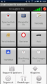
概要
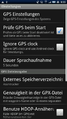
設定
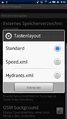
レイアウト変更
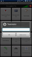
add a notice
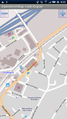
地図と軌跡標示
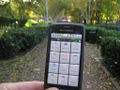
公園内の小道を行く
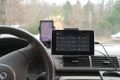
車のダッシュボード上のタブレット

トラックファイルの位置
For each new track, a subdirectory is created in the dedicated OSMTracker directory, which by default is typically on the SD/USB storage in osmtracker/. While pictures and audio annotations are written immediately into this subdirectory, the track itself has to be exported explicitly. To do so, select the track in the tracklist so you see the "Track Details", modify the name if necessary.
Still being in the "Track Details", go to the context menu and select "Export as GPX", and it will be written in the respective subdirectory. Alternatively, touch+hold the respective track name to open a context menu. (Please note that "Save" means not exporting yet. Could the developer please explain where the track is being hold before exporting.) (Edit: I'm not the developer, but it looks to be in a SQLite database if I've skim read the code correctly --EdLoach (talk) 08:02, 19 July 2013 (UTC))
背景の OSM 地図
When the setting "OSM background" is set and an Internet connection exists, the tiles of the current position will be downloaded and shown.
If no connection exists, the map will only be shown if the tiles were previously downloaded. This download can be done offline, the directory path where the tiles are stored is "sdcard/osmdroid/tiles/Mapnik/(zoomlevel)/...". Offline downloaded tiles need to be renamed from "*.png" to "*.png.tile" as a new extension.
ソースからのコンパイル
Be aware that these instructions check out from the SVN repository on Google Code, which may no longer contain the latest version. Consider using git clone https://github.com/nguillaumin/osmtracker-android.git instead.
 svn checkout http://osmtracker-android.googlecode.com/svn/trunk/ osmtracker
 android update project --name Osmtracker --target android-3 --path osmtracker
 cd osmtracker
 ant (debug|release)