Key:feeding:type
Jump to navigation
Jump to search
| Description |
|---|
| A tag to refine an object mapped with amenity=feeding_place |
| Group: animals |
| Used on these elements |
| Requires |
| Status: in use |
| Tools for this tag |
|
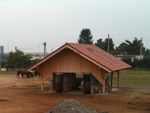
To further refine an element tagged with amenity=feeding_place use feeding:type=*.
Values
The list isn't fixed; it can be extended by additional values if needed. Please discuss them in the comments before adding them to this page.
| Value | Comment | Photo |
|---|---|---|
| manger | A structure used to hold food to feed animals. | 
|
| automated | An automated feeding station for animals. | 
|
