Lincoln
| V・T・E |
| latitude: 53.22, longitude: -0.54 |
| Browse map of Lincoln 53°13′12.00″ N, 0°32′24.00″ W |
| Edit map |

|
|
External links:
|
| Use this template for your locality |
Lincoln is a city in Lincolnshire at latitude 53°13′12.00″ North, longitude 0°32′24.00″ West.
City centre about 30% done (Ojw)
Nearby:
Areas of Lincoln
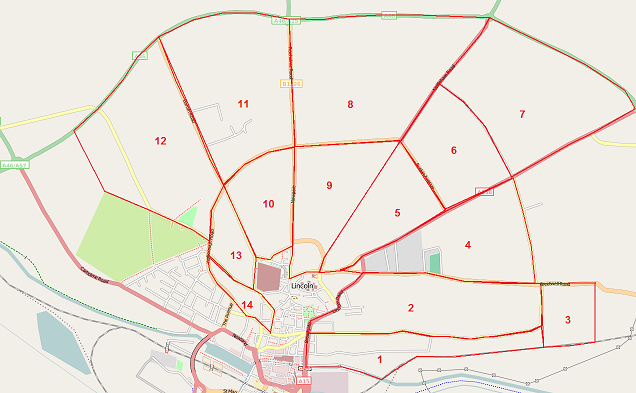
EdLoach visited Lincoln on 17th January 2009 and before visiting prepared a map of areas he wished to target. Many of the streets in the area numbered 1 were mapped on that visit, as were some of those in area 2, traced by car in about 2 hours. The map is uploaded here in case anyone else finds themselves in Lincoln and fancies picking an area, or if anyone fancies organising a mapping party the marked areas seem fairly manageable. Apologies for the qualities of the red lines, but my artistic skills are lacking.
Lincoln Projects
Please feel free to update and add to this section as required.
Roads
Roads are well mapped within Lincoln, well aligned in general. However most roads only have highway & name tags, lacking sidewalk, speed limit & lit tags.
Most cycleways are well mapped within the city too
Rail
- Alignment of rail with satellite imagery:
- Sleaford - Lincoln - Gainsborough line - complete
- Newark - Lincoln - Grimsby line - complete
Waterways
- Alignment of riverbanks with satellite imagery:
- River Witham - Incomplete
- Fosdyke Navigation - Incomplete
- Brayford Pool - Incomplete

