OSM Mapper
When Ito World first started delivering tools for OpenStreetMap (OSM), there were very few options on the market. Since that time, many new tools and companies have focused on serving the OSM community. As a result, Ito World has decided to withdraw its OpenStreetMap Tools.
We’d like to take this opportunity to thank everyone who has used these tools over the past 8 years and would like to encourage everyone to keep contributing to OSM.
Alternative services you may wish to look at include https://www.geofabrik.de and https://www.mapbox.com. For more information about OSM data, please visit https://learnosm.org/en/ or https://wiki.openstreetmap.org/.
OSM Mapper (http://product.itoworld.com/product/osm/map) was a free to use product that allows areas of OSM data to be monitored and analysed. Produced by ITO World with support from Ideas in Transit.

Features
- Monitoring changes to OSM data within a defined area
- See who is doing edits and where
- Subscribe using RSS to be kept informed about changes
- Generate images on the fly for usage of particular tags
- Generate lists of street names
- Full planet coverage
- Updated roughly weekly with the latest published planet file.
Note that:
- Point features are currently only available in the UK. These will be available soon elsewhere.
- You will not be warned about deleted features
If you have suggestions about how to improve OSM Mapper then please add them on the Feature Requests page.
Images
-
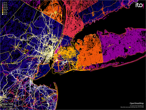 New york
 -
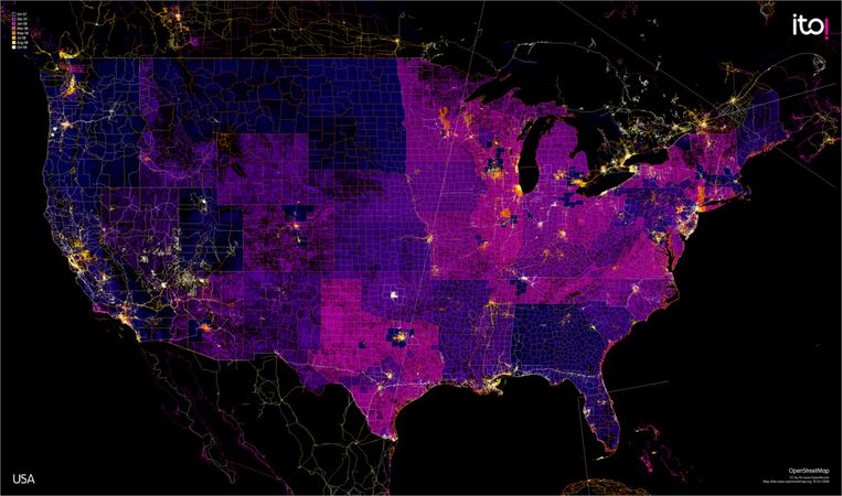 OSM Mapper - 1 Year of work in the US - 24 October 2008.
 -
 OSM Mapper - 1 Year of work in the US - 11 December 2008.


For more images uploaded to this wiki see Category:Maps made by OSM Mapper
External Links
- Blog posts
- OSM Mapper tutorial on Slideshare
- ITOworld video tutorials on Vimeo
- Images on Flickr