OSMer in residence Program data import
Project goal
The data to be imported in this campaign in Nigeria is part of the OSMer in Residence program, a collaboration between HOT's North and West Africa HUB and Médéçins Sans Frontières. This is a win-win collaboration between the two organizations, in which the expertise of a member of a local OSM community is made available to an organization with a well-defined technical need. The data to be imported are historical data relating to health structures from MSF's various missions where they have been involved in Nigeria in the past. For more information on the OSMer in Residence program, please consult the following link.
Nigeria
You can consult the OSM Nigeria Wiki page here.
Schedule
The planning of the import started in mid January 2024, we would like to have the import completed in February 2024.
Import account
For this campaign we encourage contributors from Nigeria to use a different account from their personal account. We therefore strongly encourage them to create new accounts for this campaign if they do not already have one .
Data to import
Data background
The data to be imported here are historical data collected by MSF concerning health structures in Nigeria. It is difficult to give the context and date of data collection for these health structures. Nevertheless, these data have been stored in the MSF Master database and are being used by the MSF operations.
Osm data files
Import type
The best approach to import this data is manually by the Nigerian volunteers community, with data split in a number of challenges in Maproulette.
Advantages:
- Any volunteers may join the import effort, at any time (although only skilled mappers should join).
- We can check, at any time, the mapping progress of the import.
- We can easily validate each task too, and check the validation progress.
Data preparation
Tagging plan
The MSF database has its own nomenclature for tagging healthcare facilities. In this case, we have five categories of health facility, namely: health_center; health_post, hospital, clinic and dispensary. The data attribute fields selected in the MDB are: iso3; name_en; operated_b; hlfac_typ and source. These fields were selected because their equivalents exist on osm and the other fields had empty contents.
Find here a list with all original attributes and their corresponding translation into the OSM tagging schema:
| MDB Attributes | MDB Attributes meaning | OSM Tag |
|---|---|---|
| ISO 3 | Country code of Nigeria where the health facilities have been collected | / |
| name_en | Name of the health facilities in english that have been collected | name=* |
| operated_b | Name of the institution responsible of the health facility | operator=* |
| hlfac_typ=
clinic hospital dispensary health-centre health post |
Type of the health facilities | amenity=clinic
amenity=hospital health_facility:type=dispensary health_facility:type=health_centre amenity=health post |
| source | Source of the health facility data collected | source=* |
Changeset tag
We will use the following changeset tags generated automatically when you want to upload a data:
Data transformation
- The original file (in shapefile) comes from the MSF Master Data base after having been applied the query on health structures present in Nigeria found in this base and whose source is MSF.
- In Qgis, empty and irrelevant tags were removed, while those easily adaptable to the OSM language were left.
- We then opened this cleaned file in QGIS on JOSM using the opendata plugin and saved it in osm format.
- The file, saved in osm servira format, will be integrated into maproulette and will propose different tasks to be mapped.
Note: We have retained the msf attributes in maproulette because the data contained several themes with different attributes. As a result, the transformation of this data into the osm language will take place directly during import.
Data merge workflow
Team Approach
This import (data integration) will be done through Maproulette, so the number of people who will import the data is unknown, but we expect volunteers mapper from the Nigeria community as they have a good knowledge of their country and the context of data. Training will be done beforehand to build the community's capacity to use maproulette, understand msf attributes and how to tag them in order to produce quality data: Some necessary skills:
- Have an import account different from the personal account;
- Have JOSM installed in your workstation;
- Basic knowledge of tagging on osm
Reference
Workflow
We will use the JOSM editor for this import.
Step by step instructions
There are several ways to reach the same results. We have tried to find the simplest one, the less error-prone and the one that assures a higher level of consistency across different import volunteers. The proposed workflow is as follows:
- The editor
We encourage contributors to use the editor they prefer. This may be JOSM . The choice of editor is made after selecting the challenge to map.
- Imagery
Bing imagery is strongly encouraged for this data import campaign. However, should contributors encounter problems associated with imagery (cloudy areas or clarity issues), they can change imagery to better appreciate the area.
- How to map
- Enable remote control on josm, which will enable communication between the maproulette server and josm.
- Create a point approximately where it is located on maproulette in the selected editor
- Copy the object's properties from maproulette and paste them into the editor . These properties will be indicators, but you'll need to adapt them to a language that osm can understand. For this reason, please refer to the tagging plan for this campaign, to see what each property corresponds to and how it fits in OSM.
- If a health structure already exists, make a property comparison between the health structure on OSM with the properties that you have with maproulette. If there is a property in the MSF data that the OSM data does not contain, add it to the properties of the existing data on OSM.
- For health structures that don't come across buildings directly, identify the nearest building and, if no building exists nearby, move on to a challenge.
- If you're faced with challenges whose object properties are unknown, don't add them to osm, skip the challenge.
- When the task is complete, the modifications can be sent, remembering to describe the operation performed and the campaign hashtag.
Conflation
To compare data from the MSF database with that already present on OSM, we're going to do this manually. We're going to look at the attribute names of the data from the different sources. If we have similar names even though the positions of the objects are different, we consider that the data already exists on OSM. If the msf data has more complete attributes than the data in OSM, we will integrate them into the OSM data.
Quality assessment
Project update
Niger
You can consult the OSM Niger Wiki Page here
Schedule
The planning of the import started in mid January 2024, we would like to have the import completed in February 2024.
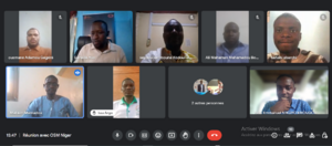
- 11th January 2024: Meeting with the OSM community in Niger to present the OSMer in Residence program, the data to be imported and the different expectations of the community.
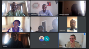
- 24th January 2024: Training on Maproulette
Import account
For this campaign we encourage contributors from Niger to use a different account from their personal account. We therefore strongly encourage them to create new accounts for this campaign if they do not already have one
Data to import
Data background
The data to be imported here are historical data collected by MSF concerning health facilities and villages in Niger. It is difficult to give the context and date of data collection for these health structures but for the villages they have been collected in 2022. Nevertheless, these data have been stored in the MSF Master database and are being used by the MSF operations. MSF has given full authorization for the use of their data in OpenStreetMap by communities. A scan of the document can be found here
289 data to be imported into OSM, 183 for health facilities and 106 for villages.
Osm data files
Import type
The best approach to import this data is manually by the community, with data split in a number of challenges in Maproulette.
Advantages:
- Any volunteers may join the import effort, at any time (although only skilled mappers should join).
- We can check, at any time, the mapping progress of the import.
- We can easily validate each task too, and check the validation progress.
Data preparation
Tagging plan
The MSF database has its own nomenclature for tagging healthcare facilities. for the import campaign in Niger, we have four categories of health facility, namely: health_center (hc); health_post (hp), hospital, clinic . The data attribute fields selected in the MDB are: iso3; name_fr; operated_b; hlfac_typ and source. These fields were selected because their equivalents exist on osm and the other fields had empty contents.
Find here a list with all original attributes and their corresponding translation into the OSM tagging schema:
| MDB Attributes | MDB Attributes meaning | OSM Tag |
|---|---|---|
| ISO3=ner | Country code of Niger where the health facilities have been collected | iso3=ner |
| name_fr | Name of the health facilities in French that have been collected | name=* |
| hlfac_typ=
clinic hospital hc (health_centre) hp (health post) |
Type of the health facilities | amenity=clinic
amenity=hospital health_facility:type=health_centre amenity=health post |
| source=msf | Source of the health facility data collected | source=MSFsurvey |
| Villages attributes | ||
| ISO3=ner | Country code of Niger where the villages have been collected | iso3=ner |
| name_fr | Name of the villages in French that have been collected | name=* |
| type=village | Type of village | place=village |
| source=msf | Source fo the village data collected | source=MSFsurvey |
Changeset tag
We will use the following changeset tags generated automatically when you want to upload a data:
comment=#osmerinresidence_niger #maproulette #missingMaps #MSF #WNAH
Data transformation
- The original file (in shapefile) comes from the MSF Master Data base after having been applied the query on health structures present in Nigeria found in this base and whose source is MSF.
- In Qgis, empty and irrelevant tags were removed, while those easily adaptable to the OSM language were left.
- We then opened this cleaned file in QGIS on JOSM using the opendata plugin and saved it in osm format.
- The file, saved in osm servira format, will be integrated into maproulette and will propose different tasks to be mapped.
Note: We have retained the msf attributes in maproulette because the data contained several themes with different attributes. As a result, the transformation of this data into the osm language will take place directly during import.
Data merge workflow
Team Approach
This import (data integration) will be done through Maproulette, so the number of people who will import the data is unknown, but we expect volunteers mapper from the Niger community as they have a good knowledge of their country and the context of data. Training will be done beforehand to build the community's capacity to use maproulette, understand msf attributes and how to tag them in order to produce quality data: Some necessary skills
- Have an import account different from the personal account;
- Have JOSM installed in your workstation;
- Basic knowledge of tagging on osm
Reference
Following the imports guidelines, We first have a meeting with the communities leaders especially the OSM Niger president to explain him the project. Then an additional meeting was organised with the osm local community in Niger via a meeting on Google meeting.
Workflow
We will use the JOSM editor for this import.
Step by step instructions
There are several ways to reach the same results. We have tried to find the simplest one, the less error-prone and the one that assures a higher level of consistency across different import volunteers. The proposed workflow is as follows:
- The editor
We encourage contributors to use the editor they prefer. This may be JOSM . The choice of editor is made after selecting the challenge to map.
- Imagery
Bing imagery is strongly encouraged for this data import campaign. However, should contributors encounter problems associated with imagery (cloudy areas or clarity issues), they can change imagery to better appreciate the area.
- How to map
- Enable remote control on josm, which will enable communication between the maproulette server and josm.
- Create a point approximately where it is located on maproulette in the selected editor
- Copy the object's properties from maproulette and paste them into the editor . These properties will be indicators, but you'll need to adapt them to a language that osm can understand. For this reason, please refer to the tagging plan for this campaign, to see what each property corresponds to and how it fits in OSM.
- If a health structure already exists, make a property comparison between the health structure on OSM with the properties that you have with maproulette. If there is a property in the MSF data that the OSM data does not contain, add it to the properties of the existing data on OSM.
- For health structures that don't come across buildings directly, identify the nearest building and, if no building exists nearby, move on to a challenge.
- If you're faced with challenges whose object properties are unknown, don't add them to osm, skip the challenge.
- When the task is complete, the modifications can be sent, remembering to describe the operation performed and the campaign hashtag.
Conflation
To compare data from the MSF database with that already present on OSM, we're going to do this manually. We're going to look at the attribute names of the data from the different sources. If we have similar names even though the positions of the objects are different, we consider that the data already exists on OSM. If the msf data has more complete attributes than the data in OSM, we will integrate them into the OSM data.
Mapathon and Results
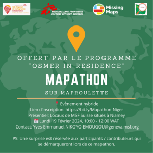
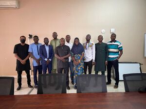
After consultation with members of the OpenStreetMap community in Niger, a mapathon was organized on April 19 to map data relating to the village and health facilities. In collaboration with the MSF teams in Niger, who provided us with the premises, we organized the event as a hybrid. In addition to members of the OSM Niger community, the GIS Specialist from MSF in Niger was also present.The alternative found today was to give a brief introduction to tasking manager, another organized editing tool, and to map the Niger projects that are present in this tool. With regard to the MSF data present on Maproulette and to be imported into OSM, the individual mapping approach was prioritized, enabling contributors to map where they wished, when they wished, while avoiding any server overload.
Out of 289 data entries in Maproulette relating to health structures and villages, 228 new data entries were integrated into OSM during the mapathon period. The 61 data entries that were not added were data that already existed in OSM and integration was not necessary.
The results of the data added to OpenStreetMap can be seen here
Quality assessment
Maproulette evolves as HOT's Tasking Manager. As a result, when a task was mapped by a contributor, another contributor took charge of validation, using the editor that suited them best.
Project update
Chad
You can consult the OSM Chad Wiki Page here
Schedule
The planning of the import started in mid January 2024, we would like to have the import completed in February 2024
Import account
Data to import
Data background
The data to be imported here are historical data collected by MSF concerning health structures in Chad . It is difficult to give the context and date of data collection for these health structures. Nevertheless, these data have been stored in the MSF Master database and are being used by the MSF operations.
Osm data files
Import type
Data preparation
Tagging plan
The MSF database has its own nomenclature for tagging healthcare facilities. for the import campaign in Chad, we have five categories of health facility, namely: health_center (hc/hc_reference), hospital, clinic dispensary, pharmacy . The data attribute fields selected in the MDB are: iso3; name_fr; operated_b; hlfac_typ and source. These fields were selected because their equivalents exist on osm and the other fields had empty contents.
Find here a list with all original attributes and their corresponding translation into the OSM tagging schema:
| MDB Attributes | MDB Attributes meaning | OSM Tag |
|---|---|---|
| ISO 3 | Country code of Chad where the health facilities have been collected | / |
| name_fr | Name of the health facilities in French that have been collected | name=* |
| operated_b | Name of the institution responsible of the health facility | operator=* |
| hlfac_typ=
clinic hospital dispensary health-centre (hc/hc_reference) Pharmacy |
Type of the health facilities | amenity=clinic
amenity=hospital health_facility:type=dispensary health_facility:type=health_centre amenity=pharmacy |
| source | Source of the health facility data collected | source=* |
Changeset tag
Data transformation
Data merge workflow
Team Approach
Reference
Workflow
Conflation
Quality assessment
Validation of the import will be done by a second user in the Tasking Manager.


