Uploads by Joshdoe
Jump to navigation
Jump to search
This special page shows all uploaded files.
| Date | Name | Thumbnail | Size | Description | Versions |
|---|---|---|---|---|---|
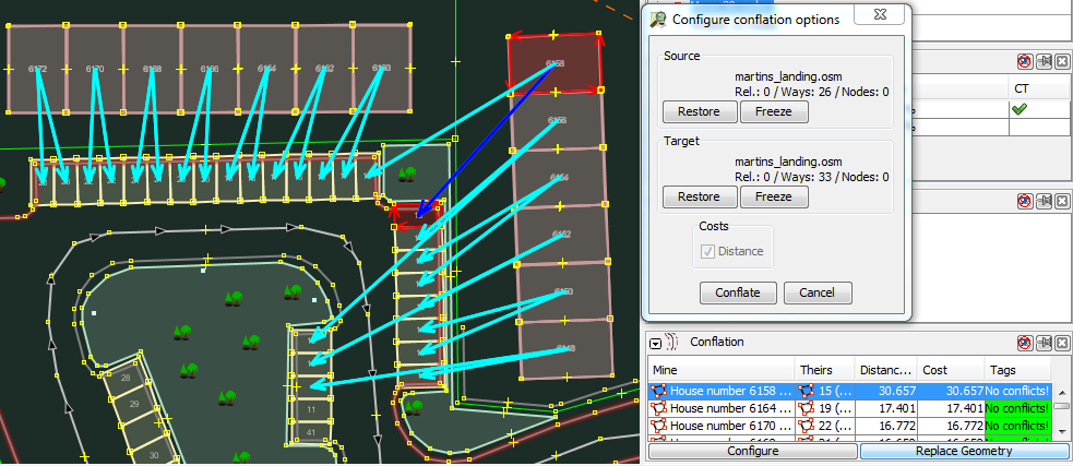
| 11:50, 1 March 2012 | Josm conflation parking example.png (file) |  |
137 KB | Screenshot of JOSM using conflation plugin to assign parking spaces to houses, taken by myself. Images of JOSM | 1 |
| 11:02, 30 November 2011 | US suite with outdoor entrance.jpg (file) |  |
525 KB | Photo of an outdoor suite taken by User:Joshdoe. | 1 |
| 02:35, 25 August 2011 | FCDOT TermsConditions LicenseAgreement DOTdata.pdf (file) |  |
70 KB | 1 | |
| 11:56, 18 August 2011 | SRTS walkability after new sidewalk.jpg (file) |  |
136 KB | Add new sidewalk in red | 2 |
| 11:47, 18 August 2011 | SRTS walkability before new sidewalk.jpg (file) |  |
141 KB | 1 mile walkability map for Terra Centre Elementary School before construction of new sidewalk. Created with OSM data, osm2pgrouting, PostgreSQL, PostGIS, PgRouting, QGIS, and GIMP. | 1 |
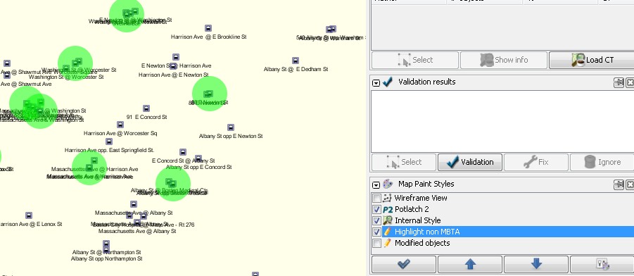
| 19:13, 12 August 2011 | JOSM MBTA Highlight OSM.jpg (file) |  |
59 KB | 1 | |
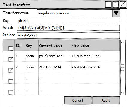
| 00:59, 8 August 2011 | JOSMTextTransformerRegex.png (file) | 37 KB | Created in [http://pencil.evolus.vn Pencil 1.2]. | 1 | |
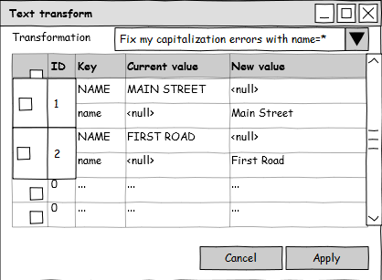
| 19:51, 7 August 2011 | JOSMTextTransformer2Keys.png (file) | 32 KB | Created in [http://pencil.evolus.vn Pencil 1.2]. | 1 | |
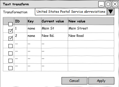
| 19:19, 7 August 2011 | JOSMTextTransformer.png (file) | 30 KB | Created in [http://pencil.evolus.vn Pencil 1.2]. | 1 | |
| 17:38, 21 June 2011 | Kerb key example map.jpg (file) |  |
123 KB | Cropped screenshot from JOSM, showing public domain USGS imagery from 2009 in Virginia. Crossings are marked with {{Tag|highway|footway}} and {{tag|footway|crossing}}, crossings are taggged with {{tag|highway|crossing}} and {{tag|crossing|traffic_sign | 1 |
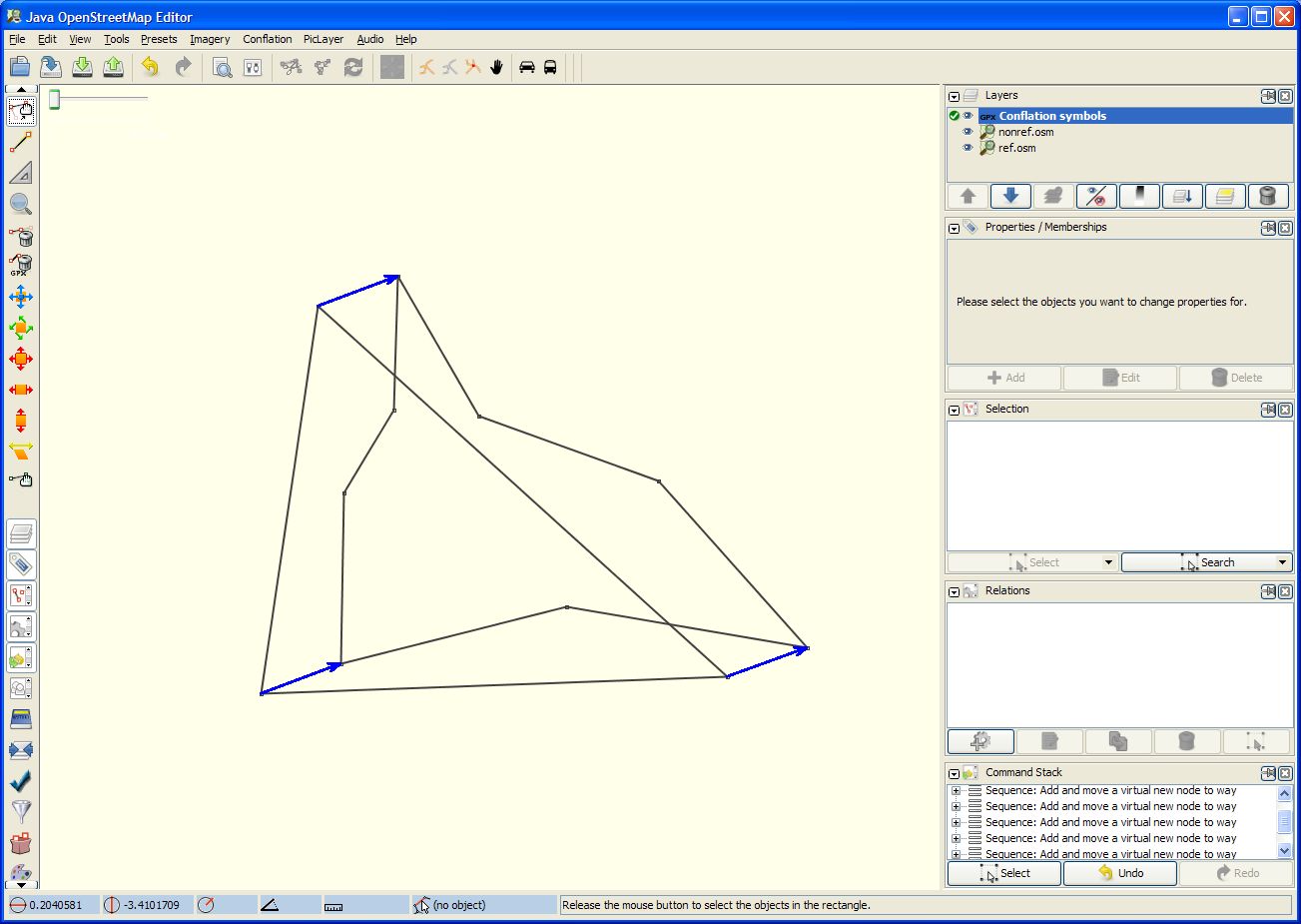
| 14:36, 16 May 2011 | JOSM Conflation results.jpg (file) |  |
113 KB | 1 | |
| 14:35, 16 May 2011 | JOSM Conflation dialog.jpg (file) |  |
131 KB | 1 | |
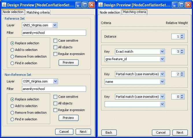
| 04:31, 23 April 2011 | Josm node conflation config dialog mockup.jpg (file) |  |
212 KB | mockup created in netbeans | 1 |
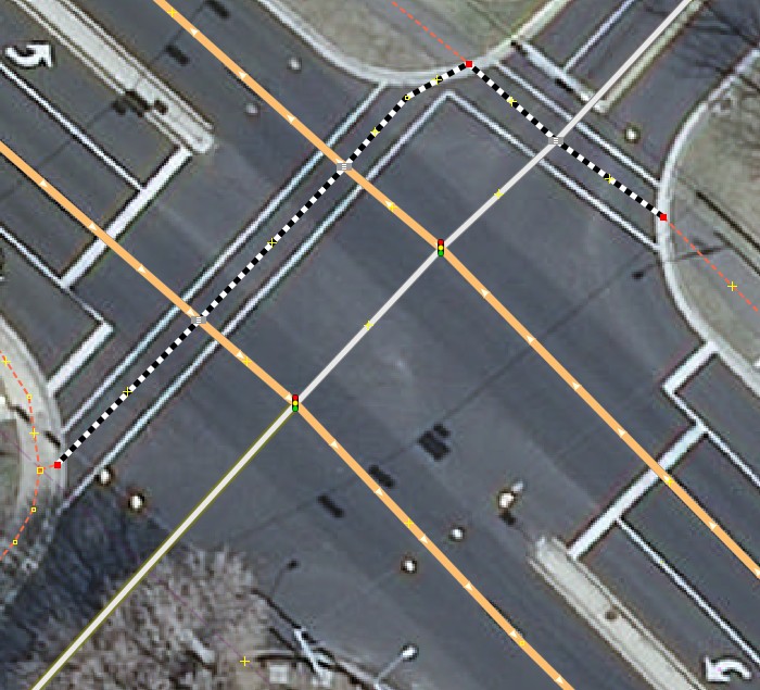
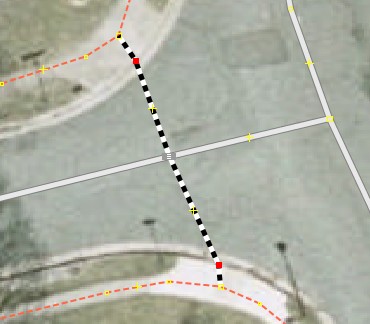
| 12:14, 18 April 2011 | Crossing in josm.jpg (file) |  |
26 KB | Background is VBMP2006/2007, public domain imagery. | 1 |
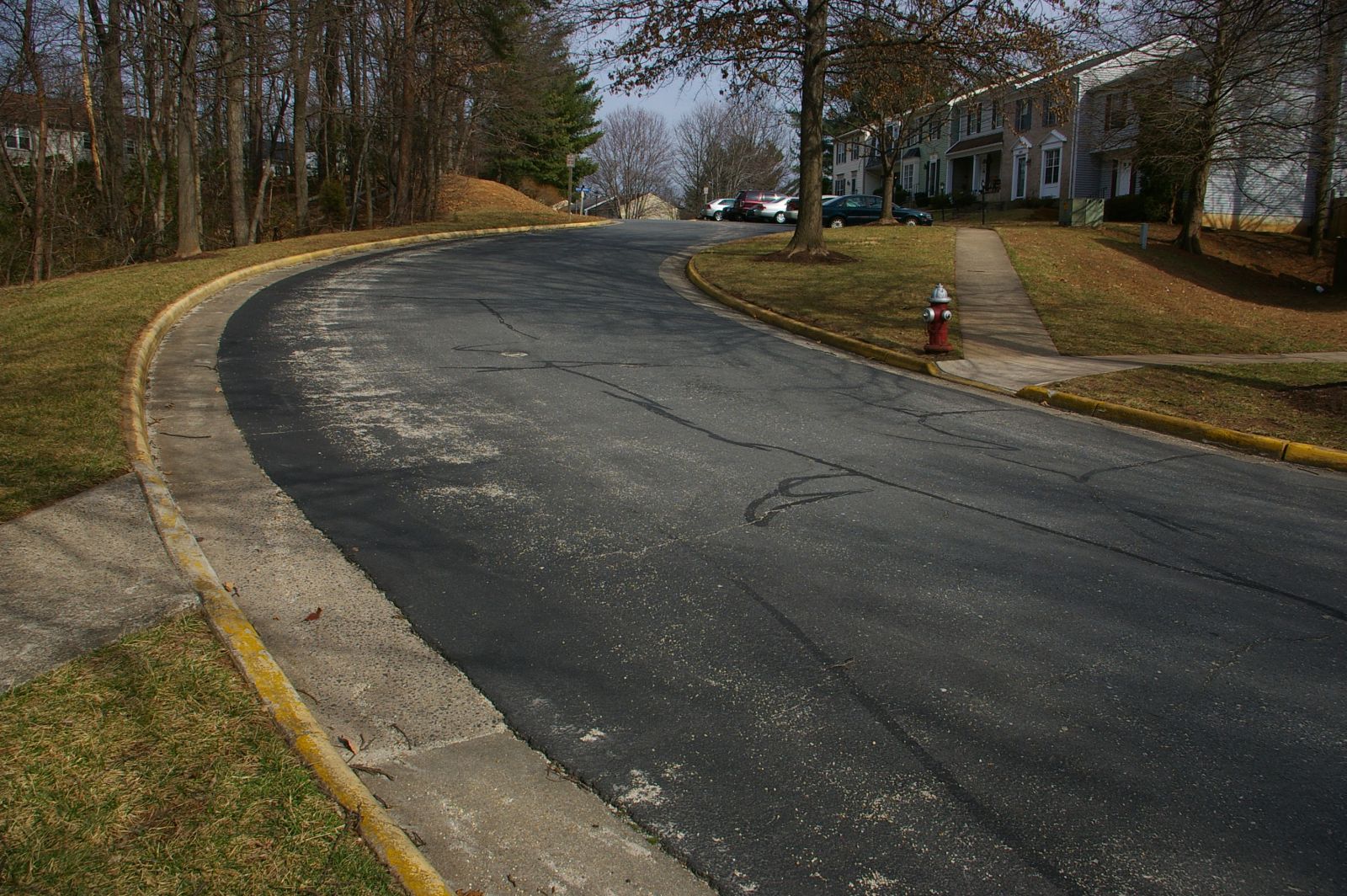
| 02:06, 28 February 2011 | Crossing with sloped curbs.jpg (file) |  |
445 KB | A {{tag|highway|footway}} intersecting a {{tag|highway|residential}}, intersecting node tagged {{tag|highway|crossing}}, {{tag|crossing|unmarked}}, with nodes on the curbs tagged {{tag|sloped_curb|yes}} | 1 |
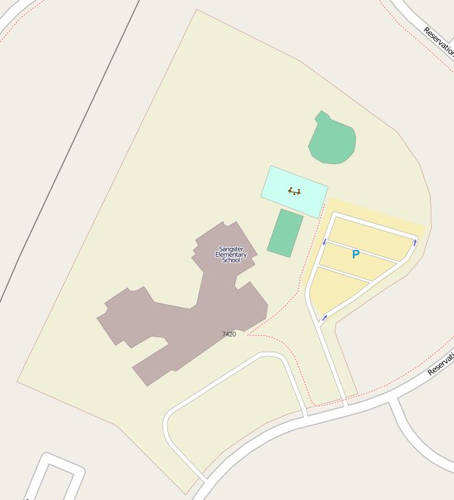
| 20:44, 1 February 2011 | Sangster ES site relation example.jpg (file) |  |
32 KB | [http://www.openstreetmap.org/browse/relation/1403393 Sangster ES] | 1 |
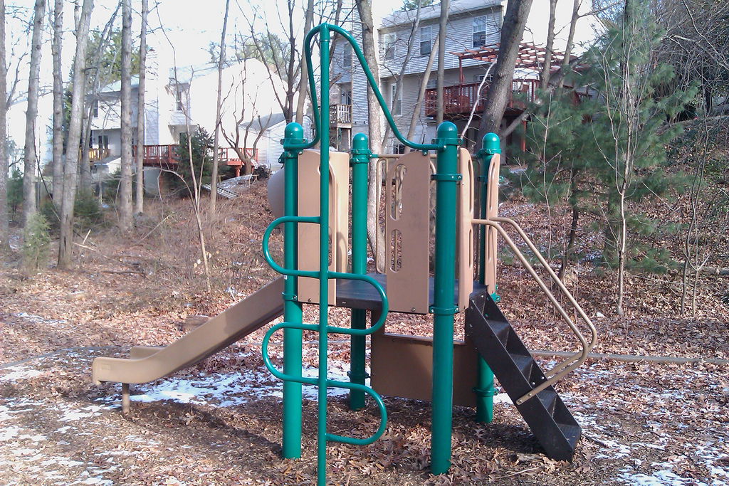
| 04:22, 16 January 2011 | Play structure.jpg (file) |  |
668 KB | Play structure with slide, steps, and a climbing frame | 1 |
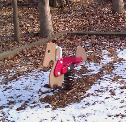
| 04:15, 16 January 2011 | Springy horse.jpg (file) |  |
85 KB | Springy horse in a playground | 1 |