Uploads by PeterCooperJr
Jump to navigation
Jump to search
This special page shows all uploaded files.
| Date | Name | Thumbnail | Size | Description | Versions |
|---|---|---|---|---|---|
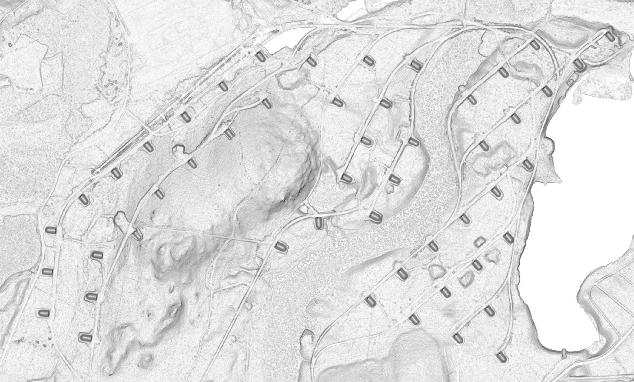
| 00:41, 1 June 2023 | MassGIS Slope LiDAR, Assabet River National Wildlife Refuge.jpg (file) |  |
383 KB | A portion of the Assabet River National Wildlife Refuge, where via LiDAR Slope imagery one can see WWII ammo bunkers and railroad tracks, even though these could be hard to find using aerial imagery. The imagery comes from 2021 [https://www.mass.gov/info-details/massgis-data-lidar-terrain-data MassGIS LiDAR Data] as can be seen on the MassGIS#LiDAR_Slope imagery and is in the public domain. | 1 |
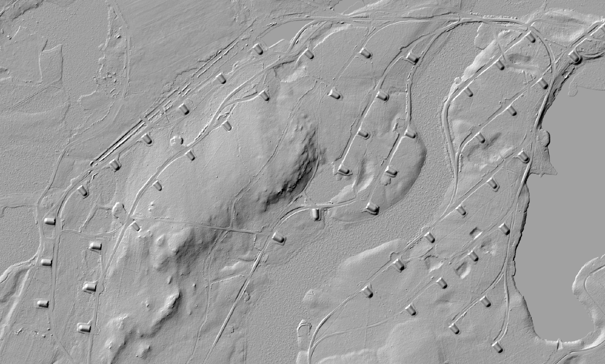
| 00:34, 1 June 2023 | MassGIS Shaded Relief LiDAR, Assabet River National Wildlife Refuge.jpg (file) |  |
340 KB | 2 | |
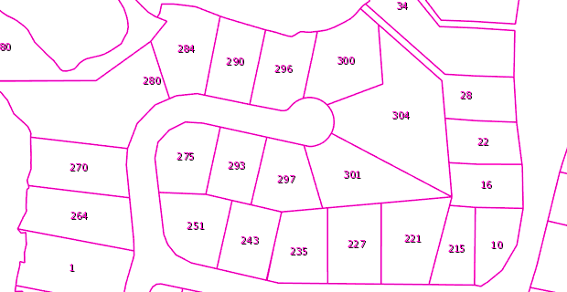
| 16:28, 6 January 2021 | MassGIS Parcels Example.png (file) |  |
12 KB | Example of overlay available from the MassGIS L3 Parcels data layer. Taken from [https://www.mass.gov/service-details/massgis-base-map]. | 1 |
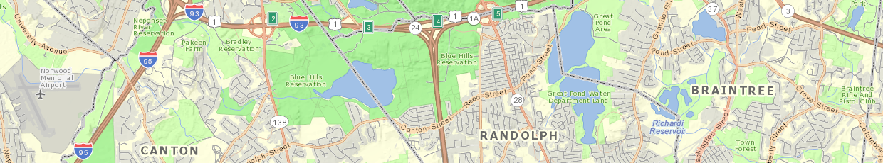
| 16:07, 6 January 2021 | MassGIS Basemap Example.png (file) | 462 KB | An example of the MassGIS Basemap, copied from the description of it at https://www.mass.gov/service-details/massgis-base-map | 1 |