MassGIS

MassGIS (mass.gov/mgis) is the shorthand name for the Commonwealth of Massachusetts Bureau of Geographic Information, within the Executive Office of Technology Services and Security (EOTSS). MassGIS provides a large amount of public domain geographic data that, among other uses, can be used to improve OpenStreetMap. Significant amounts of MassGIS data has already been imported into OpenStreetMap, and other data is routinely used for reference in editing.
The OpenStreetMap Massachusetts community would like to note our appreciation to MassGIS for making large amounts of data available under OSM-compatible license terms.
Right to Use
MassGIS states in their FAQ that their data is public domain, though credit is appreciated:
Since MassGIS data is paid for by public tax dollars, the data are in the public domain and therefore can be used by anyone for any purpose. When using MassGIS data on maps or in digital applications, source credit should be stated as "MassGIS (Bureau of Geographic Information), Commonwealth of Massachusetts EOTSS"
— https://www.mass.gov/service-details/massgis-frequently-asked-questions
Similar language is in their "About" page: https://www.mass.gov/service-details/about-massgis
Note on copyright from e-mail exchange with MassGIS (note that the language is from before a reorganization into EOTSS):
All of our data is paid for by the taxpayers and is therefore in the public domain. We do prefer to be credited though in any publications... When using MassGIS data on maps or in digital applications, source credit should be stated as [see FAQ above for currently-recommended text]
In February, 2020, a MassGIS person confirmed that the 2019 Orthophotos are usable for OpenStreetMap (and other purposes). MassGIS appreciates attribution but it is not required. (Omitting name and not posting the mail because this is a odd combination of a public record and standard courtesy of not posting email.)
The page about the 2015 Orthoimagery layer has unusual licensing text, saying that the images themselves cannot be distributed. In January 2021, a MassGIS person confirmed that while the imagery itself cannot be redistributed, the imagery can be used for any purpose, including deriving vector feature data for OpenStreetMap.
Some older MassGIS data layer pages indicated that the layers are CC-BY, which is in conflict with the PD statement in the FAQ. In January of 2021 a MassGIS person confirmed that the CC-BY label was an artifact of the web site publishing system and incorrect.
Overall, it is very clear from responses to multiple questions that all MassGIS data can be used for OpenStreetMap, with attribution requested. While the full name of the department as listed above is what's preferred on something public-facing, the shorthand of just saying "MassGIS" is fine, especially in places like changeset comments and source tags.
Privacy Policy
Two privacy policies apply to people using this data. One is the Commonwealth of Massachusetts's website policy, for requests via that site, and the other is ESRI's privacy policy, for access to tiles and features hosted by ESRI (ArcGIS) on behalf of the Commonwealth.
- Mass.gov Privacy Policy: https://www.mass.gov/privacypolicy
- ESRI (ArcGIS) Privacy Policy: https://www.esri.com/en-us/privacy/overview
Imagery and Feature Services
Imagery & Background Layers
There are several sets of imagery available from MassGIS that can be used as a background in an OpenStreetMap editor for reference. Some of the layers are in the Editor Layer Index (ELI) and so are already listed in iD and JOSM as menu items. Layers in ELI are called out in each section.
- For use as a custom background in the iD editor: Go to the Background menu on the right side, and choose Custom. Paste in the "iD Background" link below for the layer you want to use as a background.
- For use in the JOSM editor: See LearnOSM's page on adding imagery to JOSM for instructions. There are two ways that can work, pick the one that works best for you:
- Adding the WMTS source (which includes information like the layer name and available zoom levels)
- Adding the "JOSM TMS" URL below as a TMS source.
- For other editors or GIS software: Most editors should be able to use at least one of the TMS or WMTS formats.
2021 15cm Aerial Imagery
This is in ELI and available in iD and JOSM as "MassGIS 2021 Aerial Imagery".
The most recent MassGIS imagery is 15-cm color leaf-off ortho imagery, acquired between March 17 and April 24, 2021. (MassGIS also provides a map of specific flight dates.)
- For use in the iD editor: MassGIS imagery has already been included as the default background, or select "MassGIS 2021 Aerial Imagery".
- Link for custom iD background:
https://tiles.arcgis.com/tiles/hGdibHYSPO59RG1h/arcgis/rest/services/orthos2021/MapServer/tile/{zoom}/{y}/{x} - Link for JOSM TMS is:
tms[7,20]:https://tiles.arcgis.com/tiles/hGdibHYSPO59RG1h/arcgis/rest/services/orthos2021/MapServer/tile/{zoom}/{y}/{x} - Link for WMTS is:
https://tiles.arcgis.com/tiles/hGdibHYSPO59RG1h/arcgis/rest/services/orthos2021/MapServer/WMTS/1.0.0/WMTSCapabilities.xml - For other editors or GIS software: See MassGIS's guide for connecting to their imagery sources
- MassGIS 2021 Aerial Imagery description page
- MassGIS 2021 Aerial Imagery ArcGIS Tile Layer Service information
2019 15cm Aerial Imagery
This is in ELI and available in iD and JOSM as "MassGIS 2019 Orthos".
MassGIS 2019 Orthoimagery is 15-cm color leaf-off orthophotos, acquired from airplanes between March 24 and April 25, 2019. MassGIS sometimes refers to it as USGS data because of joint sponsorship, but within OSM the preferred label is "MassGIS 2019 Orthos".
- For use in the iD editor: Select "MassGIS 2019 Orthos" from the background list.
- Link for custom iD background:
https://tiles.arcgis.com/tiles/hGdibHYSPO59RG1h/arcgis/rest/services/USGS_Orthos_2019/MapServer/tile/{zoom}/{y}/{x} - Link for JOSM TMS is:
tms[7,20]:https://tiles.arcgis.com/tiles/hGdibHYSPO59RG1h/arcgis/rest/services/USGS_Orthos_2019/MapServer/tile/{zoom}/{y}/{x} - Link for WMTS is:
https://tiles.arcgis.com/tiles/hGdibHYSPO59RG1h/arcgis/rest/services/USGS_Orthos_2019/MapServer/WMTS/1.0.0/WMTSCapabilities.xml
- MassGIS 2019 Aerial Imagery description page
- MassGIS 2019 Imagery ArcGIS tile layer service information
Older Aerial Imagery
- → Refer to MassGIS/Older Imagery for information on available older imagery that can sometimes be helpful.
L3 Parcels (Overlay)

This is in ELI and available in iD and JOSM as "MassGIS L3 Parcels".
This is a representation of parcel boundaries. It's just the outlines and addresses on a transparent background, so you may want to use it over some other background (Also see the Basemap available below that already includes the parcel boundaries). This data comes from municipal assessors' offices and is not always completely accurate, but is usually a good source for property boundaries.
- Link for iD Custom Background:
https://tiles.arcgis.com/tiles/hGdibHYSPO59RG1h/arcgis/rest/services/MassGIS_Level3_Parcels/MapServer/tile/{zoom}/{y}/{x} - Link for JOSM TMS is:
tms[15,20]:https://tiles.arcgis.com/tiles/hGdibHYSPO59RG1h/arcgis/rest/services/MassGIS_Level3_Parcels/MapServer/tile/{zoom}/{y}/{x} - Link for WMTS is:
https://tiles.arcgis.com/tiles/hGdibHYSPO59RG1h/arcgis/rest/services/MassGIS_Level3_Parcels/MapServer/WMTS/1.0.0/WMTSCapabilities.xml
- MassGIS Property Tax Parcels description, including last update date for each town
- "Property Tax Parcels" ArcGIS tile layer service information
MassGIS Basemap

This is in ELI and available in iD and JOSM as "MassGIS Basemap".
This is a general map with topography, roads, bodies of water, building structure outlines, and many other features listed.
- Link for iD Custom Background:
https://tiles.arcgis.com/tiles/hGdibHYSPO59RG1h/arcgis/rest/services/MassGISBasemap/MapServer/tile/{zoom}/{y}/{x} - Link for JOSM TMS is:
tms[7,19]:https://tiles.arcgis.com/tiles/hGdibHYSPO59RG1h/arcgis/rest/services/MassGISBasemap/MapServer/tile/{zoom}/{y}/{x} - Link for WMTS is:
https://tiles.arcgis.com/tiles/hGdibHYSPO59RG1h/arcgis/rest/services/MassGISBasemap/MapServer/WMTS/1.0.0/WMTSCapabilities.xml
- General information on MassGIS Basemap, including map legend
- MassGIS Basemap ArcGIS tile layer service information
Basemap Components
- → If you are looking for specific components of the MassGIS Basemap broken out into separate layers, refer to the MassGIS/Basemap Components page
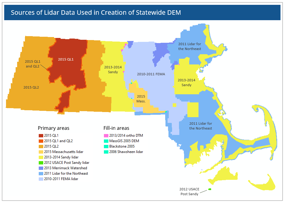
LiDAR Shaded Relief 2013-2021

The Shaded Relief LiDAR map can be especially useful for seeing features on the ground obscured by tree cover, such as stone walls and narrow streams. The LiDAR data was collected in 2021 for the central and eastern parts of the state, 2018 for Nantucket, and 2013–2015 for the western part of the state. See their map of sources for specific information.
- Link for iD Custom Background:
https://tiles.arcgis.com/tiles/hGdibHYSPO59RG1h/arcgis/rest/services/LiDAR_ShadedRelief_18Nant_21EC/MapServer/tile/{zoom}/{y}/{x} - Link for JOSM TMS is:
tms[7,19]:https://tiles.arcgis.com/tiles/hGdibHYSPO59RG1h/arcgis/rest/services/LiDAR_ShadedRelief_18Nant_21EC/MapServer/tile/{zoom}/{y}/{x} - Link for WMTS is:
https://tiles.arcgis.com/tiles/hGdibHYSPO59RG1h/arcgis/rest/services/LiDAR_ShadedRelief_18Nant_21EC/MapServer/WMTS/1.0.0/WMTSCapabilities.xml
- MassGIS LiDAR Terrain Data information
- Shaded Relief from LiDAR ArcGIS tile layer service information
LiDAR Slope 2013-2021

The Slope LiDAR map visualizes the variation in elevation (steepness) at each point. White represents something that is flat, with progressively darker values meaning steeper slope, up through black which represents a completely vertical slope.
- Link for iD Custom Background:
https://tiles.arcgis.com/tiles/hGdibHYSPO59RG1h/arcgis/rest/services/Slope_Grayscale_2013to2021/MapServer/tile/{zoom}/{y}/{x} - Link for JOSM TMS is:
tms[7,19]:https://tiles.arcgis.com/tiles/hGdibHYSPO59RG1h/arcgis/rest/services/Slope_Grayscale_2013to2021/MapServer/tile/{zoom}/{y}/{x} - Link for WMTS is:
https://tiles.arcgis.com/tiles/hGdibHYSPO59RG1h/arcgis/rest/services/Slope_Grayscale_2013to2021/MapServer/WMTS/1.0.0/WMTSCapabilities.xml
LiDAR Elevation & Shaded Relief 2013-2021
There's also a map available from the LiDAR data with elevation represented as color and and relief represented as intensity.
- Link for iD Background:
https://tiles.arcgis.com/tiles/hGdibHYSPO59RG1h/arcgis/rest/services/Elevation_and_ShadedRelief_from_Lidar_2013to2021/MapServer/tile/{zoom}/{y}/{x} - Link for JOSM TMS is:
tms[7,19]:https://tiles.arcgis.com/tiles/hGdibHYSPO59RG1h/arcgis/rest/services/Elevation_and_ShadedRelief_from_Lidar_2013to2021/MapServer/tile/{zoom}/{y}/{x} - Link for WMTS is:
https://tiles.arcgis.com/tiles/hGdibHYSPO59RG1h/arcgis/rest/services/Elevation_and_ShadedRelief_from_Lidar_2013to2021/MapServer/WMTS/1.0.0/WMTSCapabilities.xml
- MassGIS Lidar Terrain data information
- LiDAR Elevation and Shaded Relief ArcGIS tile layer service information
LiDAR Shaded Relief 2010-2014
This is in ELI and available in iD and JOSM as "MassGIS LIDAR Shaded Relief".
This is a shaded relief data from older, lower quality, LiDAR data, collected between 2010 and 2015 (depending on the part of the state); see their map of sources for specific information.
- Link for iD Custom Background:
https://tiles.arcgis.com/tiles/hGdibHYSPO59RG1h/arcgis/rest/services/LiDAR_ShadedRelief/MapServer/tile/{zoom}/{y}/{x} - Link for JOSM TMS is:
tms[7,18]:https://tiles.arcgis.com/tiles/hGdibHYSPO59RG1h/arcgis/rest/services/LiDAR_ShadedRelief/MapServer/tile/{zoom}/{y}/{x} - Link for WMTS is:
https://tiles.arcgis.com/tiles/hGdibHYSPO59RG1h/arcgis/rest/services/LiDAR_ShadedRelief/MapServer/WMTS/1.0.0/WMTSCapabilities.xml
- MassGIS LiDAR Terrain Data description
- Shaded Relief from LiDAR ArcGIS tile layer service information
Other MassGIS Tile Service Layers
For more information please check the MassGIS ArcGIS Gallery.
Features Map Data
There is also feature data available from MassGIS. Usually GeoJSON format is the easiest to view within iD, but other formats are available from the dataset links below. The data shows the location of features, with properties describing each one. In many map editors, you can overlay the GeoJSON feature data and select a feature to see its properties. See the description of each dataset for what properties are available for each feature.
For example, in the iD editor, go to the "Map Data" tab on the right side, click the ••• to the right of "Custom Map Data", and paste in the GeoJSON URL below (and ensure the "Custom Map Data" box is then checked) to see the data on the map. You can then click on one of the nodes to see the detailed properties of it.
In the JOSM editor, you can go to File / Open Location and paste in the GeoJSON URL. You probably want to check "Download as new layer".
Note: While the MassGIS data can be a helpful reference, it is not always 100% accurate. Sometimes data points aren't exactly where they would belong in OpenStreetMap, and as with any data source some information may be incorrect or incomplete. It should not generally be directly used or imported, but only used as a reference alongside other sources like on-the-ground surveying and aerial imagery.
2020 Census
(Note that per MassGIS these Census municipal boundaries can contain "many minor discrepancies, particularly along hydrologic and coastal features", so this shouldn't be used as a reference for municipal borders without also checking other sources from the state, but this can be a reference for getting population data.)
- "2020 US Census Towns" dataset description
- GeoJSON:
https://opendata.arcgis.com/datasets/f18deadd8712490281775778cdf0ca77_2.geojson
Town and City Halls
- "Town and City Halls" dataset description
- "Town and City Halls" ArcGIS Feature Layer description
- GeoJSON:
https://opendata.arcgis.com/datasets/5d4e7055f4ee4ef4972e5897a5093021_0.geojson
Places of Worship
- "Places of Worship" dataset description
- "Places of Worship" ArcGIS Feature Layer description
- GeoJSON:
https://opendata.arcgis.com/datasets/62f3db378d734d2e885130f79435614a_0.geojson
Schools
- "Massachusetts Schools (Pre-K through High School)" dataset description
- School ArcGIS Feature Layer description
- GeoJSON:
https://opendata.arcgis.com/datasets/a7ccf184af704f5fbd17d69f935554d6_0.geojson
Libraries
- Libraries dataset description
- GeoJSON:
https://opendata.arcgis.com/datasets/0c04a0071541470b8444f2332e82e2a7_0.geojson
Police Stations
- Police Stations dataset description
- Police Station ArcGIS data layer description
- GeoJSON:
https://opendata.arcgis.com/datasets/a1d1e421de6d43aca35764678695da4e_0.geojson
Fire Stations
- Fire Stations dataset description
- GeoJSON:
https://opendata.arcgis.com/datasets/a6ddf99b24d04f878c7db87a43de31ee_0.geojson
Highway Exits & Interchanges
- Limited Access Highway Exits & Interchanges dataset description
- Limited Access Highway Exits & Interchanges ArcGIS data layer description
- Exits (one point at each off-ramp) GeoJSON:
https://opendata.arcgis.com/datasets/fa0cad62bd394557b6c9335db74ec084_1.geojson - Interchanges (one point at each junction) GeoJSON:
https://opendata.arcgis.com/datasets/fa0cad62bd394557b6c9335db74ec084_0.geojson
Water Features
Warning: Some of these files may be too large for an in-browser editor like iD to handle well.
- MassDEP Hydrography data description
- Massachusetts Water Resources ArcGIS data layer description
- Major Lakes and Ponds GeoJSON:
https://opendata.arcgis.com/datasets/2832e6e99b6d42199bbc85ea5d220212_2.geojson - All Lakes and Ponds GeoJSON:
https://opendata.arcgis.com/datasets/2832e6e99b6d42199bbc85ea5d220212_6.geojson - Major Rivers and Streams GeoJSON:
https://opendata.arcgis.com/datasets/2832e6e99b6d42199bbc85ea5d220212_3.geojson - All Rivers and Streams GeoJSON:
https://opendata.arcgis.com/datasets/2832e6e99b6d42199bbc85ea5d220212_5.geojson - Wetlands GeoJSON:
https://opendata.arcgis.com/datasets/2832e6e99b6d42199bbc85ea5d220212_7.geojson
Massachusetts Historical Commission Inventory
Warning: These files may also be too large for an in-browser editor like iD to handle well.
- Massachusetts Historical Commission Inventory data description
- Massachusetts Historical Commission Inventory ArcGIS data layer description
- Historic Points GeoJSON:
https://opendata.arcgis.com/datasets/e27a15d822ef4b10bb4dd6eb631ceb3c_1.geojson - Historic Areas GeoJSON:
https://opendata.arcgis.com/datasets/e27a15d822ef4b10bb4dd6eb631ceb3c_0.geojson
- → See also Key:ref:US-MA:mhc for tagging the MHC ID for a feature.
Protected and Recreational OpenSpace
Warning: This file may also be too large for an in-browser editor like iD to handle well.
- Massachusetts Protected and Recreational OpenSpace data description
- Massachusetts Protected and Recreational OpenSpace ArcGIS map
- GeoJSON:
https://opendata.arcgis.com/datasets/b42d5d3edd974d69910387949afabcf3_0.geojson
DCR Roads and Trails
Trails and roads for property maintained by the Massachusetts Department of Conversation and Recreation
(The GeoJSON is on the larger side, but can be loaded into iD with some patience.)
- DCR Roads and Trails data description
- DCR Roads and Trails ArcGIS Map
- Paths GeoJSON (Roads, Trails):
https://opendata.arcgis.com/datasets/eb2a904422ba40b283f08641c7e5f65e_0.geojson - Points GeoJSON (Parking, Gates, Signs, Trailheads, etc.):
https://opendata.arcgis.com/datasets/8fda2202cf1e45d3b1c510da3d90f80b_0.geojson
MassDOT Data
- → See also the Massachusetts Department of Transportation (MassDOT) page for more useful public domain data sets provided by the Commonwealth of Massachusetts.
Other Data Layers
There are a variety of other datasets available from MassGIS, which one can find through several portals:
- MassGIS' ArcGIS Online Web mapping platform
- ArcGIS Hub Search for MassGIS data
- Data Layer information directly on MassGIS's site
For many of them, GeoJSON is available by clicking through to the "APIs" portion of a dataset description page. However, be warned that some of them are datasets much larger than the samples presented above, and for large sets it may be a significant download and could tax your system significantly to try to load the entire dataset, especially from within a browser-based editor like iD.
Imported layers
Some MassGIS information has been already directly imported into OSM. Status and mappings notes for imports of MassGIS data follow, by layer:
Executive Office of Transportation-OTP Roads Layer
This layer was imported in 2007.
- MassGis_to_OSM_Attribute_Map Mappings for the EOT-OTP layer by crschmidt
- Message from Brandon points to files (which are no longer available)
- It appears that the user ID "MassGIS Import" was used to upload this data
Three towns were omitted from the initial import for various reasons:
- Freetown (still missing signficant numbers of local roads)
- Gloucester (as of 201203, OSM looks pretty complete)
- Braintree (as of 201203, OSM looks pretty complete)
POI Layers
- Police Stations source_url=http://mass.gov/mgis/policestations.htm
- Fire Stations source_url=http://mass.gov/mgis/firestations.htm
- Prisons source_url=http://mass.gov/mgis/prisons.htm
- Hospitals
source_url=http://mass.gov/mgis/hospitals.htmmassgis:id=* - Lighthouses source=http://mass.gov/mgis/lighthouses.htm
- Schools source_url=http://mass.gov/mgis/schools.htm
Please add information about these imports.
OpenSpace Layer
- MassGIS Information Page
- MassGis Layer Openspace Information about import
- Chris Schmidt did this 2009-01-04 with polyshp2osm.py.
- Since much of this layer was produced by digitizing paper maps, the areas frequently do not line up with the surrounding streets. The MassGIS L3 Parcel imaging layer can be used to refine the imported boundaries.
Hydrology
- Lakes, ponds, and Wetlands were imported December 2010. Only Cape Cod and Charles River were imported by user morganwahl.
- The rest of MA lakes and ponds, but not the wetlands, are being currently imported MassGIS_DEP_Wetlands_Import_2013.
MBTA Rapid Transit Layer
Please add information about this import.
Bicycle Trails Layer
Town Boundaries from Survey Points Layer
Around 2011-10, Calvin Metcalf imported most of this layer, and then various people edited to resolve minor issues. As of 2012-03, it is believed that town boundary data in OSM is in pretty good shape. (However, coastline data was not necessarily aligned with town boundary data, this was fixed by importing the offshore town boundary layer in Aug-Sep 2012, see below).
A comprehensive list of boundary relations for each town/city which incorporates the survey points layer (and the offshore layer, below) can be found at: Massachusetts/Boundary Relations.
MassGIS released an updated boundary data set on 2019-09-03. This updated geometry was finished being applied to the existing OSM boundary geometry on 2020-06-02. Each line was checked manually one at a time, and any errors from the previous imports was removed. This included removing source & attribution tags from the nodes & ways. The source tag was added to the changeset as per current policy. Duplicate lines underneath the admin lines were removed. MassGIS notes several boundary discrepancies still exist. In addition to these the MassGIS boundary of NW Brookline did not mesh up with the parcel map, so it was made to align with the parcel map instead. In cases where boundaries were obviously meant to follow a lake's shoreline, the boundary was attached to that.
Offshore Town Boundaries and County Boundaries
As the above survey point layer lacked the offshore boundaries, in Aug-Sep 2012 ![]() fiveisalive (on osm, edits, contrib, heatmap, chngset com.) and
fiveisalive (on osm, edits, contrib, heatmap, chngset com.) and ![]() massDOT (on osm, edits, contrib, heatmap, chngset com.) imported the offshore boundaries only and connecting them up to the onshore town boundary and have adjusted the town relationships and county relationships, accordingly. The tags used for import are:
attribution=MassGIS and
source=massgis_offshore_town_boundary_import
massDOT (on osm, edits, contrib, heatmap, chngset com.) imported the offshore boundaries only and connecting them up to the onshore town boundary and have adjusted the town relationships and county relationships, accordingly. The tags used for import are:
attribution=MassGIS and
source=massgis_offshore_town_boundary_import
The MA state boundaries has been fixed to be the outer coastal boundary of all towns/counties. Join the discussion on the Talk:Massachusetts/Boundary Relations talk page. As of early Sep 2012, there is still some checking on all relations to be done. See also: diary entry
Building Layer
- Jan 2009, User crschmidt imported the 290,000 buildings around Boston. No wiki page exists for this import.
- April 2013, the rest of the state MassGIS Buildings Import was completed.
Tag Cleanup
- Best practices for tagging and imports have changed quite a bit since 2009. This project MassGIS Import Tag Cleanup 2013 is going to clean up some tagging issues with the 2009/2010 imports.
Addresses
- 7/2018 - Import discussion started regarding MassGIS import of Basic Address Data. See more here: Import/Catalogue/MassGIS Addresses