Uploads by RobJN
Jump to navigation
Jump to search
This special page shows all uploaded files.
| Date | Name | Thumbnail | Size | Description | Versions |
|---|---|---|---|---|---|
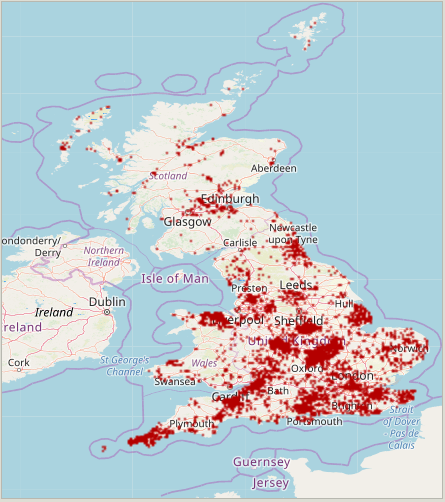
| 18:26, 12 February 2022 | Screenshot-Editing-Addresses in Great Britain.png (file) |  |
150 KB | 1 | |
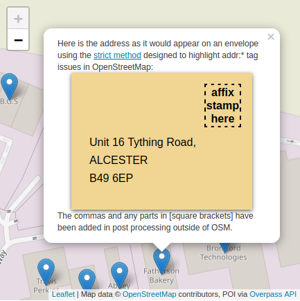
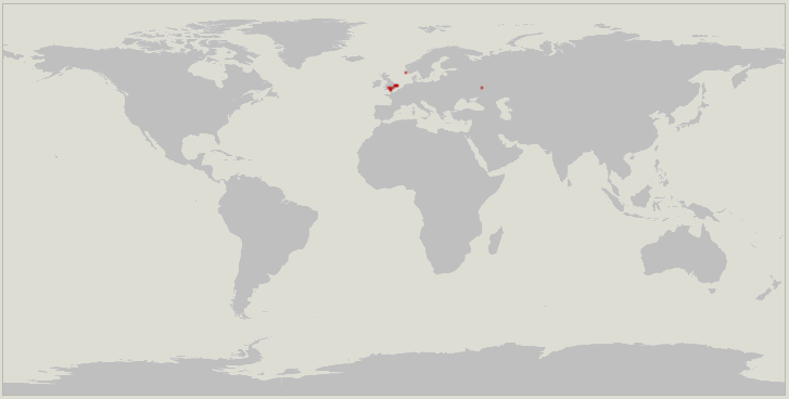
| 17:59, 12 February 2022 | Envelopes map.png (file) |  |
75 KB | 1 | |
| 14:19, 20 December 2021 | Essex Court Warwick UK-aerial.jpg (file) |  |
39 KB | 1 | |
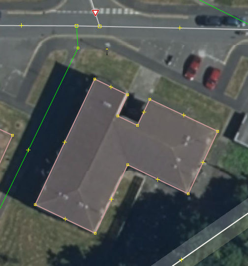
| 14:17, 20 December 2021 | Essex Court Warwick UK.jpg (file) |  |
374 KB | 1 | |
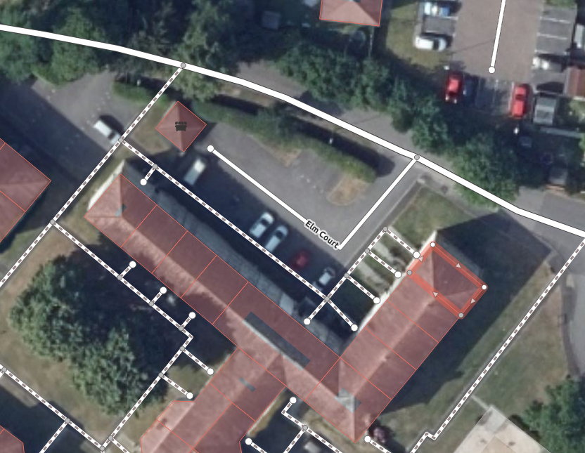
| 12:04, 20 December 2021 | Elm Court.png (file) |  |
739 KB | 1 | |
| 11:42, 20 December 2021 | Addr parentstreet global 2021-12.png (file) |  |
18 KB | 1 | |
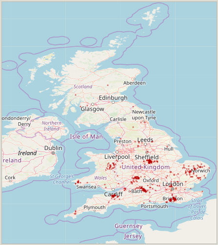
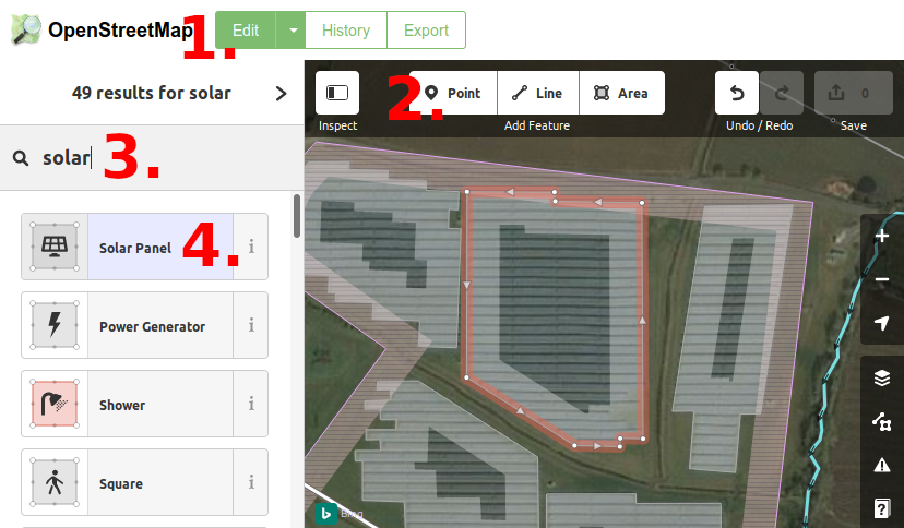
| 11:28, 20 December 2021 | Addr locality UK 2021-11.png (file) |  |
106 KB | 1 | |
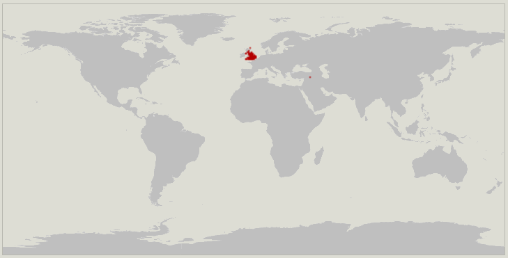
| 11:28, 20 December 2021 | Addr locality global 2021-11.png (file) |  |
16 KB | 1 | |
| 22:24, 14 December 2021 | Addr site UK 2021-11.png (file) |  |
101 KB | 1 | |
| 22:23, 14 December 2021 | Addr site global 2021-11.png (file) |  |
15 KB | 1 | |
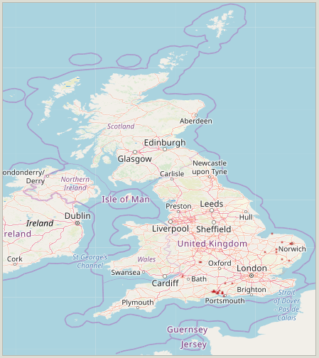
| 22:16, 14 December 2021 | Addr place UK 2021-11.png (file) |  |
128 KB | 1 | |
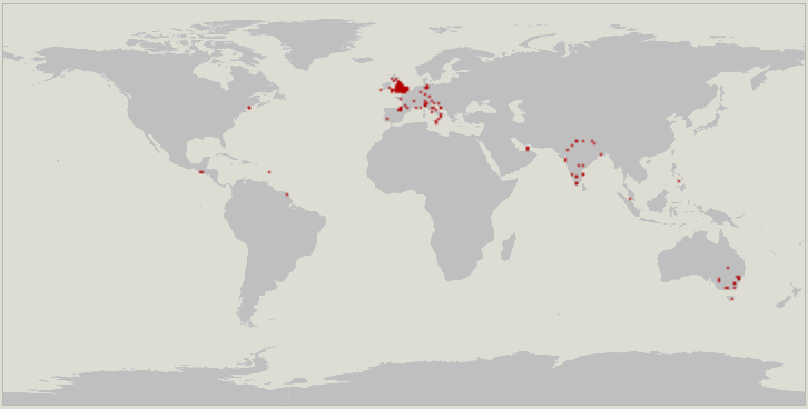
| 22:14, 14 December 2021 | Addr place global 2021-11.png (file) |  |
36 KB | 1 | |
| 19:16, 11 October 2021 | Accenture-Navigating-OpenStreetMap.pdf (file) |  |
1.83 MB | A 2020 paper written by Accenture on how to make the most of OpenStreetMap. The target audience is businesses, organisations and the public sector. | 1 |
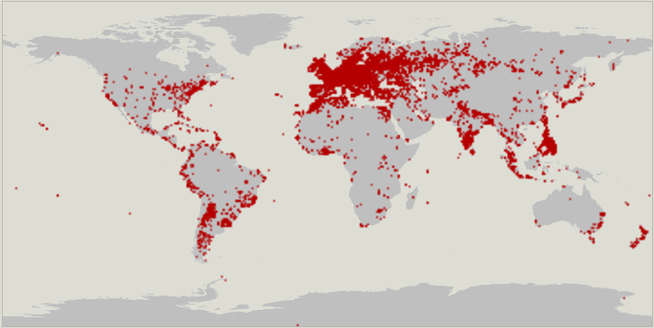
| 20:54, 8 August 2019 | Solar Mapping.png (file) |  |
273 KB | 1 | |
| 16:39, 12 May 2019 | UK regional mapathons 2019-2020.png (file) |  |
877 KB | 1 | |
| 22:42, 26 July 2018 | State of the Map 2018 attendees.pdf (file) |  |
358 KB | Update to 23:59 CET 2018-07-26 | 2 |
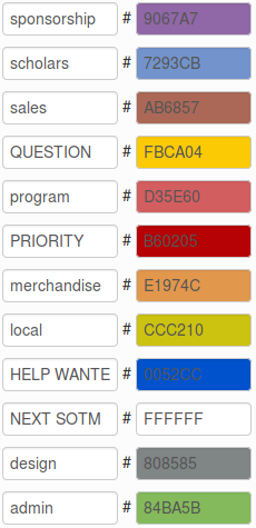
| 23:02, 8 November 2017 | GitHub sotm labels.png (file) |  |
33 KB | New set of labels that align with the categories in our timeline. | 2 |
| 11:07, 21 October 2017 | Event plan 2017.odt (file) | 258 KB | The ODT version of the State of the Map 2017 event plan, | 1 | |
| 11:04, 21 October 2017 | Event plan 2017.pdf (file) | 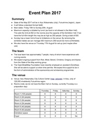 |
375 KB | The State of the Map event plan for 2017. | 1 |
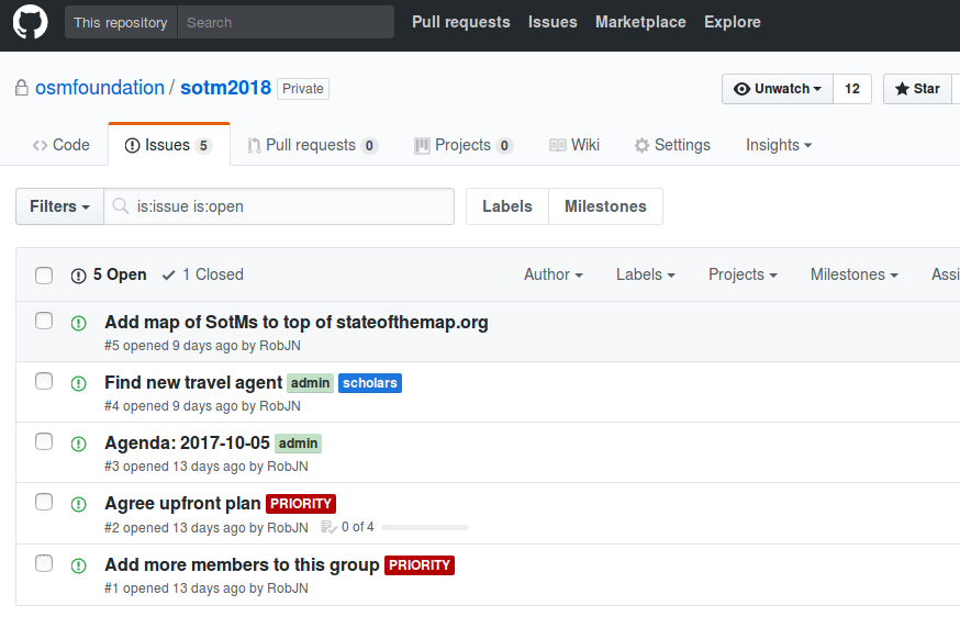
| 22:22, 9 October 2017 | SotM github.png (file) |  |
58 KB | 1 | |
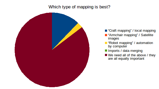
| 19:00, 2 October 2017 | Best mapping.png (file) |  |
19 KB | Result from RobJN's live polling session at State of the Map 2017. | 1 |
| 18:16, 30 September 2017 | Budget for SotM (general).ods (file) | 28 KB | 1 | ||
| 21:52, 9 August 2017 | JR-Pass-User-Guide-04-16.pdf (file) |  |
573 KB | JR Pass user guide. | 1 |
| 21:52, 9 August 2017 | JR pass collect.pdf (file) | 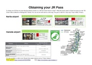 |
162 KB | 1 | |
| 21:50, 9 August 2017 | Aizu station to hotel.pdf (file) | 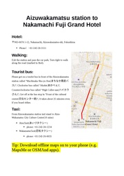 |
91 KB | Instructions from Aizu-wakamatsu station to the main hotel. | 1 |
| 21:50, 9 August 2017 | Narita to AizuW.pdf (file) | 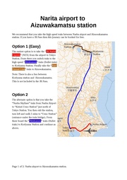 |
205 KB | Instructions from Narita airport to Aizu-wakamatsu. | 1 |
| 21:49, 9 August 2017 | Haneda to AizuW.pdf (file) | 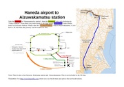 |
212 KB | Instructions from Haneda airport to Aizu-wakamatsu. | 1 |
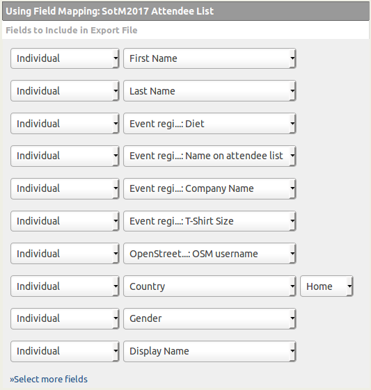
| 20:41, 10 July 2017 | Ticket fields.png (file) |  |
34 KB | Fields to select when exporting SotM attendee list. | 1 |
| 20:23, 10 July 2017 | T-Shirt size guide.ods (file) | 22 KB | Handy tool to help with getting the right size distribution. | 1 | |
| 20:53, 3 July 2017 | ExtraStay policy.ods (file) | 13 KB | Added "this does not prevent us from updating the allowable days in the case of joint arrangements (e.g. if HOT summit co-locates with SotM)" | 2 | |
| 00:25, 24 March 2017 | WikiMania scholarship form questions.doc (file) | 33 KB | WikiMania 2017 call for scholarship application form as copied from their website. Please accept our apologies for the bad formatting here. Hopefully it is still useful. | 1 | |
| 21:54, 15 February 2017 | SotM2017 Logo Design Concept.pdf (file) | 5.73 MB | The concepts behind the State of the Map 2017 logo. | 1 | |
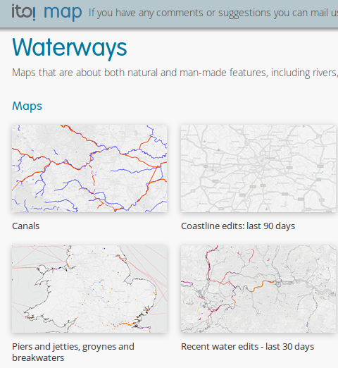
| 14:27, 7 January 2017 | Ito rivers.png (file) |  |
211 KB | ITO World series of water themed maps. | 1 |
| 11:50, 1 October 2016 | State of the Map 2016 attendees.pdf (file) |  |
95 KB | List of attendees (showing only those who accepted to be on the public list). | 1 |
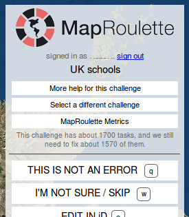
| 21:46, 4 March 2016 | Unzorrotron.png (file) |  |
62 KB | Now known as MapRoulette. | 2 |
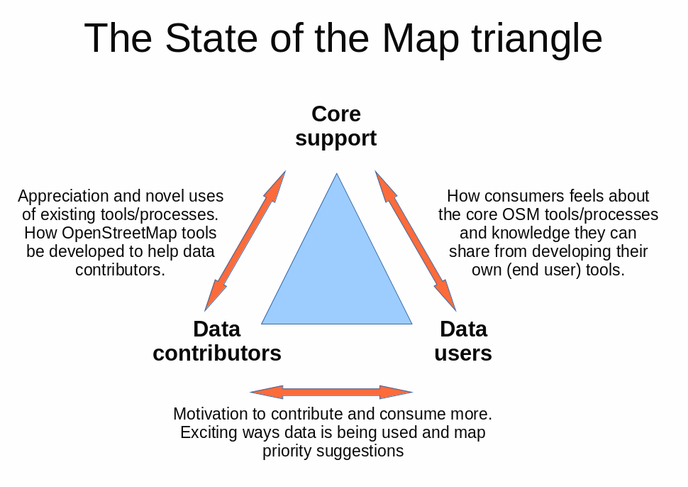
| 22:47, 3 March 2016 | SotM triangle.png (file) |  |
76 KB | Align names to text used on wiki. | 2 |
| 14:14, 11 July 2015 | Historic England logo.jpg (file) | 591 KB | The logo of Historic England. | 1 | |
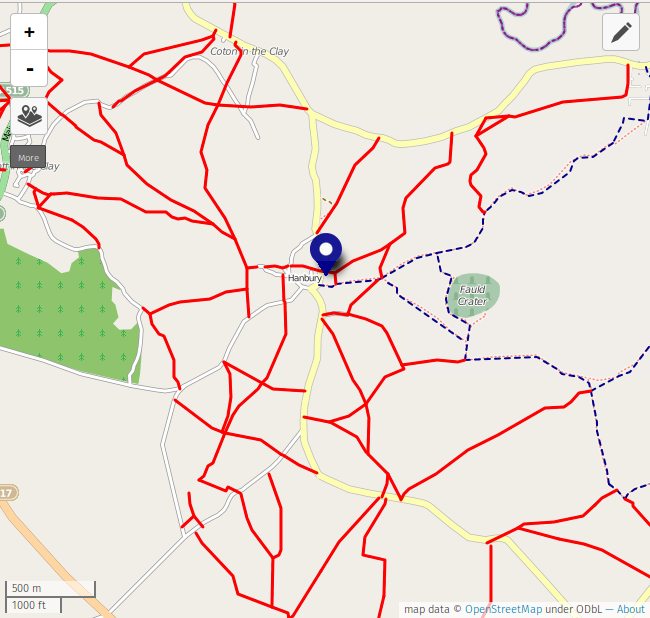
| 15:58, 29 December 2014 | HarburyPaths.png (file) |  |
145 KB | Footpaths missing from the area surrounding Harbury, Staffs. | 1 |
| 13:10, 10 August 2014 | Post box types.jpg (file) |  |
72 KB | A collection of post box types. Based on the following images (and their licences): File:Victorian_postbox_in_Windsor_Avenue_Radyr.JPG File:Post Box Back Lane - geograph.org.uk - 97825.jpg File:Windsor letterbox 02.JPG [[File:Inverness_Lon... | 1 |
| 19:00, 6 July 2014 | Mapnik-tracktype-not-set.png (file) |  |
1 KB | Update post rendering style change - https://github.com/gravitystorm/openstreetmap-carto/pull/557 | 1 |
| 18:59, 6 July 2014 | Mapnik-tracktype-grade5.png (file) |  |
1 KB | Update post rendering style change - https://github.com/gravitystorm/openstreetmap-carto/pull/557 | 2 |
| 18:59, 6 July 2014 | Mapnik-tracktype-grade4.png (file) |  |
1 KB | Update post rendering style change - https://github.com/gravitystorm/openstreetmap-carto/pull/557 | 2 |
| 18:59, 6 July 2014 | Mapnik-tracktype-grade3.png (file) |  |
2 KB | Update post rendering style change - https://github.com/gravitystorm/openstreetmap-carto/pull/557 | 2 |
| 18:59, 6 July 2014 | Mapnik-tracktype-grade2.png (file) |  |
2 KB | Update post rendering style change - https://github.com/gravitystorm/openstreetmap-carto/pull/557 | 2 |
| 18:58, 6 July 2014 | Mapnik-tracktype-grade1.png (file) |  |
1 KB | Update post rendering style change - https://github.com/gravitystorm/openstreetmap-carto/pull/557 | 4 |
| 21:18, 19 April 2014 | Sign-up-illustration.png (file) |  |
41 KB | 1 | |
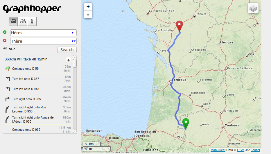
| 15:05, 25 January 2014 | Routing graphhoppercom.png (file) |  |
523 KB | Routing from Hères, France to Thère, France using GraphHopper.com | 1 |
| 21:15, 14 October 2013 | OSM 2011 Black.svg (file) |  |
160 KB | In this update I make the logo background fully transparent (previously the magnifying glass was white). Due to my lack of skill with Inkscape this edit is a bit "hacky", so should you wish to make further edits then I suggest you revert back to the pr... | 3 |
| 18:39, 8 October 2013 | SOTM2013 Birmingham final.svg (file) |  |
682 KB | Logo for State of the Map 2013, held in Birmingham, United Kingdom. Design by overflorian. | 1 |
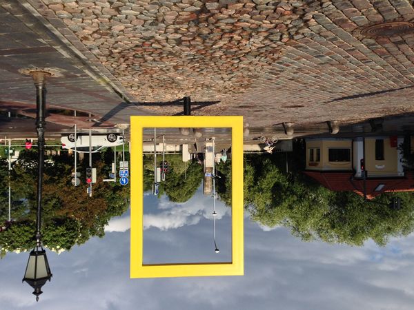
| 12:53, 8 September 2013 | SOTM Comp Photo.JPG (file) |  |
83 KB | Sculpture, Tartu, Estonia Taken at SOTM Baltics 2013 Dermot McNally | 1 |