Tag:industrial=food_industry
Jump to navigation
Jump to search
 |
| Description |
|---|
| Using this tag is discouraged, use man_made=works + industrial=* + product=* instead. |
| Group: industrial |
| Used on these elements |
| Status: deprecated |
| Tools for this tag |
|
![]()
This feature has been labeled as deprecated. The recommended replacement is: man_made=works + industrial=* + product=*.
The reason is documented in Deprecated features. You are still free to continue to use or interpret this tag as you see fit since OpenStreetMap does not have “banned features”.
Under no circumstances should you (semi-)automatically change “deprecated” tags to something else in the database on a large scale without conforming to the automated edits code of conduct. Any such change will be reverted.
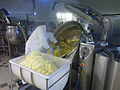
The tag industrial=food_industry is used to map entities which produce food en gros, also see ![]() Food_industry
Food_industry
How to map
Set a node or draw as an area along the shop outline. Tag it with industrial=food_industry. Add name using name=*.
Tags used in combination
- name=*
- address
- website=*
- email=*
- phone=*
- opening_hours=*
- brand=*
- operator=*
- wheelchair=*
Examples
Mashed potatoes

Stand mixer

