Tag:place=ocean
Jump to navigation
Jump to search
| Description |
|---|
| The world's five main major oceanic divisions. |
| Group: places |
| Used on these elements |
| Useful combination |
|
| Status: de facto |
| Tools for this tag |
|
| Note that there are various methods of dividing Earth's water into oceans[1] making this tag highly subjective. In addition, with so prominent objects and low element count it is highly dubious whatever this data would be considered as better than manual labelling by data consumers. Manual labeling can be tweaked to fit specific map and will not be changed by OSM edits. |
For identifying and locating the world's five main major oceanic divisions, see ![]() Ocean:
Ocean:
- Arctic Ocean
- Atlantic Ocean
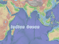
- Indian Ocean
- Pacific Ocean
- Southern Ocean
Note that seas (parts of oceans) are mapped separately, see place=sea.
How to Map
Add place=ocean and name:code=* (where code is ISO 639 code of the language) to the appropriate node. Because oceans belong to all nations, they don't have one main name, so leave the tag name=* empty.
Example
place=ocean
name:en=Atlantic Ocean
name:eo=Atlantiko
name:fr=Océan Atlantique
name:it=Oceano Atlantico
name:ja=大西洋
name:pt=Ilhas do Oceano Atlântico
name:es=Océano Atlántico
place=ocean
name:en=Pacific Ocean
https://www.openstreetmap.org/node/305640005#map=4/-0.57/-107.84&layers=P
Maps showing oceans
References
- ↑ Borders of the oceans on Wikipedia

