WikiProject Slovakia/Sources
Except GPS logs, there are some free sources for mapping of Slovakia. This is just rough summary of them, more can be found at http://wiki.freemap.sk (in Slovak only).
Atribúty Katastrálneho Operátu
Includes data from https://ako.vugk.sk/
From: Vojtko Peter, Ing. <peter.vojtko@skgeodesy.sk>
To: "pochypat7@gmail.com" <pochypat7@gmail.com>
CC: "Hudák Štefan, Mgr." <stefan.hudak@skgeodesy.sk>, "Raškovič Vladimír, Ing." <vladimir.raskovic@skgeodesy.sk>
Date: 2022-05-25 15:52
Subject: Súhlas

Týmto vyjadrujeme súhlas s využívaním datasetov vypublikovaných ako Open Data (Otvorené dáta) zo stránky https://ako.vugk.sk/ (Atribúty   katastrálneho operátu) na účely využívania v rámci OpenStreetMap. Autorom údajov je ÚGKK SR.

S pozdravom

Ing. Peter Vojtko
riaditeľ Katastrálneho odboru
Úrad geodézie, kartografie a katastra SR
Chlumeckého 2, 820 12  Bratislava 212
Tel.: +421 2 2081 6050
e-mail:  peter.vojtko@skgeodesy.sk
web:http://www.skgeodesy.sk
Tagging: source=ÚGKK SR AKO
Územné a správne usporiadanie
Includes data "Územné a správne usporiadanie" from https://www.geoportal.sk/sk/zbgis_smd/na-stiahnutie/.
From: Fojtl Matúš, Ing. <matus.fojtl@skgeodesy.sk>
CC: "Leitmannová Katarína, Ing." <Katarina.Leitmannova@skgeodesy.sk>
Date: 2021-03-16 8:48

Týmto vyjadrujeme súhlas s využívaním datasetu Územné a správne usporiadanie zo stránky ÚGKK SR na účely mapovania do databázy OpenStreetMap. Ako autora treba uviesť GKÚ Bratislava
Tagging: source=GKÚ Bratislava
ÚGKK SR DMR 5.0
Includes data from https://www.geoportal.sk/sk/udaje/lls-dmr/.
From: Fojtl Matúš, Ing. <matus.fojtl@skgeodesy.sk>
CC: "Hanus Dušan, Ing." <Dusan.Hanus@skgeodesy.sk>, "Leitmannová Katarína, Ing." <Katarina.Leitmannova@skgeodesy.sk>,
"Slabeyová Zuzana, Mgr." <Zuzana.Slabeyova@skgeodesy.sk>
Date: 2021-03-04

Týmto vyjadrujeme súhlas s využívaním datasetu Digitálny model reliéfu DMR 5.0 zo stránky ÚGKK SR (https://www.geoportal.sk/sk/udaje/lls-dmr/) na účely mapovania do databázy OpenStreetMap. Ako autora treba uviesť ÚGKK SR.
Tagging: source=ÚGKK SR DMR 5.0
Inspire datasets
Includes datasets from https://www.geoportal.sk/sk/inspire/zobrazovacie-sluzby/ and https://www.geoportal.sk/sk/inspire/ukladacie-sluzby/.
From: Fojtl Matúš, Ing. <matus.fojtl@skgeodesy.sk>
CC: "Hanus Dušan, Ing." <Dusan.Hanus@skgeodesy.sk>, "Leitmannová Katarína, Ing." <Katarina.Leitmannova@skgeodesy.sk>,
"Slabeyová Zuzana, Mgr." <Zuzana.Slabeyova@skgeodesy.sk>
Date: 2021-03-04

Týmto vyjadrujeme súhlas s využívaním údajov a služieb INSPIRE zo stránky ÚGKK SR (https://www.geoportal.sk/sk/inspire/) na účely mapovania do databázy OpenStreetMap. Autora treba uvádzať vždy tak, ako je uvedený k príslušnej téme (ÚGKK SR/GKÚ Bratislava).
Tagging: source=ÚGKK SR Inspire or source=GKÚ Bratislava Inspire depending on the Author column
Ortofotomozaika SR (orthophoto by GKÚ and NLC)
National forestry center (Národné lesnícke centrum vo Zvolene) and Geodetic and Cartographic Institute Bratislava (Geodetický a kartografický ústav Bratislava) released imagery for free use. More info and order on https://www.geoportal.sk/sk/udaje/ortofotomozaika/ (Slovak only).
Terms of use of source data:
- Source data is provided to the subscriber free of charge.
- The data subscriber is entitled to combine source data with other data, to use them in creating their own work for commercial and non-commercial purposes, create new work, publish work on the Internet, publish source data as the underlying map, publish source data in conjunction with other data / thematic layers through web applications.
- The subscriber is obliged to state the author of the source data when creating his own work and when publishing it in the form "© GKÚ, NLC; r.2017. "
- Copyrights enjoy protection under the relevant provisions of Act no. 185/2015 - Copyright Act, as amended, as well as the Criminal Code.Abuse of data by users may therefore have civil or criminal consequences.
Imagery in JOSM: tms[19]:https://ofmozaika.tiles.freemap.sk/{zoom}/{x}/{y}.jpg
Tagging: source=Ortofotomozaika SR
Entire Slovakia is available.
From: Leitmannová Katarína, Ing. <Katarina.Leitmannova@skgeodesy.sk>
Date: Tue, Oct 13, 2020 at 9:09 AM
Subject: FW: Použitie Ortofotomozaiky SR pre účely mapovania do OpenStreetMap
To: martin.zdila@freemap.sk <martin.zdila@freemap.sk>
Cc: Michalík Ľuboslav <Luboslav.Michalik@skgeodesy.sk>, Mikova Anna (anna.mikova@nlcsk.org) <anna.mikova@nlcsk.org>

Dobrý deň,

týmto vyjadrujeme súhlas s využívaním ortofotomozaiky SR zo stránky https://www.geoportal.sk/sk/ na účely mapovania do OSM. Zároveň Vás upozorňujeme, že je potrebné dodržiavať licenčné podmienky - Podmienky poskytovania a používania údajov ortofotomozaiky.

Na stránke prispievateľov do OSM prosím upravte zdroj údajov takto:

Data with <code>source=Ortofotomozaika SR</code> derived from National forestry center (Národné lesnícke centrum vo Zvolene) and Geodetic and Cartographic Institute Bratislava (Geodetický a kartografický ústav Bratislava) imagery. © GKÚ, NLC; r.2017-2019.

S pozdravom

Ing. Katarína Leitmannová
riaditeľka odboru geodézie a medzinárodných vzťahov
Úrad geodézie, kartografie a katastra SR
Chlumeckého 2, 820 12  Bratislava 212
Tel.: +421 2 2081 6080
e-mail: ugkkogmv@skgeodesy.sk
http://www.geodesy.gov.sk
ZBGIS WMS
WMS from https://www.geoportal.sk/sk/sluzby/mapove-sluzby/wms/wms-zbgis.html can be used to derive data into OpenStreetMap.
Tagging: source=ZBGIS
Update: June 28, 2023 Permission to use data from ZBGIS for OpenStreetMap.
From: GKUZC <GKUZC@skgeodesy.sk>
To: "michal.bellovic@freemap.sk" <michal.bellovic@freemap.sk>
Subject: RE: otazka na novu zmluvu s Freemap Slovakia

Dobrý deň,

(posielame vyjadrenie):

uzatváranie dohody nie je potrebné. Nižšie je emailový súhlas s využívaním voľne dostupných služieb ZBGIS.

Týmto vyjadrujeme súhlas s využívaním voľne dostupných služieb ZBGIS zo stránky https://www.geoportal.sk/sk/sluzby/mapove-sluzby/ na účely mapovania do databázy OpenStreetMap. Autora treba uvádzať vždy tak, ako je uvedený k príslušnej službe Geodetický a kartografický ústav Bratislava. Zároveň je potrebné dodržiavať licenčné podmienky.

Pekný deň.

S pozdravom

Zákaznícke centrum
Michaela Strapková
Geodetický a kartografický ústav Bratislava
Chlumeckého  4, 827 45 Bratislava
Tel.: +421 902 906 631
e-mail: gkuzc@skgeodesy.sk
http://www.gku.sk
Old agreement
Agreement between Geodetický a kartografický ústav Bratislava (Cartography and Cadastre Authority) and Freemap Slovakia. Agreement is valid for 5 years from June 25, 2018.


Geografický ústav Slovenskej akadémie vied
Geomorphological borders.
Agreement on https://www.crz.gov.sk/index.php?ID=4100043&l=sk (Slovak language)
source=Geografický ústav SAV
Yahoo! Aerial Imagery
Yahoo! Aerial Imagery is available only in area around Bratislava. See outline.
Cadastral map
Cadastral map is public domain in Slovakia. Big part is digitized and accesible on-line.
Data from cadaster has no copyright as stated by Geodesy, Cartography and Cadastre Authority of the Slovak Republic. Communication with authority (in Slovak) is listed at http://wiki.freemap.sk/KatasterPortal
In JOSM you can use FreeKaPor plug-in. It exports all vector data or just buildings. See freemap wiki for details.
Also accesible using WMS at http://93.184.70.94:21880/cgi-bin/mapserv. See freemap wiki for details.
Tagging: source=kapor2
Forest paths
According to agreement with Národné Lesnícke Centrum (National forestry center) forest tracks from their database can be placed into OSM. See freemap wiki for details.
Tagging: source=NLC

ATM address data & ref of VUB bank
As per written permission (email) we are allowed to use address data & id for approx. 500 (as of 2016) atm's operated by VUB bank for inclusion in OSM. Coordinates come from a source incompatible with ODbL therefore we are not entitled to use them. For areas in OSM with dense address data coverage this should still bring reasonable accuracy.
Tesco Stores shops
TESCO STORES SR, a.s. gave permission to use information about their retail shops in Slovak Republic, as published at http://www.tesco.sk/tesco-v-sr/obchody/. The permission is to use this data displayed on the website: name of the shop, type (like supermarket, hypermarket, department store, etc.), address, opening hours, contact information. There is no permission to use anything else from the underlying maps as those are from Google Maps. The email communication (in Slovak) is currently available on request from user aceman444.
Tagging:
source=www.tesco.sk
website=http://www.tesco.sk/tesco-v-sr/obchody/
Barborská cesta
Skeyemap, s.r.o. on behalf of Mr. Jaroslav Piroh gave permission written by email to use GPX tracks of Barborská cesta (Barbora trail) from http://barborskacesta.com for mapping to OpenStreetMap.
A bus stop in district Rožňava
eurobus, a.s. on Ing. Rudolf Dzuruš, vedúci odd. projektovej, dopravnej a pokladničnej činnosti, written by email to use bus stop name, GPS and ISCP code.
Other sources
Some sources from neighbour countries may overlap with Slovakia at border areas. See Austria, Czech Republic, Hungary, Poland and Ukraine.
Tatranské názvoslovie (High Tatras peaks)
Publisher of the map called "Vychodne Tatry v mierke 1:20000, ISBN 978-80-970646-6-2" gave written permission by email to use names of peaks and saddles in the OpenStreetMap. Map was issued by Litvor (Marián Jacina) in 2019, permission given in January 2021.
source=Litvor
Tatranské názvoslovie (High and Low Tatras)
Owner of the web site "http://www.miropeto.sk/sprievodca/vseobecne-informacie-o-sprievodcovi/" Miroslav Peťo gave written permission by email to use names of peaks, saddles, valleys and ridges in the OpenStreetMap from his photo maps. This permission does not include using schematic maps! Permission given in February 2021.
source=MiroslavPeťo
Slovenská pošta - pobočky (Slovak post office branches)
We've been given a permission over a phone call to use data published at https://www.posta.sk/stranky/informacie-k-otvaracim-hodinam-post to add missing/correct existing information regarding branches of Slovenská pošta. The owner of the data Ing. Marta Suchá Odbor podpory a rozvoja pobočkovej siete also agreed and provided access to GPS coordinates and opening hours at https://otvaraciehodiny.posta.sk/. Dodko is an organizer and a coordinator of the import. There is no dedicated user and import participants use their own accounts to add information to OSM. Related discussion thread: https://groups.google.com/g/osm_sk/c/afglwDyRtBM/m/KGd1-IjvAQAJ [Slovak]
The import started in June 2021 and was completed in July 2021. As part of the import the following tags are being added/updated:
name=
operator=Slovenská pošta
brand=Slovenská pošta or brand=Pošta Partner
amenity=post_office
opening_hours=
website=
phone=
source=https://www.posta.sk/stranky/informacie-k-otvaracim-hodinam-post;
Skratky vnútroštátnych dopravných bodov ŽSR (The Slovak Railways national traffic points abbreviations)
Based on the email shown below The Slovak Railways (ŽSR) gave permission to use The Slovak Railways national traffic points abbreviations.
Zverejnenie skratiek názvov staníc ŽSR na otvorenej železničnej mape sveta openrailwaymap.org
Zeleňák Roman Thu, Sep 9, 2021 at 6:54 AM
To: Tomas Jancovic
Cc: Mitas Ľubomír , Wlachovský Ivan
Dobrý deň,
v prílohe vám zasielame požadované údaje.
Ing. Roman Zeleňák
vedúci oddelenia GR ŽP
Odbor dopravy
Oddelenie technologické
ŽSR - Železnice Slovenskej republiky
Klemensova 8, 813 61 Bratislava
---------- Preposlaná správa ----------
Od: Mitas Ľubomír
Dátum: 9. 9. 2021 6:36
Predmet: FW: Zverejnenie skratiek názvov staníc ŽSR na otvorenej železničnej mape sveta openrailwaymap.org
Komu: Wlachovský Ivan ,___ŽSR GR O410 sekretariát
Kópia: Ing. Ľubomír Mitas
Manažér externej komunikácie
Odbor komunikácie a marketingu
ŽSR - Železnice Slovenskej republiky
Klemensova 8, 813 61 Bratislava
From: Tomas Jancovic
Sent: Thursday, September 9, 2021 1:15 AM
To: ŽSR hovorca
Subject: Zverejnenie skratiek názvov staníc ŽSR na otvorenej železničnej mape sveta openrailwaymap.org
Dobrý deň,
podieľam sa na úpravách otvorenej železničnej mapy sveta openrailwaymap.org. Uvedená mapa zobrazuje v okolitých štátoch v jednej zo svojich vrstiev aj skratky názov staníc železničnej siete. Žiaľ, na Slovensku tieto informácie v mape chýbajú. Prosím, mohli byste mi zaslať skratky názvov staníc pre sieť ŽSR (napr. Bahl pre Bratislava hlavná stanica, Zvos pre Zvolen osobná stanica a podobne ) a súhlas a ich použitím v uvedenej mape? Skrátky následne do mapy doplním a budú slúžiť pre orientáciu v mape hlavne pre železničných fanúšikov . Ďakujem.
S pozdravem
Tomáš Jančovič
Skratky_vnútroštátnych_dopr._bodov_ŽSR.xls
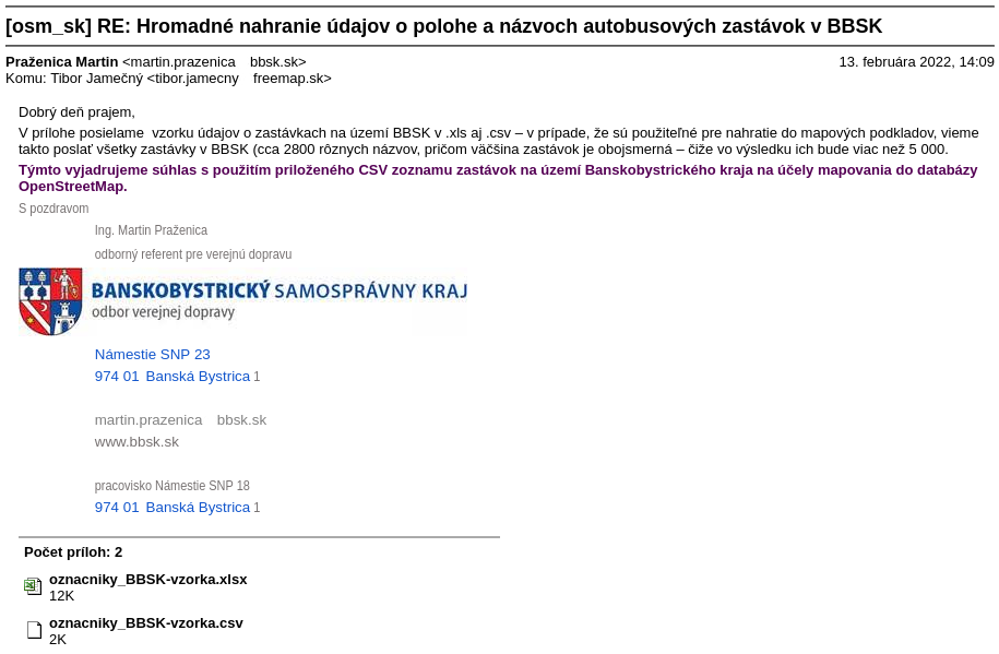
Zoznam autobusových zastávok na území Banskobystrického samosprávneho kraja (List of bus stops in the area of Banskobystrický samosprávny kraj)
The provided XLS file contains: name, GPS position, shelter, bench, bin, lit, wheelchair, tactile_paving.
Permission: here (it is not possible to upload it here on the Wiki)
Tagging: source=BBSK
From: Tomas Jancovic
Date: Wed, Nov 9, 2022 at 10:02 AM
Subject: Re: Žiadosť o súhlas s použitím údajov zo stránky galeriaulice.sk
To: Mgr. Adrián Kobetič
Dobrý deň,
ďakujem, stačí takto. Dáta postupne vložím do Openstreetmap v priebehu nasledujúcich mesiacov.
S pozdravom
Tomáš Jančovič
Dne st 9. 11. 2022 9:55 uživatel Mgr. Adrián Kobetič napsal:
Zdravím vás! Ďakujem veľmi pekne za záujem a určite áno môžete údaje použiť. Otázka je či potrebujete aj nejaký oficiálny súhlas alebo stačí takto mailom. Vďaka a pekný deň
AK Odoslané z aplikácie Outlook pre iOS
Od: Tomas Jancovic
Odoslané: Monday, November 7, 2022 5:37:19 PM
Komu: Mgr. Adrián Kobetič ; [[1]]
Predmet: Žiadosť o súhlas s použitím údajov zo stránky galeriaulice.sk
Dobrý deň,
som jeden z dobrovoľníkov, ktorý sa podieľa na vytváraní celosvetovej zdarma dostupnej mapy Openstreetmap (www.openstreetmap.org). Chcel by som do mapy pridať umelecké diela a základné údaje o nich (dátum vzniku, umelec...), ktoré ste popísali vo Vašom projekte Galéria ulice.
Prosím pre tento účel o Váš súhlas s použitím údajov o umeleckých dielach zo stránky https://galeriaulice.sk/.
Ďakujem.
S pozdravom
Tomáš Jančovič
Mapa Tatier https://petermatula.github.io/tatry/
On Wed, Feb 14, 2024 at 12:03 PM Tatry Mapa <tatry.mapa@...> wrote:
Dobry den,
urcite ano, ak sa Vam do toho chce. ... S pozdravom Peter Matula On 2/14/24 09:37, Tomas Jancovic wrote: > Zdravim, > môžem použiť vašu mapu https://petermatula.github.io/tatry/ pre > doplnenie názvov objektov, ktoré existujú v Openstreetmap, ale nie sú > pomenované? > Ďakujem za odpoveď.
> Tomáš Jančovič alias Tomas_J v OSM