Zh-hans:Featured images/Jul-Sep 2015
Jump to navigation
Jump to search
这是特色图片,展现开放街图画地图范例,以及最能代表开放街图的专案。
如果你知道其他有类似品质的图片,你可以在特色图片提名处(en)提名。
| ← 从2014年7月到9月 | ← 从2015年4月到6月 | 从2015年10月到12月 → | 从2016年7月到9月 → |
特色图片库、从2015年7月到9月
细节和字幕
第27周(从2015年6月29日星期一到2015年7月5日星期日) [Edit]
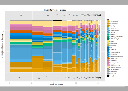
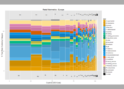
- English : User:SK53 has been investigating retail POI data, looking at the stats by country, and plotting this in a variety of ways. Read more on his blog post. This "Marimekko" diagram shows different retail types (shop tags) in different European countries.
- 中文(简体) : User:SK53研究商家兴趣点资料,依照国家整理数据,并且用不同类型图表呈现,可以到他的部落格文章了解更多资讯。这种"Marimekko"风格的图表能够显示在不同欧洲国家,不同类型的商家(商店标签)。
第28周(从2015年7月6日星期一到2015年7月12日星期日) [Edit]
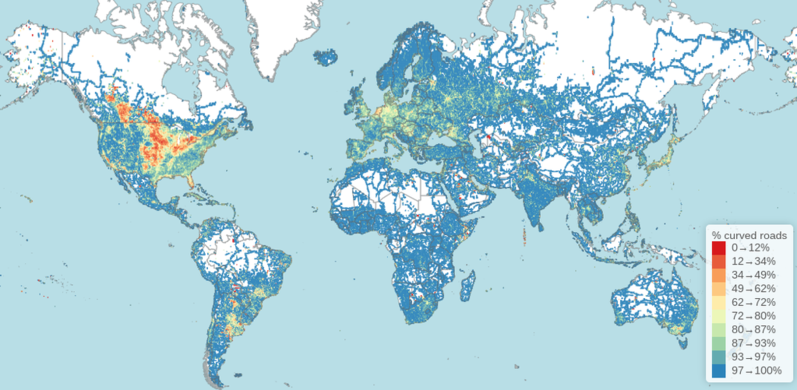
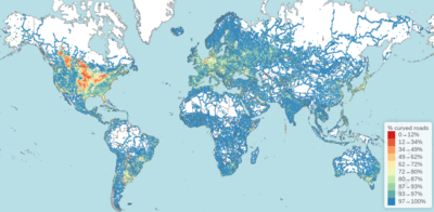
- English : Rory McCann analysed OpenStreetMap data to create this visualisation which answers the question "Where in the world has the straightest roads?
- 中文(简体) : Rory McCann 分析开放街图资料,视觉化资料,来回答「在世界那里有最直的道路?」这个问题。
第29周(从2015年7月13日星期一到2015年7月19日星期日) [Edit]
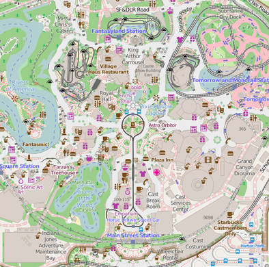
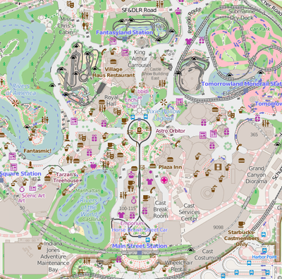
- English : Disneyland in California is celebrating its 60th anniversary this week. Kiosks, gardens and the routes of the roller-coasters, have all been mapped in glorious detail here on OpenStreetMap
- 中文(简体) : 加州迪士尼乐园这周庆祝60周年,自动贩卖机、花园、云霄飞车路线,全都被极其详细的画在-117.91880 开放街图上了
第30周(从2015年7月20日星期一到2015年7月26日星期日) [Edit]
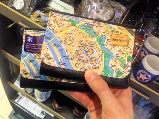
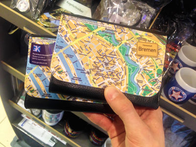
- English : This OpenStreetMap decorated wallet, manufactured by gerdkoch.de, was spotted on sale at the airport souvenirs shop in Bremen
- 中文(简体) : 这个开放街图案装饰的钱包,是由 gerdkoch.de 生产制作,可以在不来梅机场的纪念品店找到。
第31周(从2015年7月27日星期一到2015年8月2日星期日) [Edit]
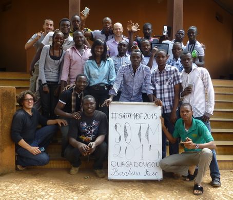
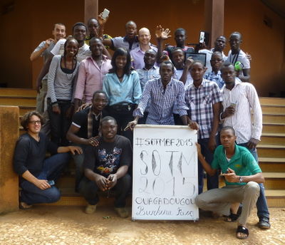
- English : Participants of the first West African State Of The Map (SOTM)! Organized at the Campus Numérique Francophone (CNF) in Ouagadougou, Burkina Faso last week. 20 mappers from 7 sub-region countries joined (Bénin, Burkina Faso, Côte d'Ivoire, Mali, Niger, Sénégal, Togo), within the context of a capacity-building mission from the Projet Espace OpenStreetMap Francophone (Projet EOF). See the SOTMBF conference program
- 中文(简体) : 上週在布吉尼納法索瓦加杜古 Campus Numérique Francophone (CNF) 舉行的活動,有 20 位來自 7 個不同分區加入 Bénin, Burkina Faso, Côte d'Ivoire, Mali, Niger, Sénégal, Togo), 為了 Projet Espace OpenStreetMap Francophone (Projet EOF) 的能量建構任務努力。請看SOTMBF 大會議程。
第32周(从2015年8月3日星期一到2015年8月9日星期日) [Edit]
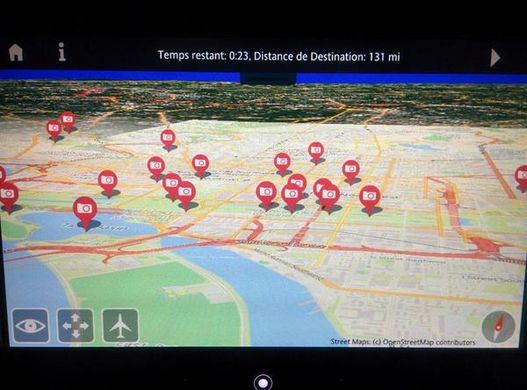
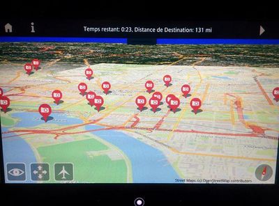
- English : Air France have an interactive 3D globe map view on their seatback displays, with maps from OpenStreetMap!
- 中文(简体) : 法国航空在椅背显示器里有3D互动的全球地球,地图资料来自开放街图!
第33周(从2015年8月10日星期一到2015年8月16日星期日) [Edit]
- English : The London Hack Weekend took place last weekend, with developers coming together to work on a wide variety of technical projects, as well as celebrating the OpenStreetMap birthday!
- 中文(简体) : 上周社群举办London Hack Weekend,开发者动手做种类繁多的技术计画,当然也包括庆祝开放开图生日快乐
第34周(从2015年8月17日星期一到2015年8月23日星期日) [Edit]
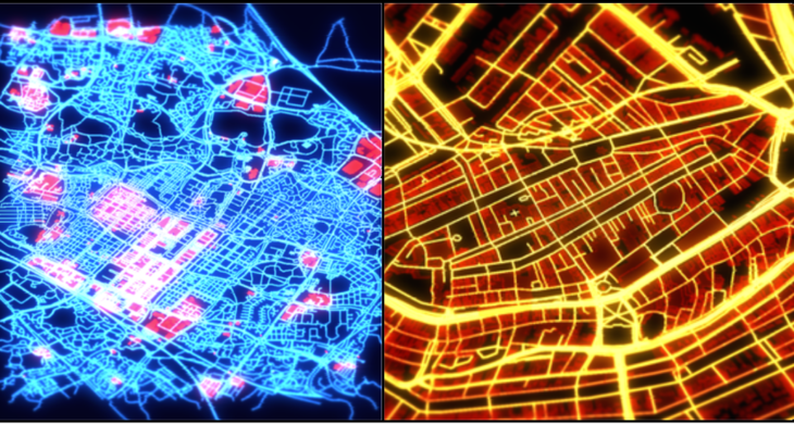
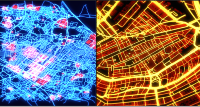
- English : Danny Goodayle experimented with OpenStreetMap data fed into the unity engine to create these and many more interesting city images
- 中文(简体) : Danny Goodayle 实验用开放街图资料放进unity 引擎,制作这些和其他许多有趣的城市影像
第35周(从2015年8月24日星期一到2015年8月30日星期日) [Edit]
- English : A mapping party in Parque del Retiro in Madrid, adding details of historical monuments and botanical targets to the map
- 中文(简体) : 在马德里Parque del Retiro 举行的图客松,目标是添加历史遗迹和植物相关的图征到地图上。
第36周(从2015年8月31日星期一到2015年9月6日星期日) [Edit]
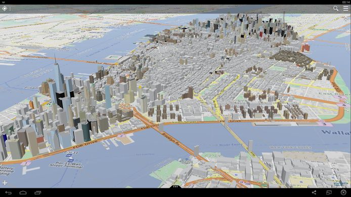
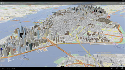
- English : OpenStreetMap building data in New York, New York. This was initially imported from NYC government datasets and has since been refined manually, to give more detailed shapes to many skyscrapers (ongoing). Viewed here with OSG-Maps the 3D data also looks great on osmbuildings.org, on F4 Map, and other 3D#Viewing software
- 中文(简体) : 纽约州纽约市的开放街图建筑资料。这些资料最初是由纽约市的政府资料汇入而来,如今经由人工校正修改,为摩天大楼加上更多建筑细节描述。这些资料的视觉化呈现可以在OSG-Maps,3D 资料在osmbuildings.org 和 F4 Map的呈现也相当好,以及其他3D 显示的软体观看。
第37周(从2015年9月7日星期一到2015年9月13日星期日) [Edit]
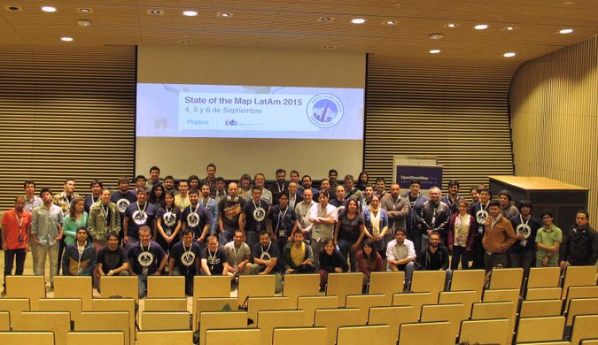
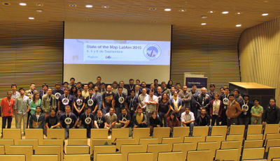
- English : State of the Map Latin America took place this weekend in Santiago, Chile
- 中文(简体) : 开放街图拉丁美洲大会这周末在智利的圣地牙哥举行。
第38周(从2015年9月14日星期一到2015年9月20日星期日) [Edit]
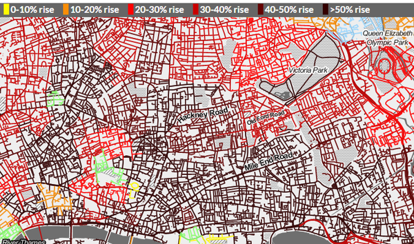
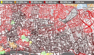
- English : Transport campaigning website howcongestedismyroad.org.uk shows traffic modelling data from Transport For London, snapped onto OpenStreetMap road network data and overlaid over Stamen's black & white toner style base-map
- 中文(简体) : 大众运输倡议网站howcongestedismyroad.org.uk 显示伦敦的交通流量模拟资料,嵌入开放街图的道路网资料,与Stamen 黑白蜡笔风格底图地图。
第39周(从2015年9月21日星期一到2015年9月27日星期日) [Edit]
- English : Volunteers verifying their position. The American Red Cross recently ran a community mapping exercise in Khayelitsha, a large township in Cape Town, South Africa. Read more on this diary entry including ways you can help with the ongoing mapping work
- 中文(简体) : 志工确认他们所在的位置。美国红十字会在南非开普敦一个相当大的小镇Khayelitsha 练习让社群画地图。 在这项日记项目阅读更多细节,包括让你加入参与仍在进行的画地图工作。

