File:Absalons Arch Roskilde 2015-03-30-4779.jpg
Jump to navigation
Jump to search


Size of this preview: 800 × 533 pixels. Other resolutions: 320 × 213 pixels | 640 × 427 pixels | 1,024 × 683 pixels | 1,280 × 853 pixels | 2,560 × 1,707 pixels | 5,150 × 3,433 pixels.
Original file (5,150 × 3,433 pixels, file size: 9.09 MB, MIME type: image/jpeg)
This file and its description are from Wikimedia Commons.
Summary
| Description |
Русский: Вид через арку Абсалона на ул. Domkirkestræde, соединяющую Роскилльский собор с резиденцией епископа. Готическая арка построена из травертина из остатков бывшей церкви на её месте. Видно, что арка была построена позже красно-кирпичного собора. Предполагается, что её строительство было по заказу Педера Сунесена.
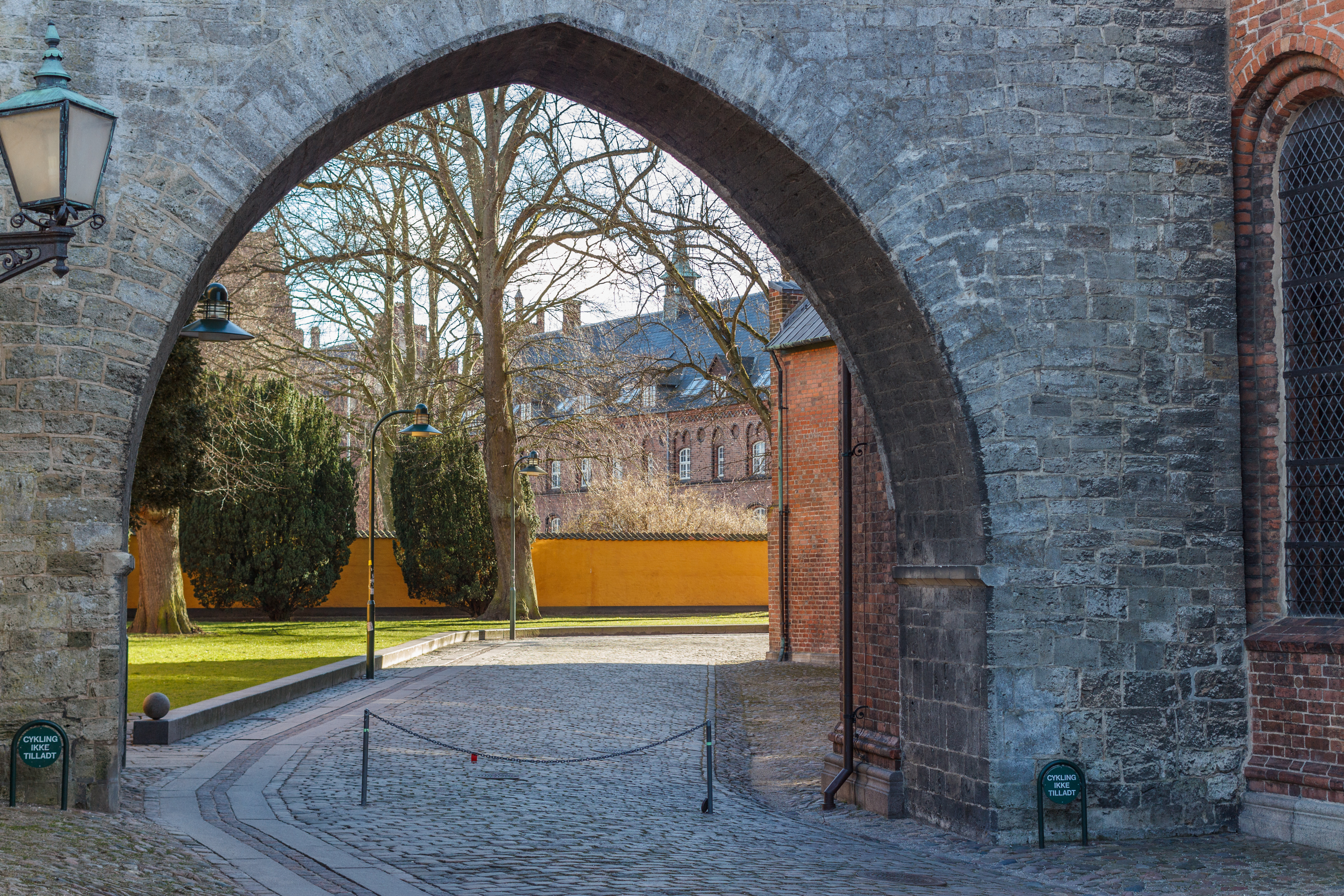
English: View through Absalon's Arch from Domkirkestræde connecting Roskilde Cathedral with the residence of the bishop. The gothic arch is built in travertine from remains of a previous church on the same location. It can be seen that it has been built after the red brick-stone s of the cathedral and it is speculated that the its construction has been commisioned by Peder Sunesen. |
| Date | |
| Source | Own work |
| Author | Slaunger |
| Camera location | | View this and other nearby images on: OpenStreetMap |
|---|
Licensing
I, the copyright holder of this work, hereby publish it under the following license:
This file is licensed under the Creative Commons Attribution-Share Alike 4.0 International license.
- You are free:
- to share – to copy, distribute and transmit the work
- to remix – to adapt the work
- Under the following conditions:
- attribution – You must give appropriate credit, provide a link to the license, and indicate if changes were made. You may do so in any reasonable manner, but not in any way that suggests the licensor endorses you or your use.
- share alike – If you remix, transform, or build upon the material, you must distribute your contributions under the same or compatible license as the original.
File history
Click on a date/time to view the file as it appeared at that time.
| Date/Time | Thumbnail | Dimensions | User | Comment | |
|---|---|---|---|---|---|
| current | 18:39, 13 April 2015 | | 5,150 × 3,433 (9.09 MB) | wikimediacommons>Slaunger | User created page with UploadWizard |
File usage
The following page uses this file: