File:Karte der Bahnstrecke Mönchengladbach–Düsseldorf.png
Jump to navigation
Jump to search

Size of this preview: 800 × 277 pixels. Other resolutions: 320 × 111 pixels | 1,209 × 418 pixels.
Original file (1,209 × 418 pixels, file size: 529 KB, MIME type: image/png)
This file and its description are from Wikimedia Commons.
Du möchtest selbst eine Bahnstreckenkarte in diesem Stil herstellen? Hier findest Du die Anleitung dazu!
You want to create a rail map in this style yourself? Here you can find a tutorial (in German) for that!
You want to create a rail map in this style yourself? Here you can find a tutorial (in German) for that!
| Description |
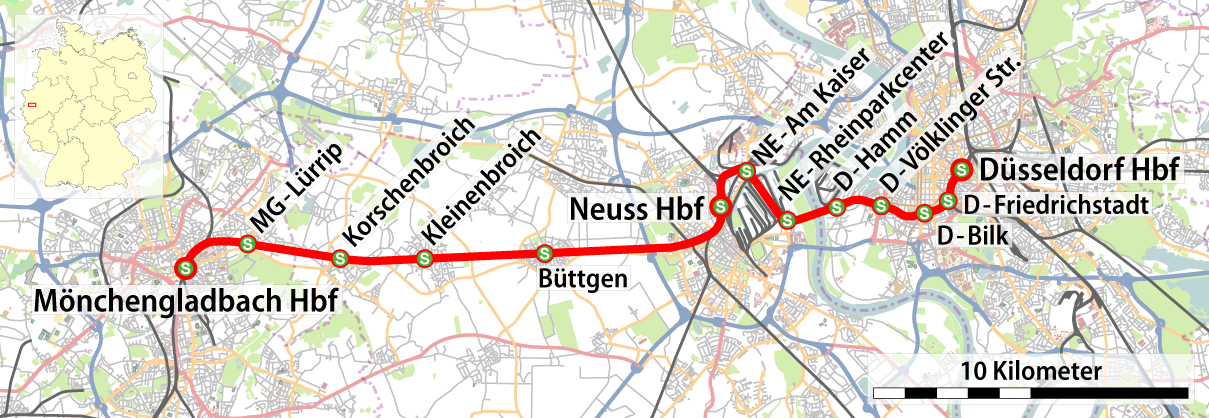
Deutsch: Karte der Bahnstrecke Mönchengladbach – Düsseldorf |
| Date | see file history |
| Source |
own work, using
|
| Author | Maximilian Dörrbecker (Chumwa) |
| Permission (Reusing this file) |
All OpenStreetMap data and maps are Creative Commons "CC-BY-SA 2.0" licensed This file is licensed under the Creative Commons Attribution-Share Alike 2.0 Generic license.
|
| Other versions |
|

File history
Click on a date/time to view the file as it appeared at that time.
| Date/Time | Thumbnail | Dimensions | User | Comment | |
|---|---|---|---|---|---|
| current | 05:26, 26 June 2009 | 1,209 × 418 (529 KB) | wikimediacommons>Chumwa | Orientierungskarte hinzugefügt |
File usage
The following 2 pages use this file: