File:Map-Lusophone World-en.png
Jump to navigation
Jump to search

Size of this preview: 800 × 370 pixels. Other resolutions: 320 × 148 pixels | 640 × 296 pixels | 1,357 × 628 pixels.
Original file (1,357 × 628 pixels, file size: 37 KB, MIME type: image/png)
This file and its description are from Wikimedia Commons.
Summary
| Description |
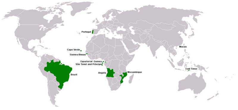
Map of Lusophone world. Map made from Image:BlankMap-World.png. The blank map was made by User:Vardion and adapted by User:E Pluribus Anthony for Wikipedia. |
||||
| Date | |||||
| Source | Own work | ||||
| Author | This version was made by User:Yug with country names by User:Sting. Fixed by User:The Ogre | ||||
| Permission (Reusing this file) |
|
||||
| Other versions |
|


File history
Click on a date/time to view the file as it appeared at that time.
| Date/Time | Thumbnail | Dimensions | User | Comment | |
|---|---|---|---|---|---|
| current | 21:35, 7 March 2018 | | 1,357 × 628 (37 KB) | wikimediacommons>Maphobbyist | South Sudan border |
File usage
There are no pages that use this file.