File:National Cycle Network Sign on Neath Canal Towpath - geograph.org.uk - 206794.jpg
Jump to navigation
Jump to search


No higher resolution available.
National_Cycle_Network_Sign_on_Neath_Canal_Towpath_-_geograph.org.uk_-_206794.jpg (640 × 384 pixels, file size: 164 KB, MIME type: image/jpeg)
This file and its description are from Wikimedia Commons.
Summary
| Description |
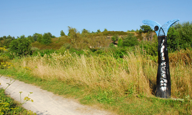
English: National Cycle Network Sign on Neath Canal Towpath. This sign is situated on the towpath of the Neath Canal at Giant's Grave, Briton Ferry. In the background is a disused quarry. |
| Date | |
| Source | From geograph.org.uk |
| Author | Cedwyn Davies |
| Attribution (required by the license) | Cedwyn Davies / National Cycle Network Sign on Neath Canal Towpath / |
| Camera location | | View this and other nearby images on: OpenStreetMap |
|---|
_heading:112.00&language=en)
| Object location | | View this and other nearby images on: OpenStreetMap |
|---|
_heading:112.00&language=en)
Licensing

|
This image was taken from the Geograph project collection. See this photograph's page on the Geograph website for the photographer's contact details. The copyright on this image is owned by Cedwyn Davies and is licensed for reuse under the Creative Commons Attribution-ShareAlike 2.0 license.
|
This file is licensed under the Creative Commons Attribution-Share Alike 2.0 Generic license.
Attribution: Cedwyn Davies
- You are free:
- to share – to copy, distribute and transmit the work
- to remix – to adapt the work
- Under the following conditions:
- attribution – You must give appropriate credit, provide a link to the license, and indicate if changes were made. You may do so in any reasonable manner, but not in any way that suggests the licensor endorses you or your use.
- share alike – If you remix, transform, or build upon the material, you must distribute your contributions under the same or compatible license as the original.
File history
Click on a date/time to view the file as it appeared at that time.
| Date/Time | Thumbnail | Dimensions | User | Comment | |
|---|---|---|---|---|---|
| current | 20:17, 31 January 2010 | | 640 × 384 (164 KB) | wikimediacommons>GeographBot | == {{int:filedesc}} == {{Information |description={{en|1=National Cycle Network Sign on Neath Canal Towpath. This sign is situated on the towpath of the Neath Canal at Giant's Grave, Briton Ferry. In the background is a disused quarry.}} |date=2006-07-22 |
File usage
The following page uses this file: