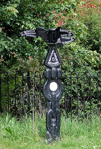
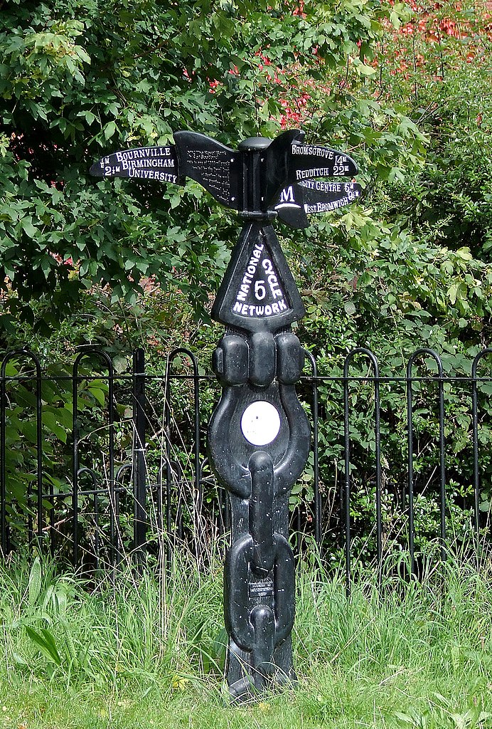
File:National Cycle Network Signpost near King's Norton, Birmingham - geograph.org.uk - 1726425.jpg
Jump to navigation
Jump to search


Size of this preview: 405 × 599 pixels. Other resolutions: 162 × 240 pixels | 324 × 480 pixels | 519 × 768 pixels | 692 × 1,024 pixels | 1,551 × 2,295 pixels.
Original file (1,551 × 2,295 pixels, file size: 1.93 MB, MIME type: image/jpeg)
This file and its description are from Wikimedia Commons.
Summary
| Description |
English: National Cycle Network Signpost near King's Norton, Birmingham.
|
| Date | |
| Source | From geograph.org.uk |
| Author | Roger Kidd |
| Attribution (required by the license) | Roger Kidd / National Cycle Network Signpost near King's Norton, Birmingham / |
| Camera location | | View this and other nearby images on: OpenStreetMap |
|---|
_heading:0.00&language=en)
| Object location | | View this and other nearby images on: OpenStreetMap |
|---|
_heading:0.00&language=en)
Licensing

|
This image was taken from the Geograph project collection. See this photograph's page on the Geograph website for the photographer's contact details. The copyright on this image is owned by Roger Kidd and is licensed for reuse under the Creative Commons Attribution-ShareAlike 2.0 license.
|
This file is licensed under the Creative Commons Attribution-Share Alike 2.0 Generic license.
Attribution: Roger Kidd
- You are free:
- to share – to copy, distribute and transmit the work
- to remix – to adapt the work
- Under the following conditions:
- attribution – You must give appropriate credit, provide a link to the license, and indicate if changes were made. You may do so in any reasonable manner, but not in any way that suggests the licensor endorses you or your use.
- share alike – If you remix, transform, or build upon the material, you must distribute your contributions under the same or compatible license as the original.
File history
Click on a date/time to view the file as it appeared at that time.
| Date/Time | Thumbnail | Dimensions | User | Comment | |
|---|---|---|---|---|---|
| current | 12:18, 5 March 2011 | | 1,551 × 2,295 (1.93 MB) | wikimediacommons>GeographBot | == {{int:filedesc}} == {{Information |description={{en|1=National Cycle Network Signpost near King's Norton, Birmingham This is on the towpath of the Worcester and Birmingham Canal*. The post shows local directions and distances for Route No 5 http://www. |
File usage
The following page uses this file: