File:Portable boat lift totes a Santa Barbara patrol boat.jpg
Jump to navigation
Jump to search


Size of this preview: 800 × 450 pixels. Other resolutions: 320 × 180 pixels | 640 × 360 pixels | 1,024 × 576 pixels | 1,280 × 720 pixels | 2,560 × 1,440 pixels | 6,000 × 3,376 pixels.
Original file (6,000 × 3,376 pixels, file size: 15.06 MB, MIME type: image/jpeg)
This file and its description are from Wikimedia Commons.
Summary
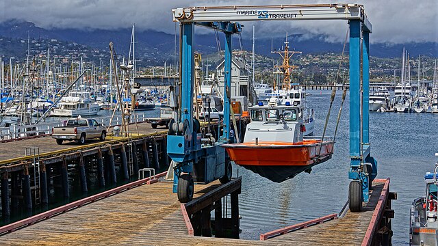
| Description | Santa Barbara Harbor |
| Date | |
| Source | Patrol Boat Up |
| Author | Damian Gadal |
| Camera location | | View this and other nearby images on: OpenStreetMap |
|---|
Licensing
This file is licensed under the Creative Commons Attribution 2.0 Generic license.
- You are free:
- to share – to copy, distribute and transmit the work
- to remix – to adapt the work
- Under the following conditions:
- attribution – You must give appropriate credit, provide a link to the license, and indicate if changes were made. You may do so in any reasonable manner, but not in any way that suggests the licensor endorses you or your use.
| This image was originally posted to Flickr by Damian Gadal at https://www.flickr.com/photos/23024164@N06/6971276746. It was reviewed on 8 October 2012 by FlickreviewR and was confirmed to be licensed under the terms of the cc-by-2.0. |
File history
Click on a date/time to view the file as it appeared at that time.
| Date/Time | Thumbnail | Dimensions | User | Comment | |
|---|---|---|---|---|---|
| current | 11:39, 8 October 2012 | | 6,000 × 3,376 (15.06 MB) | wikimediacommons>Geo Swan | {{Information |Description=Santa Barbara Harbor |Source=[http://www.flickr.com/photos/23024164@N06/6971276746/ Patrol Boat Up] |Date=2012-04-26 15:10 |Author=[http://www.flickr.com/people/23024164@N06 Damian Gadal] |Permission= |other_versions= }} {{Lo... |
File usage
The following page uses this file: