File:Radarstation Hooksielplate.jpg
Jump to navigation
Jump to search


Size of this preview: 409 × 600 pixels. Other resolutions: 164 × 240 pixels | 327 × 480 pixels | 682 × 1,000 pixels.
Original file (682 × 1,000 pixels, file size: 71 KB, MIME type: image/jpeg)
This file and its description are from Wikimedia Commons.
Summary
| Description |
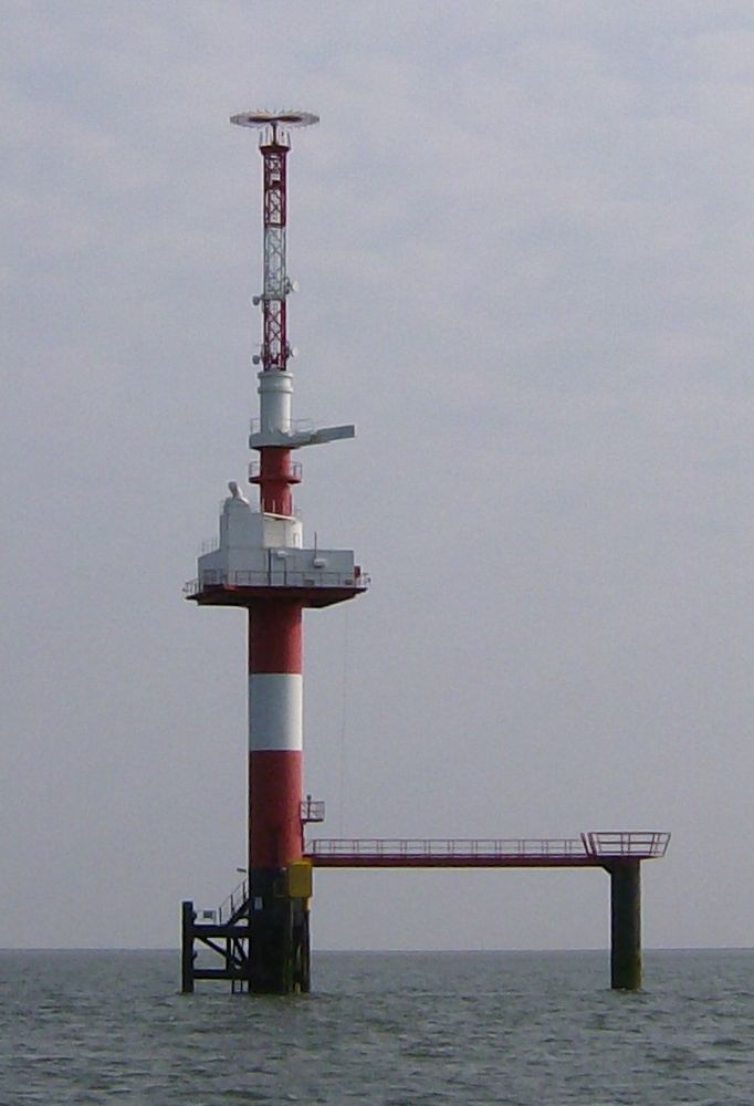
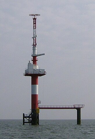
English: The radar tower Hooksielplate at the position N 53° 40,1524', E 008° 08,9158'E offshore Wilhelmshaven in the German Bight
Deutsch: Die Radarstation Hooksielplate auf der Position N 53° 40,1524', E 008° 08,9158'E vor Wilhelmshaven in der Deutschen Bucht |
| Date | |
| Source | Own work |
| Author | Wusel007 |
Licensing
I, the copyright holder of this work, hereby publish it under the following licenses:

|
Permission is granted to copy, distribute and/or modify this document under the terms of the GNU Free Documentation License, Version 1.2 or any later version published by the Free Software Foundation; with no Invariant Sections, no Front-Cover Texts, and no Back-Cover Texts. A copy of the license is included in the section entitled GNU Free Documentation License. |
This file is licensed under the Creative Commons Attribution-Share Alike 3.0 Unported, 2.5 Generic, 2.0 Generic and 1.0 Generic license.
- You are free:
- to share – to copy, distribute and transmit the work
- to remix – to adapt the work
- Under the following conditions:
- attribution – You must give appropriate credit, provide a link to the license, and indicate if changes were made. You may do so in any reasonable manner, but not in any way that suggests the licensor endorses you or your use.
- share alike – If you remix, transform, or build upon the material, you must distribute your contributions under the same or compatible license as the original.
You may select the license of your choice.
File history
Click on a date/time to view the file as it appeared at that time.
| Date/Time | Thumbnail | Dimensions | User | Comment | |
|---|---|---|---|---|---|
| current | 12:49, 19 June 2008 | | 682 × 1,000 (71 KB) | wikimediacommons>Wusel007 | {{Information |Description={{en|1=The radar tower Hooksielplate at the position N 53° 40,1524', E 008° 08,9158'E offshore Wilhelmshaven in ther German Bight}} {{de|1=Die Radarstation Hooksielplate auf der Position N 53° 40,1524', E 008° 08,9158'E vor |
File usage
The following 2 pages use this file: