Disc golf
This is a summary of different kinds of features related to disc golf and how to tag them.
Disc golf (see Wikipedia) is sometimes called "frisbee golf," usually when introducing the sport to others. However, Frisbee is a trademarked name, so disc golfers refer to the flying disc (see Wikipedia) as a "disc."
Approved established ways of mapping
Ongoing proposals for disc golf features
Here is listed the ongoing proposals relating to disc golf and their status.
- Proposed features/Disc_golf_course, leisure=disc_golf_course Request For Comments, ready for vote.
- Proposed features/disc_golf, sport=disc_golf Request For Comments
Features that should be proposed
Ideas of tags that are missing in the wiki and that should be proposed.
Currently used tags
Here is listed how disc golf seem to be tagged. Keep the description short. This could give ideas of tags that are missing in the wiki and that should be proposed.
The "holes", that is the individual tracks, are sometimes mapped as in the proposed golf-key way. see Proposed_features/Golf_course
- disc_golf=hole , a hole is a way from tee to basket.
- disc_golf=tee , a tee is the starting point from where the first throw is made. It is marked and sometimes have different surface material than the surroundings.
- disc_golf=basket , a basket is the goal. It is usually a fixed special designed basket.
| disc_golf=* | leisure=disc_golf_course |
Discussion on mapping
More lengthy discussions, proposals on how to tag different features.
Organized outdoor disc golf area in public areas like a forest or park
This is a area consisting of mostly unaltered nature or park. There are disc_golf targets that are maintained. There could be a fee or membership requirement to use. The area of the disc golf course is not exclusively for disc golf, it is still primary an open park or forest.
Tagging one node
To find the course on a map it can be enough to label one node, so that an icon can be generated. Then add the general properties of the disc_golf_course to the same element, i.e. if there are toilets, access for disabled, etc.
Tagging of the node:
leisure=disc_golf_course (proposal)
+ name=*
+ toilet=yes/no
+ Fee, membership?
+ pets=yes/no
Tagging an area
If one choose to tag the whole area of the disc_golf_course, some of the supplementary tags should be added to more detailed features. toilet=yes added to the toilet itself instead of the area. Many tags could be added to the clubhouse if there is any.
It is possible to have both an area and a single node in the middle to put the icon and gather all information, but it is not recommended.
Tagging of the area:
leisure=disc_golf_course (proposal)
+ name=*
+ Fee, membership?
+ Access (for the area)
+ pets=yes/no
An alternative tagging of an area, especially if the disc golf course isn´t run by a club, maybe it doesn´t have a name? or maybe it is so integrated in the park/forest so it feels wrong to tag the area as a disc_golf_course but you still want to show the extent of the disc_golf activity.
Tagging of the area:
sport=disc_golf (proposal)
+ name=*
+ Fee, membership?
+ Access (for the area) if not tagged it is supposed to be the same as the surrounding park.
+ pets=yes/no
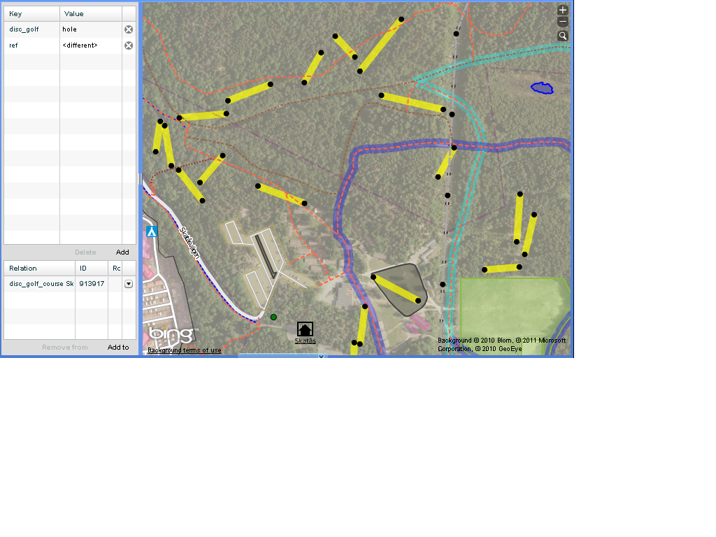
Below is an example of a disc_golf_course in the forest. Not really visible except for those looking for it. All 18 holes are tagged as ways with a tee and a basket as start and end node. Here is used the disc_golf-key: disc_golf=hole, disc_golf=tee, disc_golf=basket. all 18 holes are grouped together with a relation of the type disc_golf_course and with the name of the court and the club.https://www.openstreetmap.org/browse/relation/913917

Fully served outdoor disc golf course
This kind of disc golf course is to be compared with an ordinary golf course. Full-fledged service that can include: rental services for discs, cabins, lockers. Area can include café, restaurant, parking lots and small shops. They are served by personnel.
The area is primary used for disc golf and secondary as a park/forest.
Tagging of the element:
leisure=disc_golf_course (proposal)
+ name=*
+ toilet=yes (implied)
+ shower=yes/no
+ pets=yes/no
The use of a relation
One can group all holes and other related things of the disc_golf_course together with a relation. A relation offers a way to group elements (nodes/ways/areas/relations) which belong together, without the need to use a perimeter or boundary to form a area.
Which of the Types of relation should be used?
- type=site Relation:site, see Relations/Proposed/Site
- maybe a type=course , shared with golfcourses, Proposed features/Golf course
- or even something more general like type=sport
- type=disc_golf_course says it all