FR:Featured images/Apr-Jun 2015
Jump to navigation
Jump to search


Voici quelques images remarquables, ce qui veut dire qu’elles ont été sélectionnées comme étant parmi les meilleurs exemples de cartographie basée sur les données d’OpenStreetMap, ou qu’elles apportent une illustration utile du projet OpenStreetmap.
Si vous avez une image répondant à cette définition, vous pouvez la proposer sur la page des Propositions d’image remarquable (en).
| ← d’avril à juin 2014 | ← de janvier à mars 2015 | de juillet à septembre 2015 → | d’avril à juin 2016 → |
Galerie des images remarquables d’avril à juin 2015
2015, semaine 14

2015, semaine 16

2015, semaine 17

2015, semaine 18
2015, semaine 19

2015, semaine 20

2015, semaine 21

2015, semaine 22

2015, semaine 23
2015, semaine 24
2015, semaine 25
2015, semaine 26
Détails et descriptions
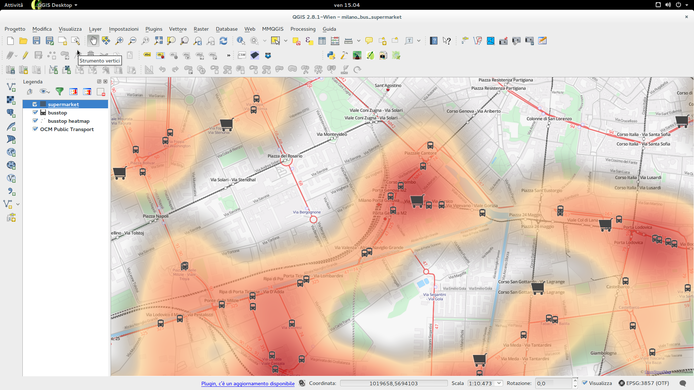
Semaine 14 (du lundi 30 mars 2015 au dimanche 5 avril 2015) [Edit]

- English : Using QGIS to create a map of supermarkets near bus stops. Data from Overpass API, presented as icons and a heatmap, and using Transport Map as the basemap. This is from a tutorial by cityplanner.it (italian)
Semaine 15 (du lundi 6 avril 2015 au dimanche 12 avril 2015) [Edit]
- English : Sorry, there was no image this week.
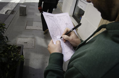
Semaine 16 (du lundi 13 avril 2015 au dimanche 19 avril 2015) [Edit]

- English : Mapping by simply taking notes on a Field Papers printout. These OpenStreetMap activities took place as part of the Almería Creative Commons Film Festival
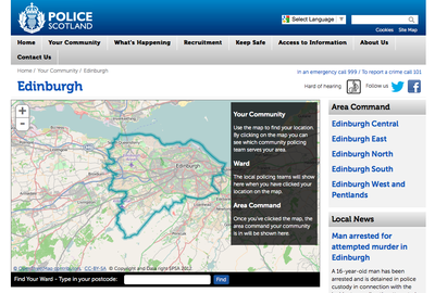
Semaine 17 (du lundi 20 avril 2015 au dimanche 26 avril 2015) [Edit]

- English : The Scottish police use our maps to display different policing regions on their website, such as this Edinburgh region
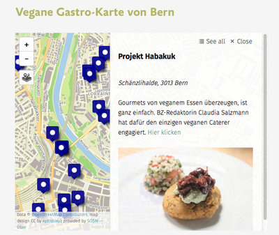
Semaine 18 (du lundi 27 avril 2015 au dimanche 3 mai 2015) [Edit]

- English : Map appearing on this website about vegan restaurants in Bern, which recently won the Swiss Press Award. The map is created using the simple uMap tool, with an OSM swiss style base-map
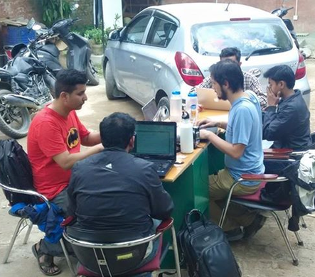
Semaine 19 (du lundi 4 mai 2015 au dimanche 10 mai 2015) [Edit]

- English : Kathmandu Living Labs have mapped their city in detail over the past few years, which is now putting OpenStreetMap in a great position to provide maps for aid agencies responding to the Nepal earthquake. Here we see them working outdoors in case of aftershocks, as they coordinate with HOT on further mapping, and providing outputs for aid responders
Semaine 20 (du lundi 11 mai 2015 au dimanche 17 mai 2015) [Edit]

- English : German and Spanish students from a Comenius project mapping in A Guarda, Spain
The school The city The project Santa Trega Some results
Semaine 21 (du lundi 18 mai 2015 au dimanche 24 mai 2015) [Edit]

- English : A signpost designed with maps from OpenStreetMap, showing the location of recycling bins in Werdohl, Germany
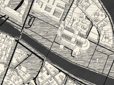
Semaine 22 (du lundi 25 mai 2015 au dimanche 31 mai 2015) [Edit]

- English : Another Mapzen 'Tangram' style, this time emulating a sketchy drawing effect. Browse the map (uses WebGL)
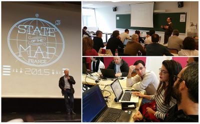
Semaine 23 (du lundi 1 juin 2015 au dimanche 7 juin 2015) [Edit]

- English : OpenStreetMap France held their national conference, State of the Map France 2015, this weekend
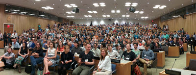
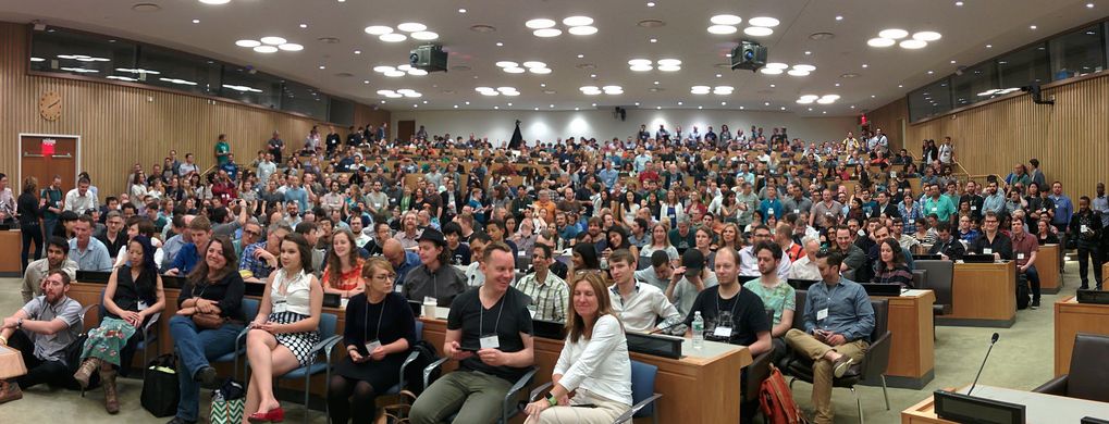
Semaine 24 (du lundi 8 juin 2015 au dimanche 14 juin 2015) [Edit]

- English : A packed auditorium for State Of The Map U.S. 2015 this weekend in New York
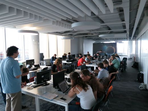
Semaine 25 (du lundi 15 juin 2015 au dimanche 21 juin 2015) [Edit]

- English : On 30th of May Maps.Me organized a "Mapping School" event in Moscow, where people were taught to survey a city block and map it in JOSM. Before and after image
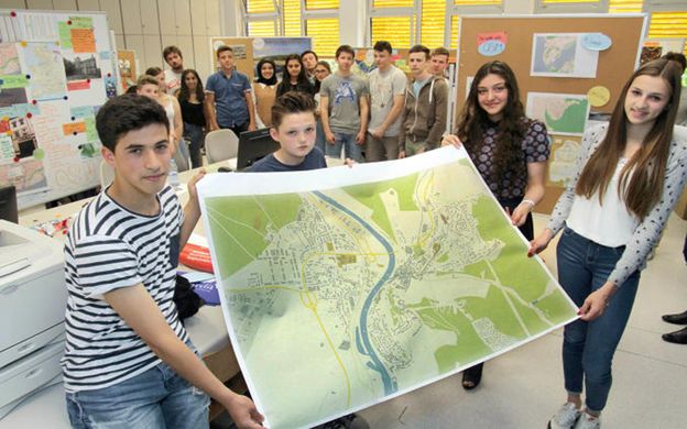
Semaine 26 (du lundi 22 juin 2015 au dimanche 28 juin 2015) [Edit]

- English : Students from four countries came together for a Comenius school project MychOSM preparing field research on historical and geographical sites. This A0 print of OpenStreetMap was made using Mapwebbing