File:Busway1.jpg

Original file (1,361 × 906 pixels, file size: 284 KB, MIME type: image/jpeg)
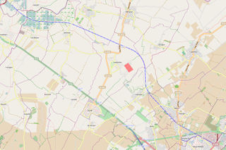
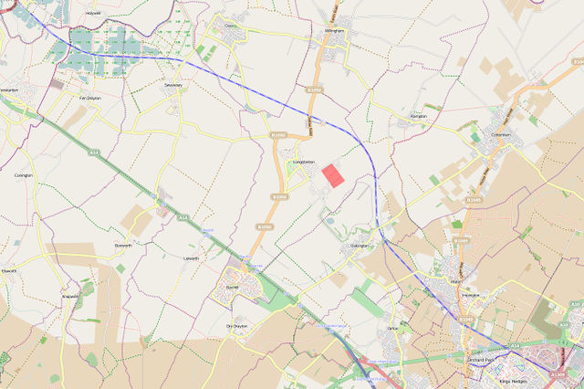
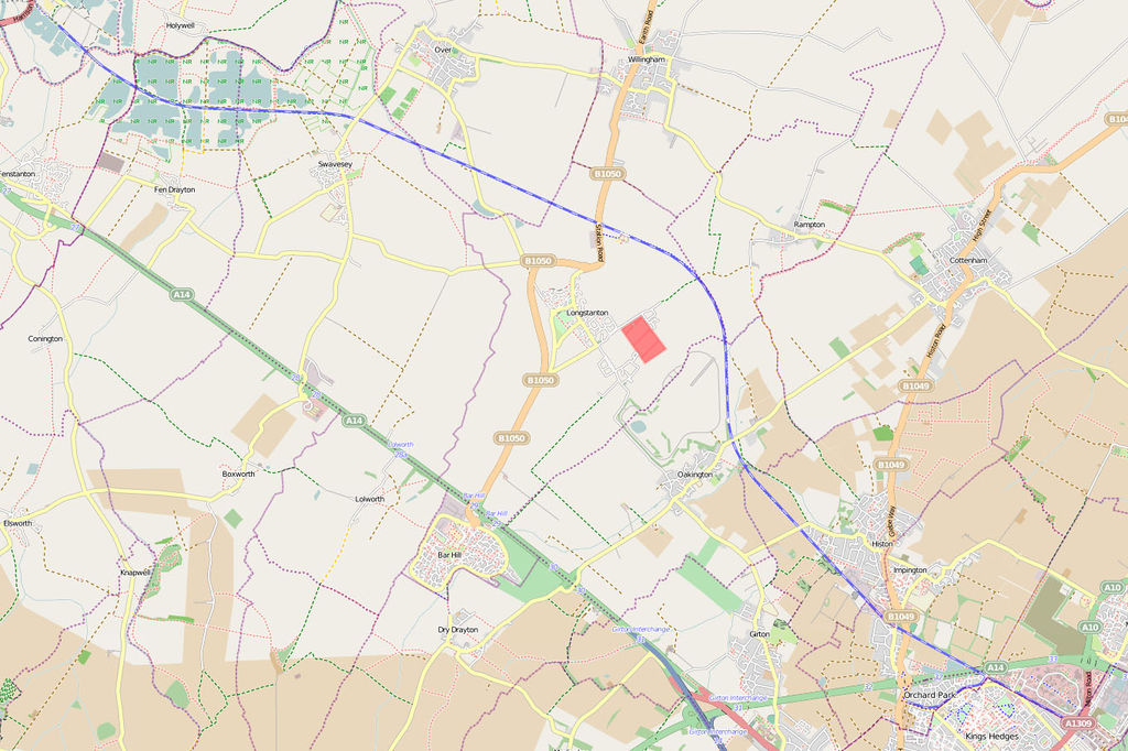
The Cambridgeshire Guided Busway opened last week, and is mapped in OSM [1]
The Busway is the world's longest Guided Bus track, and was opened to the public on August 7, 2011. It runs for 20km between north Cambridge and St Ives and also Cambridge rail station and the suburb of Trumpington. It also has a 4m-wide cycleway running the whole length. It was, of course, mapped in extreme detail, long before it was opened to the public, and has its own rendering style on Mapnik, like a blue railway.

Front-page image for week 33 of 2011 (15–21 Aug.).
- Image descriptions
- Deutsch : Der Cambridgeshire Spurbus öffnete letzte Woche und es ist in OSM gemappt: Karte.
- English : The Cambridgeshire Guided Busway opened last week, and is mapped in OSM [2]
- italiano : Il Cambridgeshire Guided Busway è stato inaugurato la scorsa settimana ed è stato mappato in OSM [3]
- 中文(繁體) : 劍橋郡軌道巴士在上週開通,已經被記錄在 OSM 上。[4]
Licensing
![]()
![]()
![]()
The OpenStreetMap Carto map style is made available under the Creative Commons CC-0 1.0 Universal Public Domain Dedication.
- Attribution to the map data:
![]()
File history
Click on a date/time to view the file as it appeared at that time.
| Date/Time | Thumbnail | Dimensions | User | Comment | |
|---|---|---|---|---|---|
| current | 10:40, 10 August 2011 | | 1,361 × 906 (284 KB) | David.earl (talk | contribs) |
You cannot overwrite this file.
File usage
The following 10 pages use this file: