File:Colombia-rivers.jpg
Jump to navigation
Jump to search


Size of this preview: 600 × 600 pixels. Other resolutions: 240 × 240 pixels | 480 × 480 pixels | 768 × 768 pixels | 1,200 × 1,200 pixels.
Original file (1,200 × 1,200 pixels, file size: 147 KB, MIME type: image/jpeg)
Summary
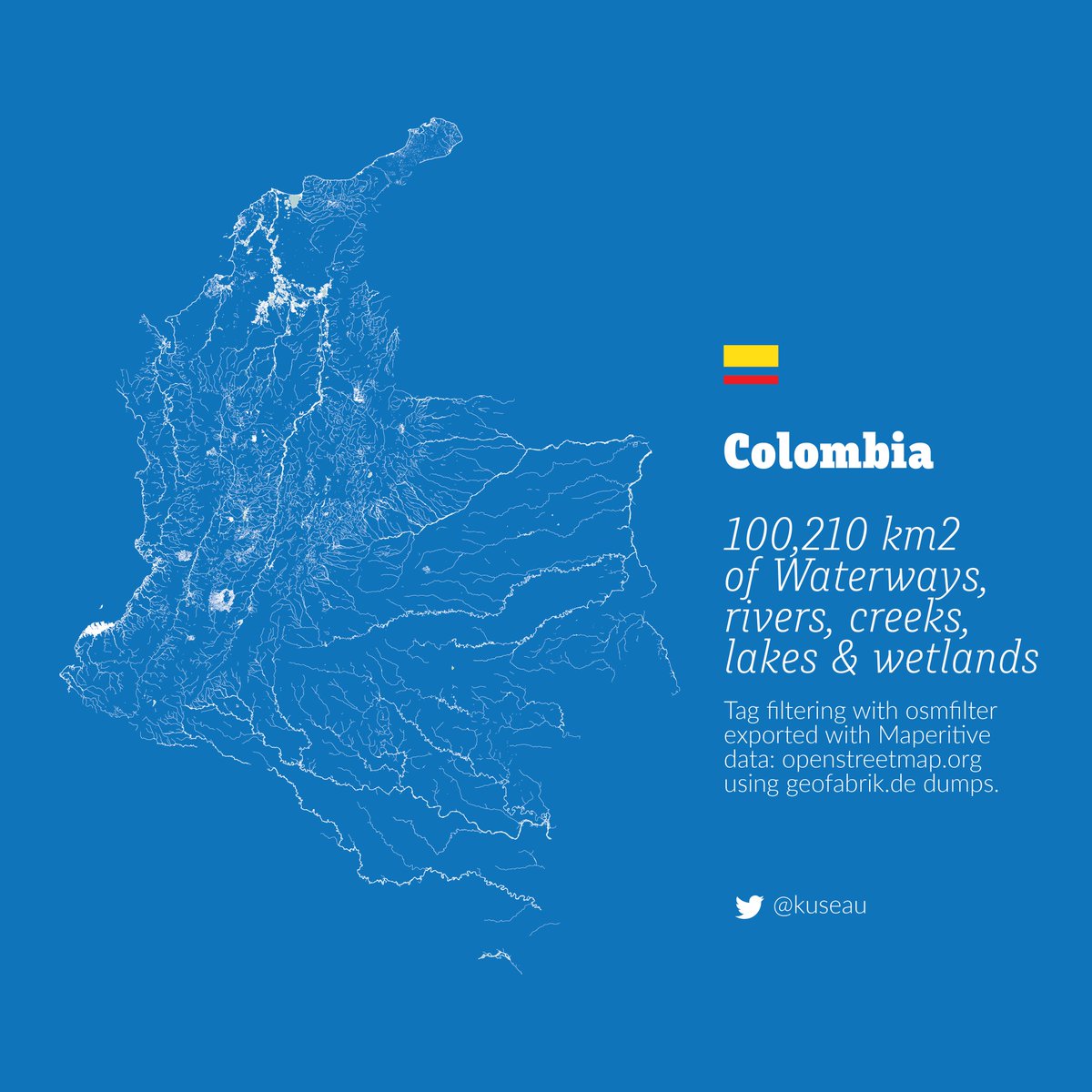
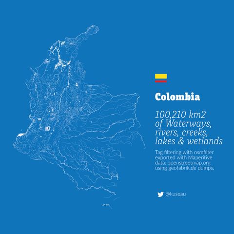
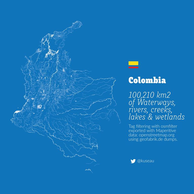
Image showing all the rivers of Colombia, based on OpenStreetMap data.
This is a Featured image, which means that it has been identified as one of the best examples of OpenStreetMap mapping, or that it provides a useful illustration of the OpenStreetMap project. If you know another image of similar quality, you can nominate it on Featured image proposals.
Front-page image for week 42 of 2016 (17–23 Oct.).
- Image descriptions
- English : The public transport service STAR in Rennes Metropole, France, uses OpenStreetMap on their information boards.
- français : Le service de transport public STAR de Rennes Métropole, en France, utilise OpenStreetMap sur ses panneaux d’informations.
- italiano : L'azienda di trasporti pubblici STAR di Rennes Metropole, Francia, usa OpenStreetMap sui propri pannelli informativi.
- русский : Карты ОСМ используются системой общественного транспорта СТАР (STAR) во французском округе Ренн.
- 中文(简体) : 法国雷恩一带当地的"STAR"巴士服务,资讯立版使用开放街图。
- 中文(繁體) : 法國雷恩一帶當地的"STAR"巴士服務,資訊立版使用開放街圖。
Licensing
![]()
![]()
![]()
This work is licensed under the Creative Commons Attribution-ShareAlike 3.0 License.
Attribution not specified as a parameter! THIS LICENSE ALWAYS REQUIRES ATTRIBUTION! Use {{CC-BY-SA-3.0|Attribution, typically name of author}} See Template:CC-BY-SA-3.0 for full description how this template should be used.
Attribution not specified as a parameter! THIS LICENSE ALWAYS REQUIRES ATTRIBUTION! Use {{CC-BY-SA-3.0|Attribution, typically name of author}} See Template:CC-BY-SA-3.0 for full description how this template should be used.
File history
Click on a date/time to view the file as it appeared at that time.
| Date/Time | Thumbnail | Dimensions | User | Comment | |
|---|---|---|---|---|---|
| current | 11:46, 19 October 2016 | | 1,200 × 1,200 (147 KB) | Wille (talk | contribs) | Image showing all the rivers of Colombia, based on OpenStreetMap data. |
You cannot overwrite this file.
File usage
The following 13 pages use this file:
- Featured images/Oct-Dec 2016
- List of featured images/2016
- Uk:Featured images/Oct-Dec 2016
- Zh-hans:Featured images/Oct-Dec 2016
- Zh-hant:Featured images/Oct-Dec 2016
- Template:Featured image d4
- Template:Iotw image/2016-43
- DE:Featured images/Oct-Dec 2016
- FR:Featured images/Oct-Dec 2016
- ES:Imágenes destacadas/Oct-Dic 2016
- IT:Featured images/Oct-Dec 2016
- RU:Featured images/Oct-Dec 2016
- JA:Featured images/Oct-Dec 2016