File:IMG 1608.JPG
Original file (5,472 × 3,648 pixels, file size: 4.55 MB, MIME type: image/jpeg)
Summary
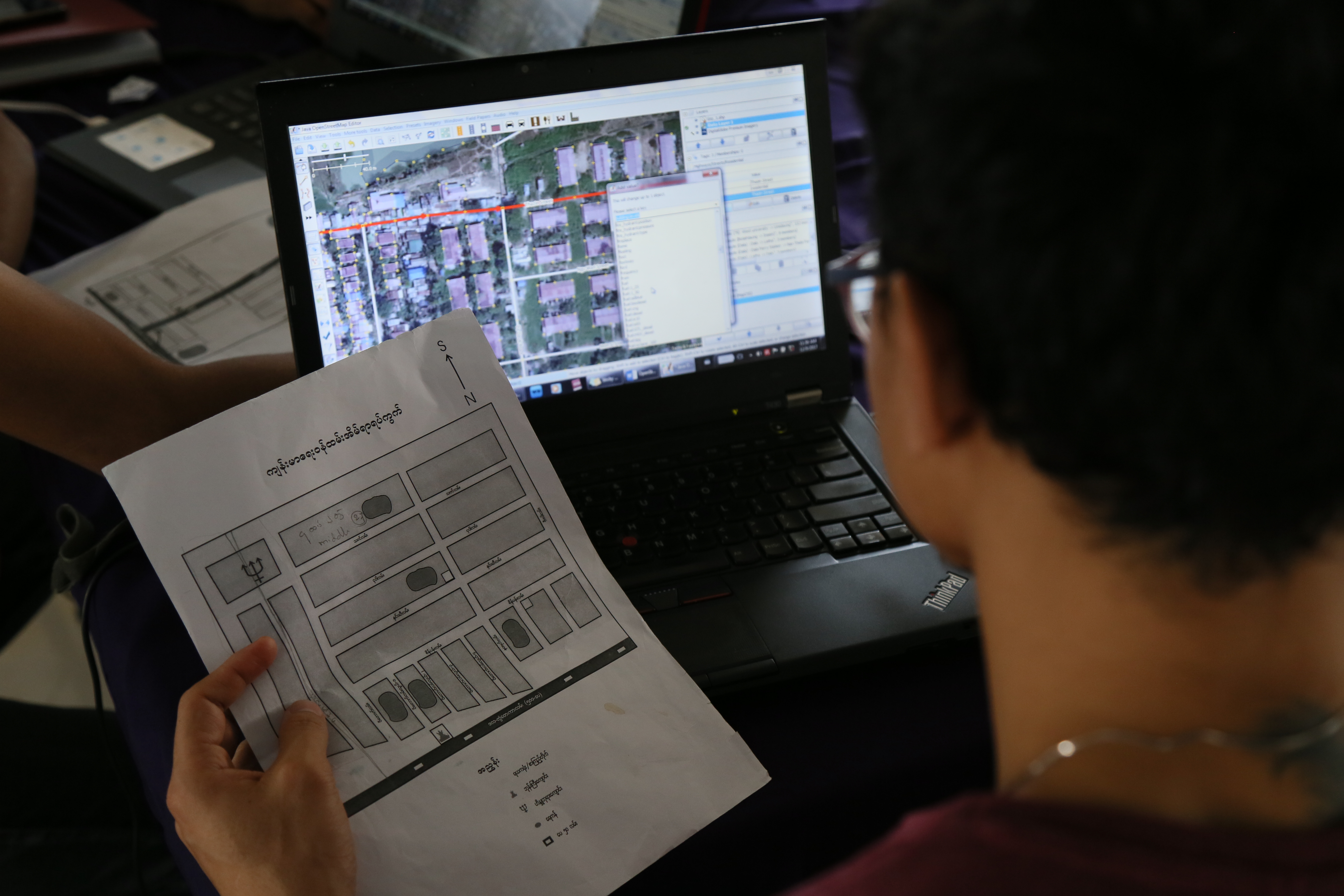
Regular Mapping Event "Mapping Yangon" at Phandeeyar Innovation Lab. We added street names, health centers and public locations of Dala township, Yangon region on OpenStreetMap.

Front-page image for week 51 of 2017 (18–24 Dec.).
- Image descriptions
- English : Regular mapping event “Mapping Yangon” at Phandeeyar Myanmar Innovation Lab added on OpenStreetMap the street names, health centers and public locations of Dala township, Yangon region, Myanmar.
- français : La cartopartie régulière « Mapping Yangon » au Phandeeyar Myanmar Innovation Lab a ajouté sur OpenStreetMap les noms de rues, les centres de santé et lieux publics du faubourg de Dala dans la région de Rangoun en Birmanie.
- italiano : L'evento periodico di mappatura “Mapping Yangon” al Phandeeyar Myanmar Innovation Lab ha aggiunto a OpenStreetMap i nomi delle strade, poliambulatori e luoghi pubblici della township di Dala, regione di Yangon region, Myanmar.
- 中文(简体) : 在Phandeeyar Myanmar Innovation Lab 平时进行的仰光画地图活动,在开放街图增加缅甸仰光区域德拉区的街道名称、健康设施以及公共设施。
- 中文(繁體) : 在 Phandeeyar Myanmar Innovation Lab 平時進行的仰光畫地圖活動,在開放街圖增加緬甸仰光區域德拉區的街道名稱、健康設施以及公共設施。
Licensing
![]()
![]()
![]()
Attribution not specified as a parameter! THIS LICENSE ALWAYS REQUIRES ATTRIBUTION! Use {{CC-BY-SA-4.0|Attribution, typically name of author}} See Template:CC-BY-SA-4.0 for full description this template should be used.
|
This file is using CC license which requires attribution, but it is not clearly specified. Uploader very often is also the author, but not always! If you created this work on your own and it is not derivative of some preexisting work, please use: {{CC-BY-SA-4.0-self}} to mark it as own work. If anyone else was involved please use: {{CC-BY-SA-4.0|1=WHOEVER SHOULD BE ATTRIBUTED}} Note: The file page should clearly state that either it is fully work of uploader or clearly specify which sources were used, preferably linking them. Note: Maybe this license is wrong and a different one should be used! Wiki:Media file license chart may be helpful. If unsure, ask on Talk:Wiki After fixing attribution – please remove this template. Files without licenses marked with this template are listed in Category:Media without a proper attribution |
File history
Click on a date/time to view the file as it appeared at that time.
| Date/Time | Thumbnail | Dimensions | User | Comment | |
|---|---|---|---|---|---|
| current | 06:49, 13 December 2017 | | 5,472 × 3,648 (4.55 MB) | SetKhaingOo (talk | contribs) | Regular Mapping Event "Mapping Yangon" at Phandeeyar Innovation Lab. We added street names, health centers and public locations of Dala township, Yangon region on OpenStreetMap |
You cannot overwrite this file.
File usage
The following 13 pages use this file:
- Featured images/Oct-Dec 2017
- List of featured images/2017
- Pt:Featured images/Oct-Dec 2017
- Uk:Featured images/Oct-Dec 2017
- Zh-hans:Featured images/Oct-Dec 2017
- Zh-hant:Featured images/Oct-Dec 2017
- Template:Iotw image/2017-51
- DE:Featured images/Oct-Dec 2017
- FR:Featured images/Oct-Dec 2017
- ES:Imágenes destacadas/Oct-Dic 2017
- IT:Featured images/Oct-Dec 2017
- RU:Featured images/Oct-Dec 2017
- JA:Featured images/Oct-Dec 2017