File:Mapping-Features-Roundabout-Secondary-Ends.png
Jump to navigation
Jump to search

No higher resolution available.
Mapping-Features-Roundabout-Secondary-Ends.png (240 × 180 pixels, file size: 4 KB, MIME type: image/png)
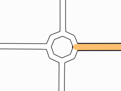
Roundabout where a secondary road ends.
File history
Click on a date/time to view the file as it appeared at that time.
| Date/Time | Thumbnail | Dimensions | User | Comment | |
|---|---|---|---|---|---|
| current | 21:09, 10 February 2007 | | 240 × 180 (4 KB) | Joto (talk | contribs) | Roundabout where a secondary road ends. |
You cannot overwrite this file.