File:Moonbase city.jpg
Jump to navigation
Jump to search


Size of this preview: 600 × 600 pixels. Other resolutions: 240 × 240 pixels | 480 × 480 pixels | 769 × 768 pixels | 1,200 × 1,199 pixels.
Original file (1,200 × 1,199 pixels, file size: 152 KB, MIME type: image/jpeg)
Summary
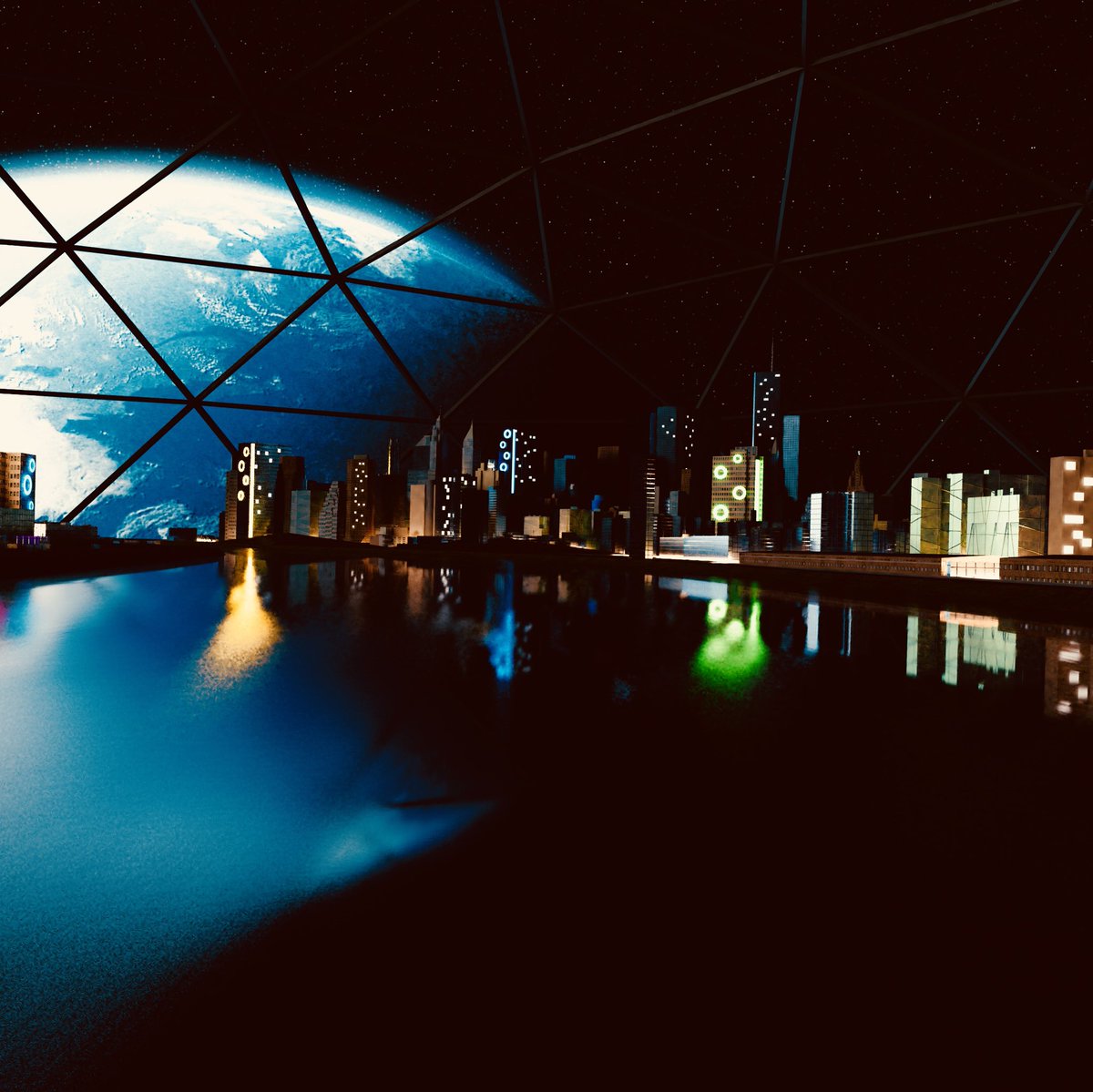
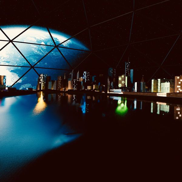
Moonbase city using a chunk of New York OpenStreetMap data by Arjan Schrauwen from Beeldkompaan.
Produced using Blender.
This is a Featured image, which means that it has been identified as one of the best examples of OpenStreetMap mapping, or that it provides a useful illustration of the OpenStreetMap project. If you know another image of similar quality, you can nominate it on Featured image proposals.
Front-page image for week 29 of 2018 (16–22 Jul.).
- Image descriptions
- English : Arjan Schrauwen from Dutch graphics design firm Beeldkompaan has taken a chunk of New York OpenStreetMap buildings data to a new moonbase location.
- français : Arjan Schrauwen de la firme d'infographie néerlandaise Beeldkompaan a placé un ensemble d’immeubles de New York extraits des données OpenStreetMap vers une nouvelle station lunaire.
- italiano : Arjan Schrauwen dello studio olandese di design grafico Beeldkompaan ha portato una parte dei dati di OpenStreetMap relativi agli edifici di New York su una nuova stazione lunare.
- 中文(简体) : 荷兰视觉设计公司 Beeldkompaan 的 Arjan Schrauwen 运用大量的纽约开放街图建筑资料,放到新的月球基地位置上面。
- 中文(繁體) : 荷蘭視覺設計公司 Beeldkompaan 的 Arjan Schrauwen 運用大量的紐約開放街圖建築資料,放到新的月球基地位置上面。
- فارسی : شهر فضایی بر ماه؛ ساختهٔ Arjan Schrauwen از شرکت طراحی گرافیک Beeldkompaan، با پرداخت دادههای ساختمانی شهر نیویورک از OSM در نرمافزار Blender.
Licensing
![]()
![]()
![]()
This work is licensed under the Creative Commons Attribution-ShareAlike 2.0 License.
Attribution not specified as a parameter! THIS LICENSE ALWAYS REQUIRES ATTRIBUTION! Use {{CC-BY-SA-2.0|Attribution, typically name of author}} See Template:CC-BY-SA-2.0 for full description how this template should be used.
Note, there is
There is also
Attribution not specified as a parameter! THIS LICENSE ALWAYS REQUIRES ATTRIBUTION! Use {{CC-BY-SA-2.0|Attribution, typically name of author}} See Template:CC-BY-SA-2.0 for full description how this template should be used.
Note, there is
{{CC-BY-SA-2.0 OpenStreetMap}} for files based on old OSM map data, before the license change made on 2012-09-12.There is also
{{OSM Carto screenshot||old_license}} for files based on old OSM map data, before the license change made on 2012-09-12, created using OSM Carto map style.
File history
Click on a date/time to view the file as it appeared at that time.
| Date/Time | Thumbnail | Dimensions | User | Comment | |
|---|---|---|---|---|---|
| current | 10:00, 17 July 2018 | | 1,200 × 1,199 (152 KB) | Harry Wood (talk | contribs) | Moonbase city using a chunk of New York OpenStreetMap data by Arjan Schrauwen from Beeldkompaan |
You cannot overwrite this file.
File usage
The following 10 pages use this file:
- Featured images/Jul-Sep 2018
- List of featured images/2018
- Pt:Featured images/Jul-Sep 2018
- Zh-hans:Featured images/Jul-Sep 2018
- Zh-hant:Featured images/Jul-Sep 2018
- Template:Iotw image/2018-29
- DE:Featured images/Jul-Sep 2018
- FR:Featured images/Jul-Sep 2018
- ES:Featured images/Jul-Sep 2018
- IT:Featured images/Jul-Sep 2018