File:OpenStreetMap in an IC2 carriage (DB).jpg
Jump to navigation
Jump to search


Size of this preview: 800 × 530 pixels. Other resolutions: 320 × 212 pixels | 640 × 424 pixels | 1,024 × 678 pixels | 1,280 × 848 pixels | 3,000 × 1,987 pixels.
Original file (3,000 × 1,987 pixels, file size: 1.31 MB, MIME type: image/jpeg)
Source: https://www.flickr.com/photos/kachkaev/23629041300/
This is a Featured image, which means that it has been identified as one of the best examples of OpenStreetMap mapping, or that it provides a useful illustration of the OpenStreetMap project. If you know another image of similar quality, you can nominate it on Featured image proposals.
Front-page image for week 3 of 2016 (18–24 Jan.).
- Image descriptions
- asturianu : OpenStreetMap nun vagón IC2 (Deutsche Bahn). El mapa amuesa la posición actual del tren y remarca les estaciones.
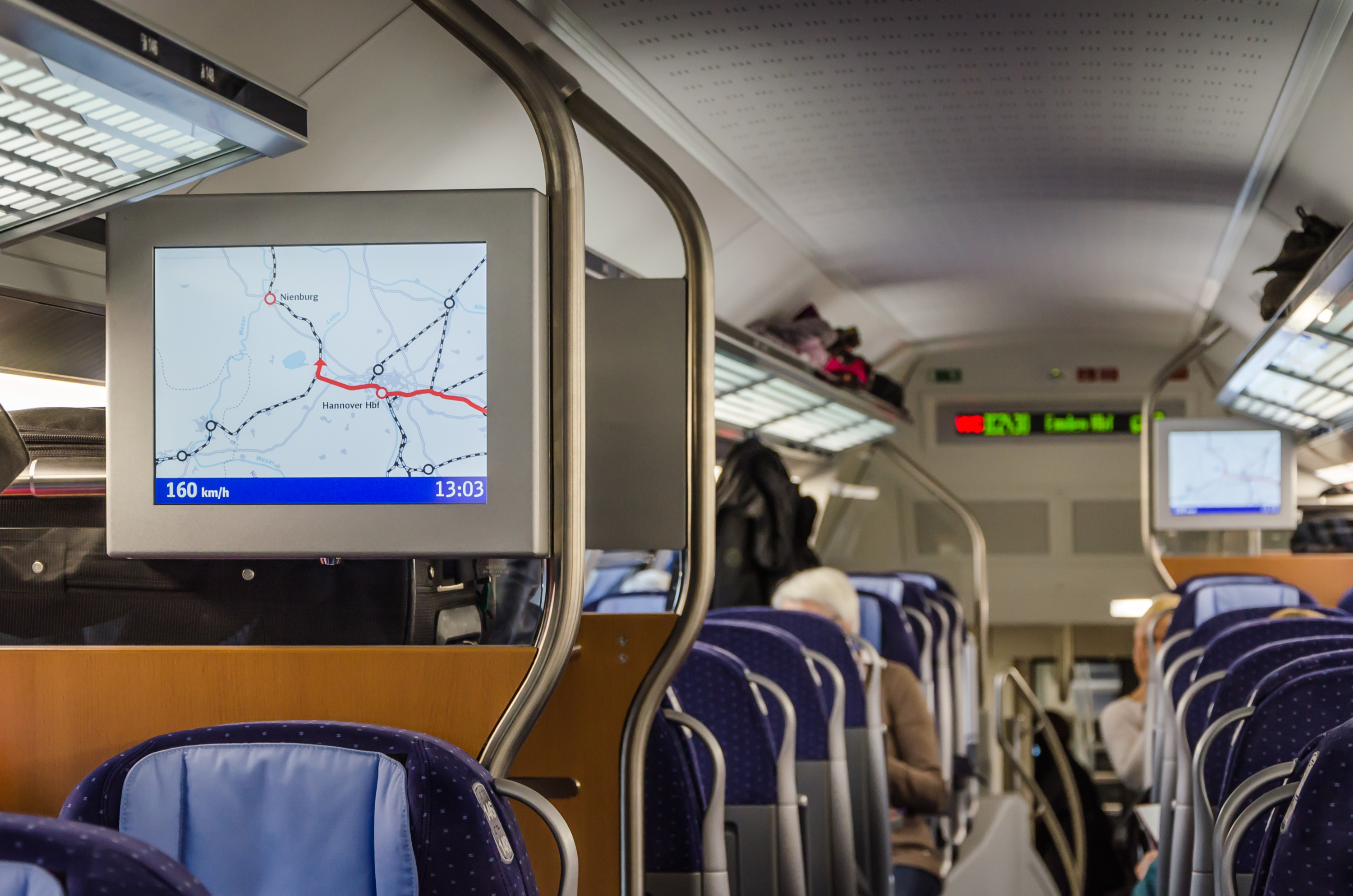
- English : OpenStreetMap in an IC2 carriage (Deutsche Bahn). The map shows the current location of the train and highlights the stations.
- italiano : OpenStreetMap in una carrozza IC2 (Deutsche Bahn). La mappa mostra la posizione attuale del treno ed evidenzia le stazioni.
- русский : ОпенСтритМап используют в новых немецких вагонах, на карте показаны координаты поезда и предстоящие остановки.
- 中文(简体) : 开放街图在 IC2 列车里(德国铁路)。这张地图显示列车即时位置,以及突显出车站位置。
- 中文(繁體) : 開放街圖在 IC2 列車裡(德國鐵路)。這張地圖顯示列車即時位置,以及突顯出車站位置。
![]()
![]()
This work is licensed under the Creative Commons Attribution 2.0 License.
Attribution not specified as a parameter! THIS LICENSE ALWAYS REQUIRES ATTRIBUTION! Use {{CC-BY-2.0|Attribution, typically name of author}} See Template:CC-BY-2.0 for full description how this template should be used.
Attribution not specified as a parameter! THIS LICENSE ALWAYS REQUIRES ATTRIBUTION! Use {{CC-BY-2.0|Attribution, typically name of author}} See Template:CC-BY-2.0 for full description how this template should be used.
File history
Click on a date/time to view the file as it appeared at that time.
| Date/Time | Thumbnail | Dimensions | User | Comment | |
|---|---|---|---|---|---|
| current | 00:23, 16 January 2016 | | 3,000 × 1,987 (1.31 MB) | Kachkaev (talk | contribs) | Source: https://www.flickr.com/photos/kachkaev/23629041300/ |
You cannot overwrite this file.
File usage
The following 9 pages use this file:
.jpg&oldid=1499571)