File:Postal code-birmingham-uk.png
Jump to navigation
Jump to search


No higher resolution available.
Postal_code-birmingham-uk.png (510 × 386 pixels, file size: 91 KB, MIME type: image/png)
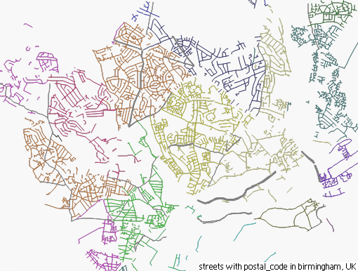
Streets with postal_code=*. Rendered by Kosmos with Kosmos postal_code rendering rules/uk. This is streets in Birmingham (UK). Another example is Image:Postal code-de-berlin.png for Berlin, Germany.
This is a Featured image, which means that it has been identified as one of the best examples of OpenStreetMap mapping, or that it provides a useful illustration of the OpenStreetMap project. If you know another image of similar quality, you can nominate it on Featured image proposals.
Front-page image on 28 Jun 2008
![]()
Contains map data © OpenStreetMap contributors, made available under the terms of the Creative Commons Attribution-ShareAlike 2.0 (CC-BY-SA-2.0).
File history
Click on a date/time to view the file as it appeared at that time.
| Date/Time | Thumbnail | Dimensions | User | Comment | |
|---|---|---|---|---|---|
| current | 08:46, 26 June 2008 | | 510 × 386 (91 KB) | Bahnpirat (talk | contribs) | Streets with {{tag|postal_code}}. Rendered by Kosmos with Kosmos postal_code rendering rules/uk |
You cannot overwrite this file.
File usage
The following 8 pages use this file: