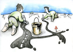
HanoiMappingParty2009
This OSM event will be the first one to be celebrated in VietNam. Among its activities it has been arranged an OpenStreetMap workshop and a Mapping party. ¡Mapping and activities are free!
- Location: CNF room in the Institut de la Francophonie pour l'Informatique (IFI), Ngõ 42 Tạ Quang Bửu (map).
- Date: Saturday 18 July 2009
- Schedule:
- 11g00: Introduction to OpenStreetMap, ( [[User:Ninomax] và * Lê Ngọc Quốc Khánh].
- 11g30: Short tutorial of using GPS, the methods of data collection: Bùi Hữu Mạnh
- 12g00: Lunch, study OSM by yourself
- 13g00: Divide groups to go out collecting data in some interesting locations in Hà Nội city: Ancient University (Văn Miếu), Hoàn Kiếm Lake (Hồ Hoàn Kiếm)
- 15g00: Turn back for data processing and upload to OSM, enjoy your result
- 16g00: Conclusion, Feedback for next party
- 16g30: Open Discussion and Beer !!!
The talk will be in Vietnamese. Hopefully, it may be internet broadcasted with live video.
What's OSM?
Think Wikipedia but for street maps :)
So why do we want to make data open anyways?
This is a big topic but briefly services like Google Maps and MS Virtual Earth prevent download of data. This prevents creative and legitimate applications by small guys like you and me from building say a specialist local map for showing where all the organic vege stores are located in HaNoi - where the vege-stores look like turnips and roads look like vine branches - cartography and art is fun :) Suffice to say OpenStreetMap lets you have the "actual data" and not just a picture.
Material needed
- Note book + pencil, PDA, camera... (anything to take notes)
- GPS (not compulsory, but very useful if you have or can borrow one)
- Good mood for having fun (requirement)
- Bike / Motorbike / Car
How are we going to do the actual mapping?
Read article about Mapping_Weekend_Howto.
Firstly we will gather around a map of our region by opening up the OpenStreetMap (OSM) website. Then we will try to find what's missing. Once we have found some points of interests, like roads, cafes, intersections or other interesting landmarks that are not in the current OSM database we will try to form some groups of people - each group with at least one GPS Unit. In our group we will learn to use the GPS and figure out how to record data. We will look at some common gotchas like quality of the fix, coordinates display, etc. Then we will go-forth and map to our hearts content. On average people will try to spend an hour mapping. After that we return to the Cafe/Place and upload the data to edit and annotate it using tools that OSM provides. And that's it, we will get some munchies or drinks at the cafe or while mapping you may want to stop and take lunch so if you pack some lunch that should be fine too. Looking forward to a fun day of mapping, kids welcome as it's guaranteed to give them the opportunity to draw the biggest squiggles eva!
Attending people
Please, write down your name if you are interested in attending. (please, put your name on the list even if you are unsure about coming,or use the Facebook Event link):
- --User:Ninomax 13:58, 16 June 2009 (UTC) (HaNoi). He has 2 spare Garmin GPS units.
- Serge Stinckwich
- Khanh Le Ngoc Quoc
- Vu Do Quynh (there are more names in the Vietnamese version)
- your name here
Mailing list
More info
- WikiProject of OpenStreetMap in VietNam
- Contact User:Capiscuas if any doubt.


