Key:whitewater:section_grade
Jump to navigation
Jump to search
| Description |
|---|
| Degree of difficulty of white water |
| Used on these elements |
| Status: in use |
| Tools for this tag |
|
Degree of difficulty of white water. These are subjective in the good sense of the term.
- See the International Scale of River Difficulty on Wikipedia
If you don't know a grade or can't decide, set it to "unknown". If you don't know about river practise, don't map it at all.
How to map
Add whitewater:section_grade=# to the whitewater section mapped with waterway=river.
You may add whitewater:section_name=* if it has a name.
Values
Grade 0 | 1 | 2 | 3 | 4 | 5 | 6 (see International Scale on Wikipedia)
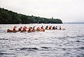
 Grade 0

 Grade 1
 Grade 2
 Grade 3
 Grade 4
 Grade 5
 Grade 6


(White water classification follows its own subjective rules not only described by these pictures, see International Scale)
See also
- Whitewater_sports
- whitewater:rapid_grade=* - Degree of difficulty of white water rapid
- Canoeing routes are mapped in relations
 of type type=route + route=canoe
 - canoe=put_in - A good/recommended/commonly used place to put in. Node placed on one side of the river (like a bus_stop is placed one side of a road).
- canoe=egress - A good/recommended/commonly used place to take out. Node placed on one side of the river
- whitewater=hazard - Minor or Major hazard. Also use a description tag. Should be accompanied by whitewater:description=*.