Nottingham
| V・T・E |
| latitude: 52.953, longitude: -1.15 |
| Browse map of Nottingham 52°57′10.80″ N, 1°09′00.00″ W |
| Edit map |
|
External links:
|
| Use this template for your locality |
Nottingham is a city in Nottinghamshire, England at latitude 52°57′10.80″ North, longitude 1°09′00.00″ West.

Nottingham is a city with unitary authority status within the ceremonial county of Nottinghamshire, in the East Midlands region of England. Pub Meetup held monthly, usually at Lincolnshire Poacher, Mansfield Road from 19:30 on 3rd or 4th Tuesday in the first & third months of each quarter (we are in Derby once a quarter).
OSM-Nottingham website
Will Phillips has built a website OSM-Nottingham which shows many groups of POIs in the Greater Nottingham area, and also allows address searches, and searches of local and national government open data sources for the area. The site also incorporates a range of historical map layers. This is a perfect one-stop shop for checking and visualising both OSM and open data in the Greater Nottingham area.
READ THIS FIRST
There are a few things which are familiar to regular and experienced mappers in Nottingham, which may not be obvious to those mapping during a visit or correcting and updating map data. Please pay particular attention to the following points:
ALIGNMENT WITH IMAGERY. Much of the area was initially mapped from Yahoo aerial photography and can be out of alignment by anything up to 20 metres. Other information was added from old out-of-copyright maps and has a similar or greater degree of inaccuracy. A small part of the data has been realigned from GPS traces, and more recently with the cadastral oerlay layer. This is a tedious and time-consuming process so has only been done when absolutely necessary to maintain topological relationships. Please be cautious before realigning any ways/areas to Bing imagery. It is best to check and realign the Bing imagery with cadastral layer and or available GPS traces before commencing editing. Bing imagery quality and alignment has varied over the years, and recent (2023) updates have tended to have parallax problems as the imagery hsa not been taken from directly overhead.
NOTTINGHAM OPEN DATA. This is a fantastic resource, but if you are using it to add to OpenStreetMap, DO NOT USE ANY INFORMATION FROM THE MAP VIEW. Unfortunately the map view contains non-open data which requires a suitable licence from the Ordnance Survey. The only data which has this licence is that for Public Rights of Way. Some other data contains co-ordinates, often these are of the relevant postcode centroid. IT IS RECOMMENDED that this data is used as a source for driving surveys, or cross-checking against other sources (particularly useful if you remember a POI from a past visit & want to know if is still there before mapping it). Imports MUST be discussed with members of local community before any action is taken. In particular AVOID the streetlamp dataset: streetlamps are being replaced across the city, the data set changes frequently and is not suitable for import.
LOCAL CONVENTIONS. Over time conventions developed within the local community of mappers which may be different from those described on various pages on the wiki. Note that frequently these conventions long preceded the wiki description in areas where mapping in Nottingham was more developed than elsewhere. The former website OSM-Nottingham was a significant consumer of things mapped within these conventions, but is now no longer active. I User:SK53 have tried to document some of these in the section below. Please don't change such tags without some prior discussion: not every convention needs to be maintained, but removing in some cases you may be inadvertently removing useful information.
Local Tagging Conventions
This documents tags which have been used with well-understood explicit meaning by local mappers which may not be understood to be useful by others:
amenity=social_club. Generally licenced premises which are private members clubs (Working Mens Clubs: WMC). By all means add club=social, but do not a) delete the amenity tag or change it to amenity=pub (these may look like pubs, but they are not). WMC were at one stage a hugely important part of the social fabric in many parts of England, Around Nottingham they took the form of Miners Welfare Clubs (Clifton, Mapperley Top, Basford Hall etc). works social clubs (including the Co-op, Boots, Players, Raleigh), often with bars, meeting rooms and extensive sports facilities, various politically associated clubs, ex-forces clubs, British Legion etc). Not only are they different from pubs, albeit often meeting similar purposes, but they are rapidly declining. The club=social is in practice too broad, and does not represent the specific importance of these institutions. An social club of this type is somewhere one might treat like a pub if you know a member, or they have an easy means of admitting guests or short-term members. Such knowledge is usually veru local.
Estate & Travel Agents. Two tags have been used for each of these depending on whether they have a high-street retail presence (plate-glass window, walk-in customers, no receptionist), when the tags shop=estate_agent and shop=travel_agent have been used. Other instances - commercial estate agents, business travel, etc - use the office=*. The distinction is useful, and use of two keys is less of an issue than might be expected.
addr:interpolation=* on nodes or single buildings. This is used when there are multiple units in a building (typically flats). The interpolation tag is to be understood to apply to {key|addr:flats}} or addr:units=* if those keys exist, otherwise it applies to addr:housenumber=*. The advantages are : a) additional addresses can be readily generated correctly (the flats=* does not provide this information in a reliable form; and b) it clearly disambiguates 120-130 Derby Road as a single address from 120,122,124,126,128,130 Derby Road as 6 distinct addresses.
addr:city=*. If adding this key to addresses with a value of "Nottingham" can you also ensure that you add appropriate other addr:suburb=*, addr:village=*, addr:town=* keys for anywhere which is: a) outside the City of Nottingham local authority, b) Bulwell (W of the Leen), Wilford and Clifton within the city. If a second location is not added then only postcodes are available to disambiguate roads. For instance there are at least three Meadow Lane, Nottinghsm streets with Nottingham postal town addresses. Wilford and Clifton were added to the city in the 1950s and this means some duplicate street names exist.
Lifecycle Tags. In the early days of mapping retail and hospitality locations it was found to be extremely useful to retain old names and some old references (fhrs:id) to assist in the process of re-surveying an area. The OSM-Nottingham site provided access to all instances of FHRS data for a given address, and I also maintained daily FHRS extracts. This was useful in re-checking addresses, or finding an address when needed. It also was a help for people long-familiar with Nottingham as they frequently would remember the older name of a shop. The convention was to add old_ to the various tags representing the former occupant. In a few cases, usually premises which changed hands frequently additional old_ style tags were used. Over time this became unwieldy and we never decided what was best retained. These days it is more likely that `disused:`, `demolished:` etc are used for all except the name.
Data Sources
The highest quality data in OSM comes from the result of on-the-ground surveys. These can often be supplemented by other on-line material to enhance the surveyed data with features which it is difficult to observe accurately.
However, many parts of Nottingham, have been armchair mapped using a wide range of sources. These are discussed below, listed in a rough chronological order of usage.
Yahoo Imagery
Most of Nottingham was covered by Yahoo imagery: areas missing were Carlton, Gedling, Arnold, and everywhere N of Valley Road. Unfortunately the imagery had a significant displacement (around 10 metres) along a N-S axis, and much detail was added before this was realised. At the time it was not significant because the amount of really detailed mapping was limited, and the focus was on ensuring topological correctness. Over time this displacement has become more of a problem.
NPE Maps
Areas outside the Yahoo imagery were often originally traced from NPE maps: for instance council estates in Bulwell, Sherwood and Bestwood. Virtually all of this has been replaced by subsequent realignment with Bing or OS Open Data, and in many places by GPS tracks and surveys.
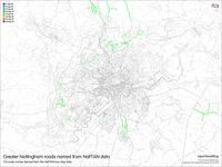
NAPTAN
NAPTAN data were imported for Nottingham and Nottinghamshire on 19 September 2009. Message from NAPTAN administrator read:
The NaPTAN bus stop data has now been uploaded for Nottingham and Nottinghamshire.
Details for merging the data with existing OSM data can be found on the wiki: NaPTAN/Surveying_and_Merging_NaPTAN_and_OSM_data
The data was used to derive road names in areas which were unmapped in 2009/2010. Of course, a standard OSM survey should be carried in the long run.
The data was uploaded in these changesets: Nottingham - [1] Nottinghamshire - [2]
As of 2013-09 much of this data is now 4 years out of date and many nodes have not been re-surveyed to remove duplicates. A comprehensive check of this data in the city is needed.
OS Open Data
Available from 2010. Used to add road names to existing roads which had been arm-chair mapped. The ITO comparison layer and OSL Musical Chairs were used to hunt down missing roads at a later stage. Some areas, notably Top Valley and Rise Park were mapped entirely from OS Open Data (despite the notice above).
Some boundaries, mainly ward boundaries, were added from Boundary Line. Others, such as the Nottingham City Council boundary have not been corrected with this data.
A limited number of features were included from OS Vector Map District: mainly rivers as areas.
Bing Imagery
The availability of Bing imagery enabled much greater refinement of both existing areas, and particularly places which had not had any aerial imagery before. Bing provided very high resolution imagery (to z21) from around 2008. This allowed very detailed mapping of buildings. Around March 2014 these detailed zoom levels have disappeared and the new 2013 imagery is not of the same quality.
DoT Cycle Data
Some details of cycle routes was added during 2012 from DoT cycle data using [Sanpshot Server].
Nottingham Open Data
Over the past 4 years (from 2012), Nottingham City Council have released a large number of data sets under the OGL. Many of these have proved extremely useful as both sources of data for OSM, or as tools to drive particular surveys. Specifc data sets which have been extensively used:
- Licensed Premises: not just pubs, clubs & restaurants licensed for serving alcohol, but also a range of other licence types. Most of these were systematically surveyed by visiting relevant postcode centroids in 2013 (at the outset, perhaps 40% were present in OSM).
- Food Hygiene data: was initially used to extend the above mainly for shops and cafes. As a result the coverage of this data was somewhat patchier (for instance caring premises were not covered systematically). Also much of the tagged objects predate widespread use of the fhrs:id tag, and in many cases the fhrs:id tag has changed for reasons which would not imply the need to change anything on OSM (e.g., change of management).
- Places of Worship. This is a very valuable dataset because a number of religions and denominations are located in non-obvious locations. For instance around the New Basford industrial area there are a number of evangelical churches and hindu temples located in old mills. Mosques may be converted terraced or semi-detached houses on residential streets. The dataset does not seem to have been updated in the past couple of years. One potentially useful feature which we have not used is the denomination of mosques. This has not been used because it is not readily ground-truthed by a non-muslim.
- Planning applications. Mainly useful as a source of postcodes, but in principle can provide much more information about change in the city.
- Streetlights. User:SK53 has blogged about various uses of this dataset: being able to add housenumbers is probably the most important one.
- Polling Stations. Has been used, but no systematic attempt has been made to keep it up-to-date or harmonise the tagging.
- Asset Register. Mainly useful for tracking down odd bits of land (for instance there are many isolated allotments hidden behind houses on many of the inter-war council estates.
Public Transport Routes
List of relations and routes tagged in Nottingham at Nottingham/Public Transport
Current Status
All roads throughout the conurbation are mapped. LCN/recommended cycle routes are marked in most of the city centre, and south of the Trent, but may be incomplete to the N & E of the conurbation.
Licenced premises (pubs, some restaurants) were mapped systematically in 2013, and effort is made to maintain this, food hygiene premises & generally any retail outlet up to date.
Addresses have been mapped extensively, largely by Will Phillips, SK53 and AlexKemp. Again details are better to the S & W of the city centre (postcode areas NG2 (N of Trent only, NG7, NG8 and NG9) and in the city centre itself (NG1). More recently many parts of NG3 and NG4 have been added. In general the primary target of address mapping is to complete the inner city suburbs: Radford, Hyson Green, Forest Fields, St Anns and Sneinton.
A more detailed picture of the current status by area (cake slice) is shown below.
The boundary of the city/unitary authority is complete but possibly inaccurate (see talk), ways which are part of the boundary are members of a relation 123292![]() 123292.
123292.
More information on mapping particular features is on the Nottingham/Features page.
Active mappers
Kev - Lives in West Bridgford and mapping most of the area south of the Trent, particularly cycle routes - hoping to map these more fully when the weather gets somewhat warmer. NTU City and Clifton campuses have been mapped.
Rob - Did some of the major roads, and bits in Bramcote and Wollaton. Unfortunately not based in Nottingham, so only doing bits and pieces when visiting family.
Russ Phillips - Done some bits and pieces (some using Yahoo's aerial imagery). Not based in Nottingham, but has friends there, so visits sometimes.
Will Hebden - Working in Nottingham, so able to start filling in the city centre.
Will Phillips - Lives in Stapleford and primarily mapping the western suburbs of Nottingham and the surrounding countryside.
SK53 - Comes from Nottingham and is in the area frequently, usually maps on SW and W side of city.
Status by Area
Greater Nottingham area, has been split into 'cake slices' with the following outer boundaries: S.of the Trent, includes Nottingham City areas of Wilford and Clifton and the West Bridgford area of Rushcliffe district; N of the Trent, bounded to the W by the River Erewash (border of Notts and Derbys) until crossed by the M1, then by the M1 to Long Lane (Watnall), to the N by Watnall Road, A611, City Boundary (S of Bestwood Country Park) and then across country to Dorket Head, to the E from Dorket Head along Mapperley Plains, along Arnold Lane, Colwick Loop Road (A612) to the Trent at the Netherfield Railway bridge.
Much of the following may be significantly out-of-date!

Map showing the areas tabulated below.
Colour and symbol legend
The status of each map region is indicated by a symbol, which describes the type of feature, and a colour, which indicates the completeness of that feature in a map region.
Usage
The status is displayed using a template Template:State
{{State|Key=progress}}- progress - 1/2/3/4/NA
Meaning of symbols
 - Street names are labelled. This means that the map can be used to find an address - Key: l
 - All housenumbers are present - Key: h
 - All footways are present - Key: fo
 - All wheelchair access is present - Key: d
 - All cycleways, and field and forest roads suitable for bicycles are present - Key: b
 - Roads for car traffic are present. One way streets and pedestrian streets are present. This means that the map can be used for car navigation - Key: c
 - All public transports are present (including name of the bus stop/station names) - Key: tr
 - All stop/station/harbour names are present - Key: ha
 - All bus lines are present (including name of the bus stop names) - Key: bu
 - All trolley/guided bus lines are present (including name of the station names) - Key: ty
 - All tram lines are present (including name of the tram station names) - Key: tm
 - All fast railway lines transports are present (including name of the train station names) - Key: tn
 - All U-Bahn (subway in Germany) lines are present (including name of the station names) - Key: u
 - All S-Bahn (regional commuter train in Germany) lines are present (including name of the station names) - Key: s
 - All steam railway lines transports are present (including name of the train station names) - Key: st
 - All ship lines are present (including name of the harbour station names) - Key: sh
 - All public institutions are present (Churches, sports facilities, venues, schools, hospitals, city hall) - Key: p
 - All emergency services (hospitals...) are present - Key: em
 - All petrol stations are present - Key: fu
 - All restaurants and hotels are present - Key: r
 - All tourist attractions are present - Key: t
 - All natural resources are mapped (e.g Water, Lakes and Woodland) - Key: n
Meaning of colours
| Background colour | Meaning | Use for navigation | To do | value |
|---|---|---|---|---|
| The map needs checking, status unknown | Availability unknown | Please check | (None) | |
| The map contains no or little data | Not to be used | Please complete | 0 | |
| The map contains partial data | Limited usability | Please complete | 1 | |
| The map is largely complete (please describe missing data) | Use with restrictions | Please complete (missing data, streets etc.) | 2 | |
| The map is complete (in the opinion of a mapper) | Suitable for use | Please check and correct any errors | 3 | |
| The map is complete (verified by 2 mappers) ; please indicate Date when checked) | Suitable for use | Please update as needed | 4 | |
| This attribute does not exist in the mapped area (e.g. no petrol stations) | Suitable for use | Please update as needed | X |
| Cake Slice | District | Status | Remarks | Mapped / Checked by |
|---|---|---|---|---|
| 1 | City Centre 52°57′14.22″ N, 1°08′49.02″ W | Complete coverage, main issues are usually updating changes. | ||
| 2 | The Meadows 52°56′22.45″ N, 1°08′42.22″ W | Coverage is complete. New construction and demolition of some 1970/80s buildings needs monitoring. | ||
| 3 | Lenton Lane 52°56′25.80″ N, 1°09′48.96″ W | A mix of industrial estates, retail parks, with odd bits of greenspace. Mostly on land formerly occupied by the railways, and the long gone Clifton Colliery, Wilford Power Station, and the Royal Ordnance Factory. Complete (all factories/industrial units on Lenton Lane estates mapped). | ||
| 4 | Lenton 52°56′53.81″ N, 1°10′09.84″ W | Predominantly residential area, more-or-less complete. Some tidying up needed around Canning Circus, and along Castle Boulevard. Some small mews type roads in The Park may have been missed. Restrictions on cars (oneway street, traffic calming etc.) in the streets around Harrington Drive needs to be checked. | ||
| 5 | Radford 52°57′24.12″ N, 1°10′26.40″ W | Predominantly residential area, road network completely in place (90%). Areas re-developed since 1970 tend to have complex networks of roads and paths. Only two or three long straight streets, and gated areas have not been surveyed on foot with GPS. One or two unnamed streets remain, usually remnants of the former road network: the names can probably be inferred from old (out-of-copyright) maps. | ||
| 6 | The Forest 52.96209&, 1°09′43.70″ W | Mix of residential (many houses in multiple occupation), green space, with schools and some commercial. Most roads in place with names from OSSV. Patches (particularly in the NW quadrant) still need detailed ground survey, but most areas have been visited and street names verified by ground survey. Detailed mapping has taken place near the Lincolnshire Poacher on Mansfield Road, and most addresses are in place to the west of the Arboretum. Alfreton Road, Radford Road and Gregory Boulevard need surveying for retail POIs. Also worth looking for in-fill developments (for instance blocks of student flats), which may have different postcodes from the main street. | ||
| 7 | Mapperley Park 52°58′14.52″ N, 1°08′29.76″ W | Most roads mapped from Yahoo and NPE data. Requires survey as there are many inaccuracies. | ||
| 8 | St. Anns 52°58′02.28″ N, 1°07′46.92″ W | Only about 50% roads present: particularly in the area N of Woodborough Road, where the Yahoo aerial photos are difficult to interpret. Intricate network of footpaths only partially mapped. | ||
| 9 | Sneinton 52°56′58.92″ N, 1°07′44.76″ W | Most roads present, with majority named. | ||
| 10 | West Bridgford and Edwalton 52°55′09.84″ N, 1°07′27.12″ W | A very large area. All roads present, along with all street names. Buildings have been imported using the automatic extractor from OS OpenData StreetView, but address data is sparse. | ||
| 11 | Wilford, Silverdale and Compton Acres 52°55′17.40″ N, 1°08′56.40″ W | All roads present, as are all streetnames in Rushcliffe (east of the line of the former Great Central Railway). The convoluted road system of the modern estate of Compton Acres has the rough road network in place but refinement is needed, the major paths are also in place, although some smaller ginnels may have been missed. | ||
| 12 | Clifton 52°54′15.12″ N, 1°10′51.24″ W | Most roads present, with about 75% now named (SK53 13:52, 25 July 2009 (UTC)). Obvious POIs (Pubs and Churches) have also been augmented. Again the footpath network will present a challenge. | ||
| 13 | Dunkirk and Beeston Rylands 52°55′27.48″ N, 1°11′18.60″ W | Mixed area of Industrial/Commercial with pockets of residential areas at Dunkirk and Beeston Rylands. The large area occupied by the Boots complex may be difficult to survey. | ||
| 14 | Beeston52°55′33.96″ N, 1°13′22.44″ W | Generally well covered, particularly around the town centre. Some gaps in outlying estates. | ||
| 15 | Nottingham University 52°56′17.77″ N, 1°11′55.54″ W | Mapped in detail some time ago, but needs revision. One or two known roads are missing or not mapped correctly (e.g. Willoughby Close). | ||
| 16 | Wollaton Park Estate 52°57′00.22″ N, 1°11′26.02″ W |
SK53 has been using this area to familiarise himself with several aspects of OSM. Most streets, footpaths etc. have been walked several times to generate GPS traces, and to acquire data for adding addresses according to the Karlsruhe scheme. |
||
| 17 | Wollaton 52°56′49.92″ N, 1°12′39.60″ W | All roads present and named. Network of footpaths largely complete, with some missing in Wollaton Park. Bus stops and routes about 50% complete. | ||
| 18 | Bilborough 52°57′47.16″ N, 1°13′03.00″ W | Most roads present. Progressive additions from ground survey. | ||
| 19 | Broxtowe 52°58′41.88″ N, 1°12′41.40″ W | Many roads present, although N part is off Yahoo imagery and much less complete. Broxtowe Country Park not mapped in any detail. | ||
| 20 | Hyson Green 52°58′19.78″ N, 1°10′18.19″ W | Includes New Basford and Forest Fields. Most roads and street names present. The area N of Gladstone St requires work: many changes to original street layout, additional housing, and loss of industrial streets means that this area is particularly difficult to interpret from aerial photos. Requires ground survey. | ||
| 21 | Sherwood 52°58′47.28″ N, 1°09′26.28″ W | Most roads present, but many from NPE are out of alignment in the N part of area. Requires ground survey. | ||
| 22 | Woodthorpe 52°59′14.68″ N, 1°07′44.47″ W | Limited amount of ground survey, usually on route somewhere else. Many street names verified. | ||
| 23 | Gedling 52°58′56.53″ N, 1°06′26.14″ W | First detailed survey work showed that NPE maps were still useful, although alignments will be wrong. | ||
| 24 | Carlton 52°57′53.46″ N, 1°06′19.66″ W | As above for Gedling. POIs and street names added along length of Carlton Hill. | ||
| 25 | Colwick 52°57′02.16″ N, 1°05′42.36″ W | Mix of industry along the main road, green space (park, country park and racecourse) and post-WWII housing (both social and private). No Yahoo photos for much of area. Colwick itself fully surveyed in Sept. 2009, with Netherfield also receiving much needed attention. Some initial surveys of other area (Bakersfield, Netherfield) have been done along main roads. Colwick Country Park and Netherfield Lagoons have been surveyed although are not complete, but Colwick Woods needs an initial survey. | ||
| 26 | Attenborough, Chilwell and Toton 52°54′42.84″ N, 1°14′15.00″ W | Largely post WWII development other than the historical centres of the original villages. Some redevelopment of the Ordnance factory site. Most missing roads and street names were added during winter 2009-10. | ||
| 27 | Stapleford 52°55′53.04″ N, 1°16′10.92″ W | Mostly complete (February 2011). Every road and street name is present. All addresses have been surveyed and house numbers are close to completion. However, there are a few instances where the correct number has yet to be ascertained. | ||
| 28 | Bramcote Hills and Wollaton Vale 52°56′45.96″ N, 1°14′17.52″ W | Most roads present, and a few missing street names. | ||
| 29 | Strelley 52°58′11.28″ N, 1°14′55.32″ W | Mainly open countryside, few roads. In a draft of a recent development plan this area was proposed for residential development. | ||
| 30 | North Bulwell 53°00′33.84″ N, 1°13′17.76″ W | Again a lot of countryside, but some residential (Bulwell Hall & Seller's Wood Drive estates) and industrial areas (Blenheim Industrial Estate). Start finally made on this area. SK53 10:25, 3 August 2009 (UTC) | ||
| 31 | Bulwell 52°59′56.76″ N, 1°12′12.96″ W | Complex mix of Victorian/Edwardian housing and industry, later infill, complete re-development and modern industrial estates. Also includes the former Cinderhill Colliery site. No Yahoo images, poor coverage. Some GPS traces for Bulwell centre, along Cinderhill road, and in the Bulwell Hall area. The Hempshill Vale estate has been completely mapped. | ||
| 32 | Basford 52°59′11.04″ N, 1°11′12.48″ W | Surveying in Aug & Sep 2009 has improved coverage significantly. Whitemoor Estate and Basford Hall College site are the main areas lacking detailed ground survey. | ||
| 33 | Highbury 52°59′47.04″ N, 1°10′54.48″ W | Poor coverage. A few street stubs and names grabbed on a drive thru. SK53 10:25, 3 August 2009 (UTC). Northern part surveyed by ~~ in Sept. 2009. | ||
| 34 | Bestwood Park and Daybrook 52°59′41.17″ N, 1°09′27.50″ W | Poor coverage. In most areas roads have been sourced from NPE with limited surveying of road names. Most of the area S of Arnold Road/Oxclose Lane has been surveyed in detail. | ||
| 35 | Rise Park and Top Valley (inc. Rise Park and Top Valley) 53°00′30.64″ N, 1°09′57.96″ W | Coverage is thorough but mainly from OSSV or Bing. | ||
| 36 | Arnold 53.0064&, 1°07′15.60″ W | Thanks to [User:Forumla1] coverage has improved considerably since 2011. |
Nearby towns and areas
- Derby - well mapped by mid-2009
- Derbyshire -
- Hucknall - excluded from this plan, but part of the Greater Nottingham transport area.
- Ilkeston - another town which is more or less contiguous with the urban fringe of Nottingham
- Leicester - active mapping community.
- Leicestershire -
- Long Eaton - work started in late 2008. Largely complete mid 2009.
- Loughborough - nearly complete, as is a good section of countryside between Leicester and Loughborough
- Mansfield - town centre done
- Nottinghamshire - basic road network in place
Useful Sources of Information
The usual caveats apply w.r.t to copyright on these sites.
- Nottingam City Transport (NCT), Trent-Barton. List of main bus routes in city. Currently only about 5% implemented as relations.
- Pedals. A local Nottingham cycle advocacy group. The monthly meeting minutes contain a wealth of information relevant to mapping cycleways, particularly status, closures, changes.
- Nottingham Civic Society. Lists of historic buildings. Also have a footpaths officer.
- Ramblers Association, Nottingham Local Group. Comments as for Pedals above, but for footpaths.
- CAMRA, Nottinghamshire Group. Formidable amount of information on pubs and associated matters (particularly transport) in their bimonthly newsletter "The Nottingham Drinker". Useful for identifying the status of pubs.
- Beeston local history. Lots of additional information about various locations in and around the city.
- Notts local history. Site devoted to transcriptions of out of copyright works.
- Rise Park. Site about this area.
- Park Views. Range of opinion and information focusing on the Lenton and Dunkirk areas.
- Lenton Local History Society. Lots of useful stuff, including pages organised by street name.
- [3]. Bulwell Hall Estate. Very useful information from the pages of a life-long resident.
Arcana
Bits and bobs noticed whilst mapping, in no particular order.
- Bus Stops: Most are coded with one or two letters followed by a two digit number. Single letter stops are in the City Centre, two letter stops represent a code for an area (LE=Lenton,RA=Radford,GE=Gedling,CA=Carlton,Wo=Wollaton, etc.). Some stops outside the city have two letters and four digits, where the letters appear to code the local authority. Most stops have a name, which can be very useful for cross-checking other local map features.
- Lamp Posts: Seem to have unique 5 or 6 figure identifiers in the city. Seems to apply to other street furniture, e.g., bollards have a code starting with B.
- Bars and Pubs: Most establishments in the City Centre have a plate outside which states how many standing and sitting customers allowed by their licence. Could be useful to selective rendering.
- Postcodes: Short streets (i.e., those with a single postcode for the whole street) in Gedling Borough have the full postcode in red on the street signs. Also true for some streets in Broxtowe.
Development of OSM Coverage
April 2007

Map from 2007, very little of the city had been mapped.
Jan 2009

A massive change can be seen 20 months later.
Q3 2009
- Stubs of roads in Rise Park, Top Valley and Bestwood Estate created, along with relations for 70 and 71 bus routes. SK53 12:53, 14 August 2009 (UTC)
- Detailed survey of Colwick village, and Industrial area by Simon Halsey. SK53 10:04, 5 September 2009 (UTC)
- Radford detailed survey completed. SK53 19:43, 8 September 2009 (UTC)
- S part of Gamston completed Simon Halsey, Netherfield partially surveyed Willumm. SK53 22:56, 11 September 2009 (UTC)
- Weekend 12/13 Sept. Part of Old Basford fully surveyed (SK53), new CentreLink bus service added (kevjs), missing roads in Edwalton added (Simon Halsey). SK53 09:37, 14 September 2009 (UTC)
- NaPTAN import of bus stops covering Nottingham and Nottinghamshire on 19 September 2009. Initially data used for naming unnamed roads, and adding a few large roads lacking from the city. SK53 13:19, 25 September 2009 (UTC)

Q4 2009
Relatively little progress
Q1 2010
- Major progress in the Stapleford, Bramcote and surrounding areas. Largely the work of will7777.
- A fleeting visit in March from Steve Chilton produced some much needed updates on Nottingham University campus.
Q2 2010
- Many missing street-names added from the Ordnance Survey Open Data StreetView set. Also some changes in status of main roads and references (particularly the A ). Where streets have been sourced from NPE the alignment has not been updated. This has been with a view to ensure that these areas get an 'on-the-ground survey'. SK53 09:04, 1 May 2010 (UTC)
- Some boundaries imported from OS OpenData BoundaryLine around Broxtowe District.
Q3 2010
Relatively little progress. (tba)
Q4 2010
Relatively little progress. (tba)

Q1 2011
- Edwards Lane Estate (Slice 34), Week 1 , 2011 SK53
- Dales Estate (Slice 34), Week 2, 2011 SK53
- Preliminary work for survey of Assarts Farm & Cinderhill will_p
- Area S of Arnold Road (Slice 34 : Belconnen Road/Torbay Crescent) Week 3, 2011. 10 additional residential roads, + two existing names ground surveyed. SK53 19:44, 19 January 2011 (UTC)