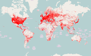
qa.poole.ch (QA tool)
qa.poole.ch is a tool to show streets with no names (respects noname=*), noaddress=* and access=yes tags. Currently displays four global quality assurance layers.
The main difference to previous implementations and to other tools is that the layers are generated directly from a rendering database updated minutely, in other words the data displayed will short term reflect edits.
noaddress layer
The noaddress layer highlights building outlines for buildings that have neither addr:housenumber=*, addr:housename=* or addr:conscriptionnumber=* tagged and don't have a node with such tags inside or on the outline. Further it supports addr:interpolation=* ways that intersects buildings.
Buildings with building-tag values: yes, house, residential, apartments, supermarket, terrace, detached, university, school, retail, warehouse, commercial, farm, public, industrial, office, shop, dormitory, train_station, factory, kindergarten, hotel, civic, manufacture are rendered in red if an address is missing all others in orange.
The check for a node in or on the building outline is computationally rather expensive leading to the layer not being as fast as the noname one. Zoom 0-12 are regularly re-rendered in batch mode.
Naturally in some areas it is common to not have building specific address information, we are currently missing tagging to suppress such false positives. I'm planning on adding support for some further addr tags that are not so common. If you have any suggestions please leave a comment.
Update 25th March 2015
Use a positive list for buildings that likely should have an address instead of the other way around.
Update 23rd March 2013
landuse residential areas that do not contain addresses are highlighted. Currently this is an all or nothing test, I may add a test for address density in the future.
noname layer

The NoName map layer highlights roads with no name=* tag. It differs a bit from previous attempts in that it respects noname=* and unsigned=* tags (that have never become popular) and is generated directly from a synchronized database. Currently changes can be expected to show up in roughly 5 minutes.
Legend
- red
- major and minor roads, service with service=alley without name or ref tag
- orange
- unspecified service, unnamed roundabouts, motorway_link, trunk_link
- dashed red
- unsigned=yes
- dashed orange
- unsigned=yes and/or noname=yes
Update 28th October 2012
- render motorway_link and trunk_link in orange. There is currently no clear way to tag such roads in the absence of explicit sign posting.
- reduce line widths at lower zooms
Update 16th November 2012
- render *_link in orange.
- support validate:no_name=yes as synonym for noname=yes and validate:no_name=no_sign as synonym for unsigned=yes
Update 26th November 2012
- support name:left=* and name:right=* as valid name tags
has address layer
Displays building and nodes with address information. It uses a similar logic as the noaddress layer however will highlight both a building outline and a address node if such is used on or in the building outline.
AEYCH
"access equals yes considered harmful"
The overlay displays streets (residential to motorway, currently ignores *_link) that have access=yes set. While this is not directly an error, it is an indicator for nonsensical access tagging and has undefined semantics, leading to stuff like adding motor_boat=no to streets in a medieval town. It can always be replaced by something simpler and more correct. The tag is most of the time added by JOSM users using the "Road Restriction" preset form.
See OSM tags for routing/Access-Restrictions and Key:access.
The layer further highlights the combination access=destination with motorcar=no which is nearly always an error (it allows everything to locations on the street except cars). The correct tagging would typically be a simple motorcar=destination (often in combination with motorcycle=destination).