Proposal:Water details
| The Feature Page for this approved proposal is located at Key:water |
| Water details | |
|---|---|
| Proposal status: | Approved (active) |
| Proposed by: | Zverik |
| Tagging: | water=* |
| Applies to: | |
| Definition: | Specification of a water body |
| Statistics: |
|
| Rendered as: | The same as natural=water with renderer-specific modifications |
| Draft started: | 2011-03-31 |
| RFC start: | 2011-04-01 |
| Vote start: | 2011-04-16 |
| Vote end: | 2011-05-09 |
Summary
This proposal adresses two points:
- For areas tagged with natural=water it should be possible to mark which type of water body it is.
- River bodies and reservoirs should be tagged consistently with other water bodies, using natural=water.
Reasoning
Now, natural=water is used to tag all types of water bodies: lakes, ponds, former riverbeds (aka oxbow lakes), even puddles visible on satellite imagery. It is ok on the map, but is completely unusable for processing. Also, there types of water that are not marked as natural, but are instead waterway=* or landuse=*. Since those are also water bodies, this proposal includes them too.
water=* should be used only in conjunction with natural=water. When the latter tag is omitted, it's up to a renderer to decide whether natural=water is assumed.
Possible Values
| Tagging | Description | Sample Photo |
|---|---|---|
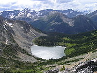
| natural=water water=lake |
A lake: a body of relatively still fresh or salt water of considerable size, localized in a basin that is surrounded by land. Intermittent lakes (which disappear seasonally) should be tagged with intermittent=yes; salt lakes — with salt=yes. | 
|
| natural=water water=cove |
A cove: a small type of bay or coastal inlet. They usually have narrow, restricted entrances, are often circular or oval, and are often inside a larger bay. May be mapped as natural=coastline. | 
|
| natural=water water=lagoon |
A lagoon: a body of shallow sea water or brackish water separated from the sea by some form of barrier. It's better to specify saltness of water with salt=yes/no. | 
|
| natural=water water=pond |
A pond: a body of standing water, either natural or man-made, that is usually smaller than a lake. Salt evaporation ponds should be tagged with landuse=salt_pond, open-air swimming pools — with leisure=swimming_pool. | 
|
| natural=water water=reflecting_pool |
A reflecting pool: a water feature found in gardens, parks, and at memorial sites. It usually consists of a shallow pool of water, undisturbed by fountain jets, for a calm reflective surface. | 
|
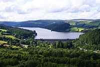
| natural=water water=reservoir |
A reservoir or an artificial lake is used to store water, which is currently mapped as landuse=reservoir. | 
|
| natural=water water=canal |
A body of a canal, a man-made channel for water. Should contain waterway=canal way inside. | 
|
| natural=water water=river |
A body of river, which is currently mapped as waterway=riverbank. Should contain waterway=river way inside. | 
|
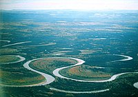
| natural=water water=oxbow |
An oxbow lake: U-shaped body of water formed when a wide meander from the main stem of a river is cut off to create a lake. | 
|
Deprecation
Some proposed values imply than natural=water tag would deprecate several currently used tags:
- waterway=riverbank (replaced by natural=water + water=river)
- landuse=reservoir (replaced by natural=water + water=reservoir)
- landuse=pond (replaced by natural=water + water=pond)
Until all renderers (which render those areas differently from natural=water) support those new values, both schemes can be used together: just add natural=water and water=* to already present tags.
"Deprecates" means "is equivalent for all purposes to". For example, landuse=reservoir should be rendered exactly like natural=water + water=reservoir. There are too many uses of the current tagging scheme, and we don't want massive retagging and edit wars.
Example
For Lake Baikal area tags would be as follows:
natural=water
water=lake
name=Baikal
See Also
- Taginfo statistics
- Proposed features/water — old proposal to merge waterway=* into natural=water + water=*.
- Proposed features/Water cover — deprecated (by natural=*) proposal for tagging mixed earth/water situations, the source for multiple water=intermittent and water=tidal in the taginfo.
- Proposed features/Water bodies — a very complex proposal for tagging water bodies.
- Proposed features/water network — not a proposal, just a summary of tagging schemes.
- landuse=salt_pond (approved proposal)
Comments
Please use the Talk page for discussion.
Voting
Voting is open until 2011-05-07. Please vote with {{vote|yes}} or {{vote|no}} and sign with ~~~~
 I approve this proposal. --Zverik 19:23, 16 April 2011 (BST)
 I approve this proposal. --Dieterdreist 19:41, 16 April 2011 (BST)
 I approve this proposal. --Glebius 19:46, 16 April 2011 (BST)
 I approve this proposal. --Dri60 19:53, 16 April 2011 (BST)
 I approve this proposal. --Csmale 20:01, 16 April 2011 (BST)
 I oppose this proposal. I don't like the usage of natural=water - there is nothing "natural" about man-made reservoir, canal etc. I like better the idea of using landcover=water (see Proposed features/landcover) for tagging each body of water, then apply landuse=* in case it's used by mankind and/or natural=* in case you want to specify a type of natural water body. Current tagging scheme is not good, but this is hardly an improvement - how do you tag natural lake that is used as a reservoir of water? Anyway back to this proposal - I don't see the point of having both water=river and water=canal, both are banks of some waterway (which is specified by waterway=*). --Xificurk 19:20, 16 April 2011 (UTC)
 I approve this proposal. --Hanska 20:37, 16 April 2011 (BST)
 I approve this proposal.--ZMWandelaar 21:10, 16 April 2011 (BST) Allthough there are more types of water. Example covert in Talk-nl is water=stream.
 I approve this proposal. Loir 21:52, 16 April 2011 (BST)
 I approve this proposal. --Canabis 10:27, 18 April 2011 (BST)
 I approve this proposal. Good proposal, even as it also has the common "independent keys as subkey of each other"-problem. --Fabi2 18:19, 19 April 2011 (BST)
 I approve this proposal. -- Pankdm 17:41, 22 April 2011 (BST)
 I approve this proposal. -- Binary Alchemy 01:17, 23 April 2011 (BST)
 I approve this proposal. --luch86 22:14, 23 April 2011 (BST)
 I approve this proposal. --Surly 20:20, 24 April 2011 (BST)
 I approve this proposal. --DINENISO 08:25, 27 April 2011 (BST)
 I oppose this proposal. The distinction between lake and pond is unclear (just citing Wikipedia is not enough!), and there is a lot of redundancy with existing tags (waterway=riverbank, landuse=reservoir). Changing the meaning of basic tags like natural=water ("an area of permanent water") would need a much longer discussion phase. Starting voting on this 15 days after RFC start is like a surprise attack. --Fkv 15:18, 27 April 2011 (BST)
 I approve this proposal. --Don-vip 00:47, 29 April 2011 (BST)
 I oppose this proposal. The whole idea is great, but the use of the word 'water" seems irrelevant to me because it's so... meaningless. 'Water' could characterize a lot of things : turbidity, saltiness, high/low waters... It's too vague. Why wouldn't we have a more clearer 'watersurface' or 'waterbody' tag as we have a 'waterway' tag ? And get rid of the natural=water, as it is contradictious with man made things like canal or reservoir (let's use a watersurface/waterbody=yes for people unable to determine what they are mapping). I'm philosophically OK with the proposal, but I think it can be improved a bit. Plus we need a final solution for the total mess the 'riverbank' tag currently is (we need a 'bank'-like tag to clarify the situation). I say : let's set all these things right once for all, and then vote.--krysst 16:43, 2 May 2011 (BST)
Result: voting is successful with 16 positive votes and 3 negative. The tagging page should be more specific, especially in lake/pond distinction.