TIGER fixup/250 cities
The "250 cities" concept was a project to connect the major cities in the USA and therefore to be able to route between them. It was initiated by Gravitystorm and with various tools being run by the old CloudMade team in London (no longer)
The aim was to provide a solid backbone of inter-city connections as the start of a major program to improve routing in the US.
The fixup challenges
These are no longer maintained.
/routing grid
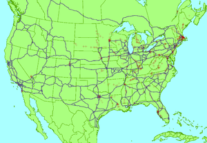
We take the biggest 250 cities in the US, and using CloudMade's routing engine generate pairs between them. This info is then munged into a giant 17Mb HTML table, the /routing grid, with links off to the routes and cities so that you can inspect them.
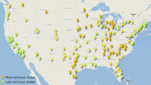
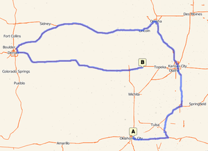
It took six weeks for everyone to get stuck in a make all 250 cities rout-able. In a second phase, this analysis was refined to show "tortuous" routes. Routes which look suspiciously long.
/duplicate nodes
Duplicate nodes are the cause of most connectivity problems in the TIGER data. We presented duplicate nodes on a map, and began tracking progress with fixing them. It took only a month for all such problems to be fixed on the U.S. interstates. We started tracking duplicate nodes on other types of highways too. This is now superseded by Matt's duplicate nodes map
What's next?
The above challenges were pretty successful. They're no longer maintained, but they served as inspiration for some other progress tracking tools:
Waychains TIGER fixup
This analysis attempts to weed out the last of the connectivity problems on U.S. interstates, by checking that the ways can be chained end-to-end correctly. It also reveals a lot of problems with 'ref' tags. Check it out, and help with fixing!
Duplicate nodes map
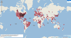
This is a worldwide display of ALL duplicate node issues, not just highways. The U.S. remains the centre of duplicate node mess, due to the TIGER data, but there's some progress at fixing it all.
Maps
No longer maintained
The routability map is all green now (can route between all cities)
The tortuous routes map shows yellow connections. It shows which of the connections look suspiciously long ( >1.5 times the great circle distance). It's a crude fuzzy indication, but reveals some interesting patterns.
The duplicate motorway nodes map shows nothing left to fix in the U.S.!
The 'important' highways duplicate nodes map shows these errors on primary, trunk and motorways.
FAQ
- Can't you get a script to do this? - Aaargh, every time, there's always someone. Seriously, no - if that was the right thing to do I'd have done that already. Fixing up the freeways involves more than just connecting them together - the alignment is wrong, the junctions are usually a mess, some areas have multiple ways from people accidentally duplicating what's there already. But it needs humans to fix it.
- Some 'green' routes go the wrong way - Indeed, and this needs fixing too. That's not the focus of this project, which is simply to first get every city connected. Getting better routes is something that'll likely happen anyway as more of the network is fixed up, but measuring that is for a future project.
- What about new imports? - There's no point in waiting for new TIGER data, since it's not routable either. And I reckon we can fix this up in about 6-8 weeks anyway, so everyone can benefit from better routing long before any magical future imports happen!
- That's so much work - it'll never get finished - Wow, defeatism. You can eat a whole elephant, one mouthful at a time. Thankfully we also have thousands of people helping out!
- It's a lot of work just to get one entry to work - Actually, for every city you can connect to the main backbone, you'll get about 300-400 more routes working. And if you can find 4-5 cities that connect to each other but not the main cluster, you could get 1000s of routes for very little effort. So very soon much of the grid will be green - and you can help.


