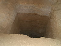
Tag:historic=mine_shaft
Jump to navigation
Jump to search
| Description |
|---|
| Vertical shaft of a historic mine. |
| Group: historic |
| Used on these elements |
| Useful combination |
|
| Status: de facto |
| Tools for this tag |
|
Historic vertical manholes of a mine. It is used in conjunction with historic=archaeological_site.
All mineshafts that are not in a archaeological site should be tagged with man_made=mineshaft (and if disused with disused=yes)
How to map
Set a node at the location of the feature.
Tag it with historic=mine_shaft
Add name=* if it is named.
