Zh-hant:Featured images/Jan-Mar 2020
Jump to navigation
Jump to search


這是特色圖片,展現開放街圖畫地圖範例,以及最能代表開放街圖的專案。
如果你知道其他有類似品質的圖片,你可以在特色圖片提名處(en)提名。
| ← 從2019年1月到3月 | ← 從2019年10月到12月 | 從2020年4月到6月 → | 從2021年1月到3月 → |
特色圖片庫、從2020年1月到3月

2020年、第1週
2020年、第2週
2020年、第3週
2020年、第4週
2020年、第5週

2020年、第6週

2020年、第7週
2020年、第8週
2020年、第9週
2020年、第10週
2020年、第11週
2020年、第12週
2020年、第13週
細節和字幕
第1週(從2019年12月30日星期一到2020年1月5日星期日) [Edit]

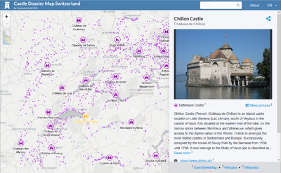
- English : The Castle Dossier Map Switzerland is a map of castles, medieval towers and fortified archaelogical sites in central Europe. The map is part of a collaboration between Wikimedia CH and the Swiss OSM Association. The web application merges data from OpenStreetMap, Wikidata, Wikipedia and Wikimedia Commons (images). The technology is a prototype of how these projects can be optimally combined. Attention was paid to scaling as well as cartographic generalization (i.e. prioritization of the objects to be displayed either as icons or as points).
第2週(從2020年1月6日星期一到2020年1月12日星期日) [Edit]

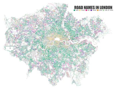
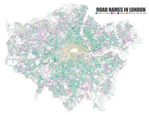
- English : A rendering of Road/Street/Way/Drive/Avenue names in London using OSMnx. See this twitter thread for similar images of many other cities
第3週(從2020年1月13日星期一到2020年1月19日星期日) [Edit]
- English : A rendering of Road/Street/Way/Drive/Avenue names in London using OSMnx. See this twitter thread for similar images of many other cities
第4週(從2020年1月20日星期一到2020年1月26日星期日) [Edit]

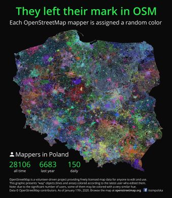
- English : OpenStreetMap data in Poland with each contributor assigned a random colour. Made with Osmosis, PostGIS and QGIS.
第5週(從2020年1月27日星期一到2020年2月2日星期日) [Edit]
- English : OpenStreetMap data in Poland with each contributor assigned a random colour. Made with Osmosis, PostGIS and QGIS.
第6週(從2020年2月3日星期一到2020年2月9日星期日) [Edit]

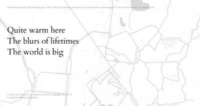
- English : OpenStreetMap Haiku generates short poems based on the map location data.
第7週(從2020年2月10日星期一到2020年2月16日星期日) [Edit]

- English : OpenStreetMap was on show at the 36th Chaos Communication Congress (a large hacker conference) in Leipzig in December. Mappers explained the project to some of the 17000 visitors while Show Me The Way was displayed on a laptop
第8週(從2020年2月17日星期一到2020年2月23日星期日) [Edit]
- English : OpenStreetMap was on show at the 36th Chaos Communication Congress (a large hacker conference) in Leipzig in December. Mappers explained the project to some of the 17000 visitors while Show Me The Way was displayed on a laptop
第9週(從2020年2月24日星期一到2020年3月1日星期日) [Edit]

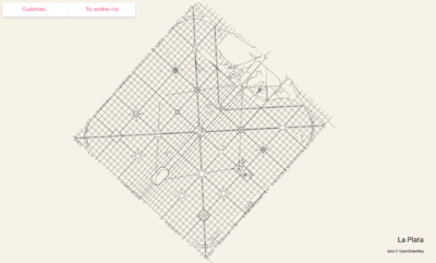
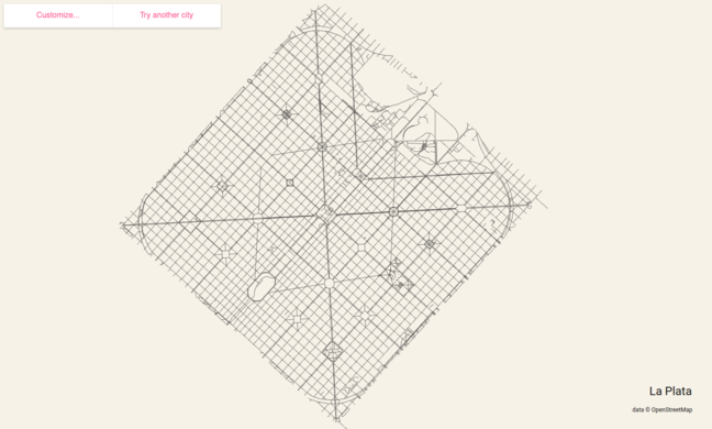
- English : City roads generates beautiful maps for printing based on the OpenStreetMap road data. Here we see a map of La Plata, Argentina.
第10週(從2020年3月2日星期一到2020年3月8日星期日) [Edit]
- English : City roads generates beautiful maps for printing based on the OpenStreetMap road data. Here we see a map of La Plata, Argentina.
第11週(從2020年3月9日星期一到2020年3月15日星期日) [Edit]

- English : Many data visualisations for #coronavirus use an OpenStreetMap basemap of course (example), but there's also been an uptick in OpenStreetMap contributions adding map details in areas such as Wuhan. This map show edits which have happened this year.
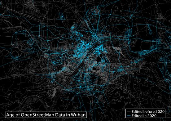
第12週(從2020年3月16日星期一到2020年3月22日星期日) [Edit]
- English : Many data visualisations for #coronavirus use an OpenStreetMap basemap of course (example), but there's also been an uptick in OpenStreetMap contributions adding map details in areas such as Wuhan. This map show edits which have happened this year.
第13週(從2020年3月23日星期一到2020年3月29日星期日) [Edit]

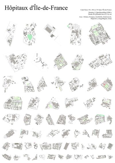
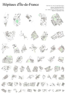
- English : Hospitals in Île-de-France. Created by JB using Python, Overpass API, GeoFabrik downloads, Osmconvert, Maperitive, ImageMagick, and Gimp.