File:20221011 manakara&vohipeno road network.png
Jump to navigation
Jump to search
Size of this preview: 800 × 578 pixels. Other resolutions: 320 × 231 pixels | 640 × 463 pixels | 1,024 × 740 pixels | 1,280 × 925 pixels | 2,316 × 1,674 pixels.
Original file (2,316 × 1,674 pixels, file size: 594 KB, MIME type: image/png)
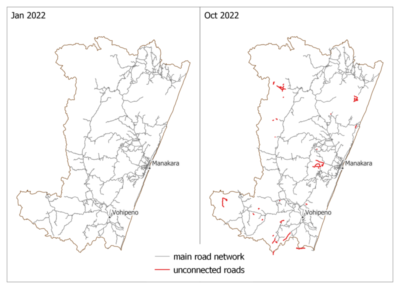
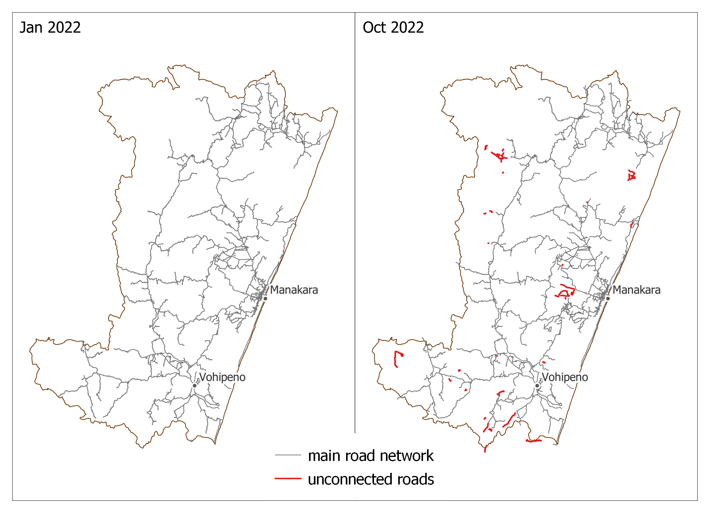
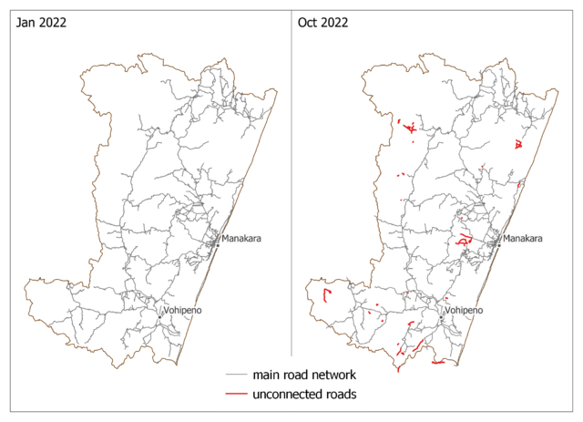
Comparison of OSM road network in Manakara and Vohipeno districts (january 2022 vs october 2022) (screenshot from QGIS with © OpenStreetMap data)
- This media file was uploaded by author of the work and its copyright holder.
![]()
![]()
![]()
This work is licensed under the Creative Commons Attribution-ShareAlike 4.0 License.
Attribution: Privatemajory
Attribution: Privatemajory
File history
Click on a date/time to view the file as it appeared at that time.
| Date/Time | Thumbnail | Dimensions | User | Comment | |
|---|---|---|---|---|---|
| current | 03:44, 11 October 2022 | | 2,316 × 1,674 (594 KB) | Privatemajory (talk | contribs) |
You cannot overwrite this file.
File usage
The following page uses this file: