File:ATB systems English.png
Jump to navigation
Jump to search
Size of this preview: 515 × 600 pixels. Other resolutions: 206 × 240 pixels | 412 × 480 pixels | 659 × 768 pixels | 879 × 1,024 pixels | 1,758 × 2,048 pixels | 2,839 × 3,307 pixels.
Original file (2,839 × 3,307 pixels, file size: 2.99 MB, MIME type: image/png)
Summary
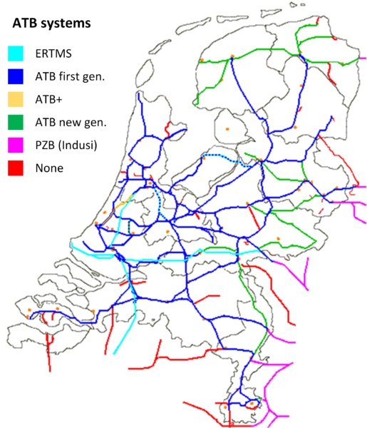
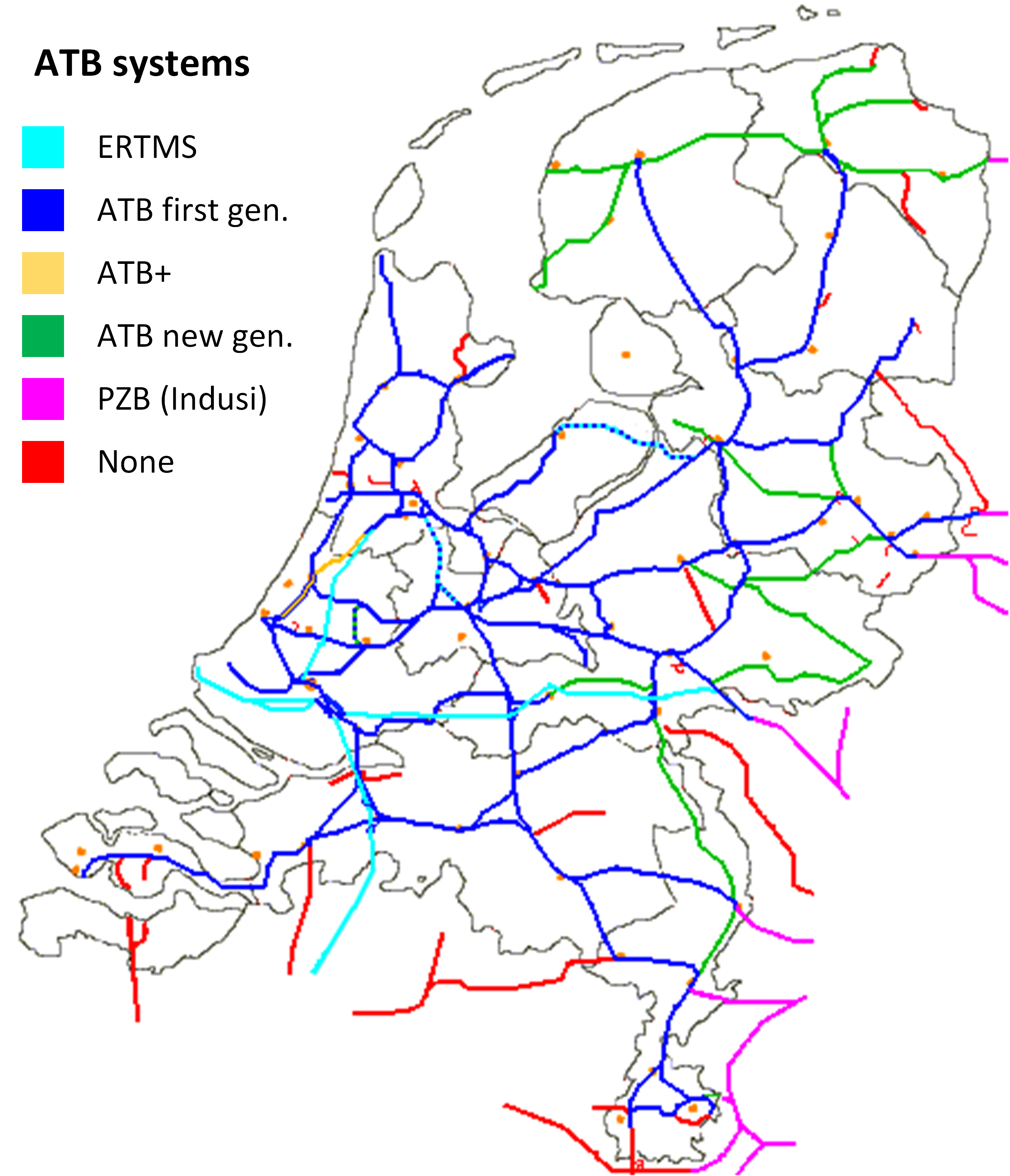
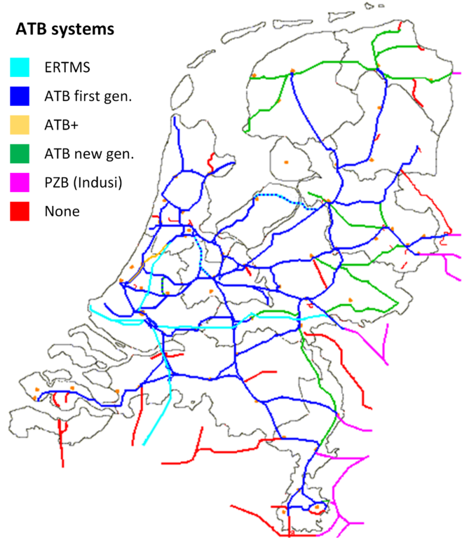
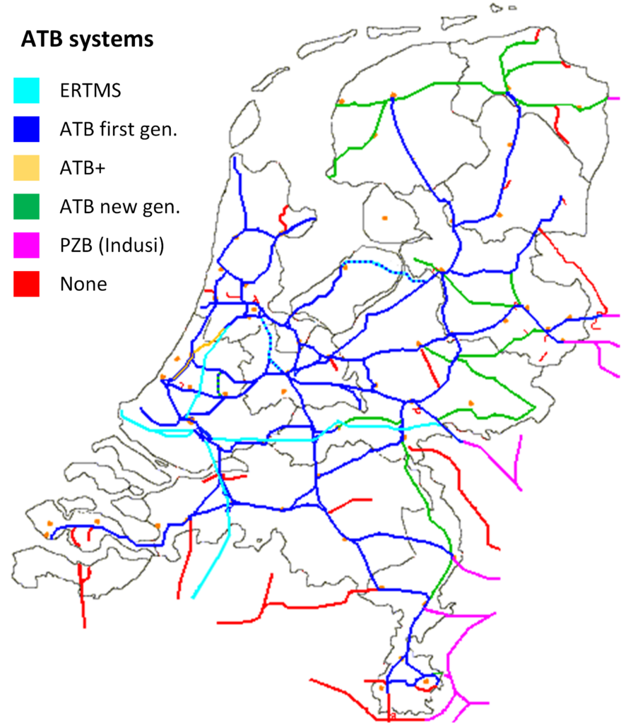
Translated version of the Dutch ATB map. Original Dutch version can be found at: http://nl.wikipedia.org/wiki/ATB_Nieuwe_Generatie#/media/File:ATB-kaart.png
Licensing
![]()
This file has been released into the public domain by the copyright holder, its copyright has expired, or it is ineligible for copyright. This applies worldwide.
Please, please use more specific template such as {{PD-self}} / {{PD-creator}} / {{PD-shape}} / {{PD-USGov}} / {{PD-old}} / {{PD-RU-exempt}} ... This template is not making clear why this work is in the public domain.
Please, please use more specific template such as {{PD-self}} / {{PD-creator}} / {{PD-shape}} / {{PD-USGov}} / {{PD-old}} / {{PD-RU-exempt}} ... This template is not making clear why this work is in the public domain.
File history
Click on a date/time to view the file as it appeared at that time.
| Date/Time | Thumbnail | Dimensions | User | Comment | |
|---|---|---|---|---|---|
| current | 10:10, 31 March 2015 | | 2,839 × 3,307 (2.99 MB) | JJJWegdam (talk | contribs) | Translated version of the Dutch ATB map. Original Dutch version can be found at: http://nl.wikipedia.org/wiki/ATB_Nieuwe_Generatie#/media/File:ATB-kaart.png |
You cannot overwrite this file.
File usage
There are no pages that use this file.