File:Basiskaart Wegen A0 20211019.svg
Jump to navigation
Jump to search


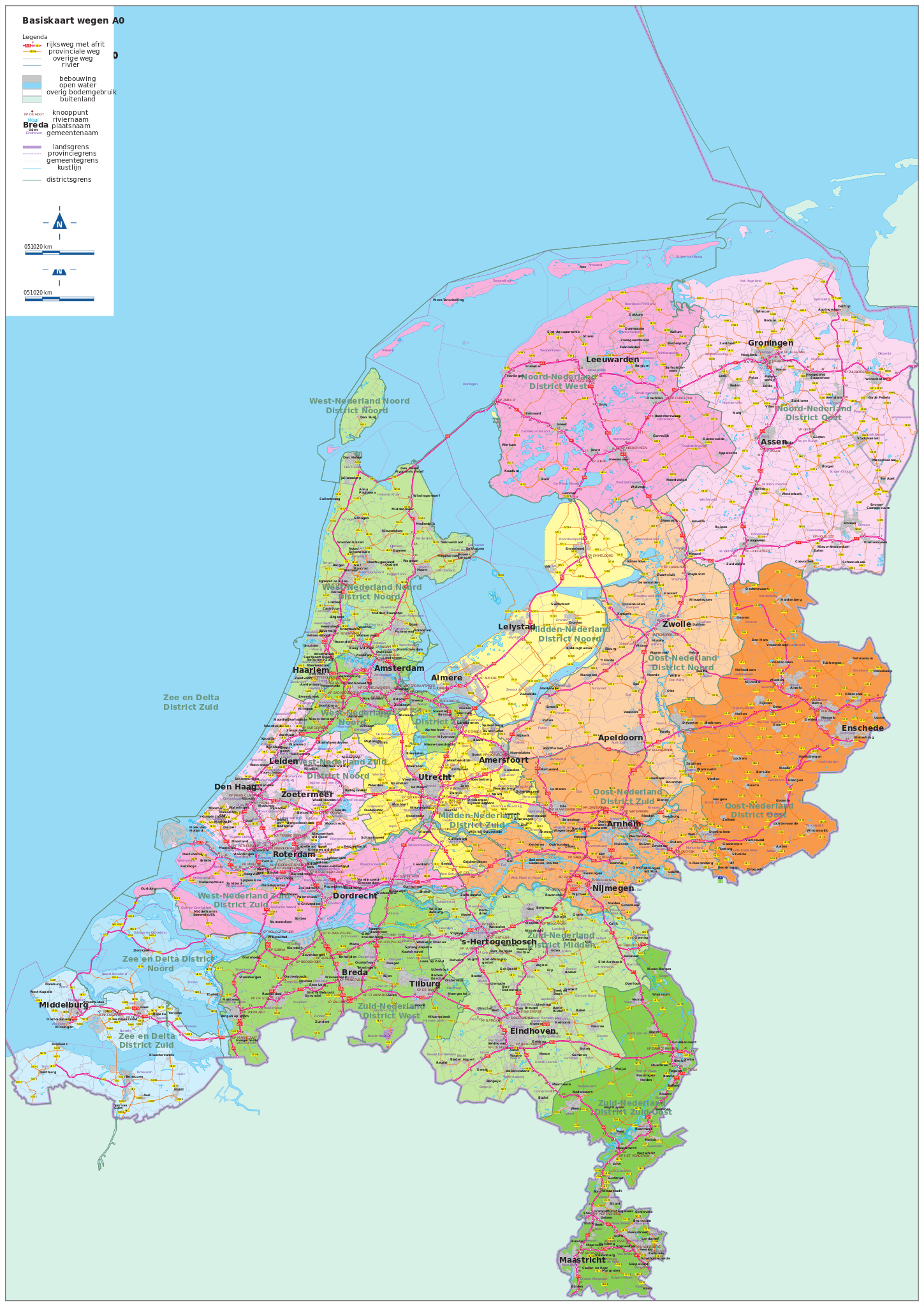
Size of this PNG preview of this SVG file: 424 × 599 pixels. Other resolutions: 170 × 240 pixels | 339 × 480 pixels | 543 × 768 pixels | 724 × 1,024 pixels | 1,449 × 2,048 pixels | 3,179 × 4,494 pixels.
Original file (SVG file, nominally 3,179 × 4,494 pixels, file size: 51.68 MB)
Summary
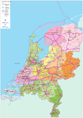
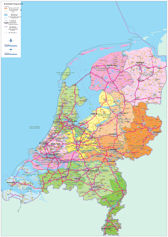
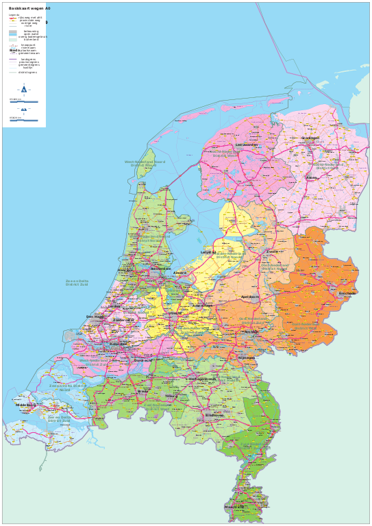
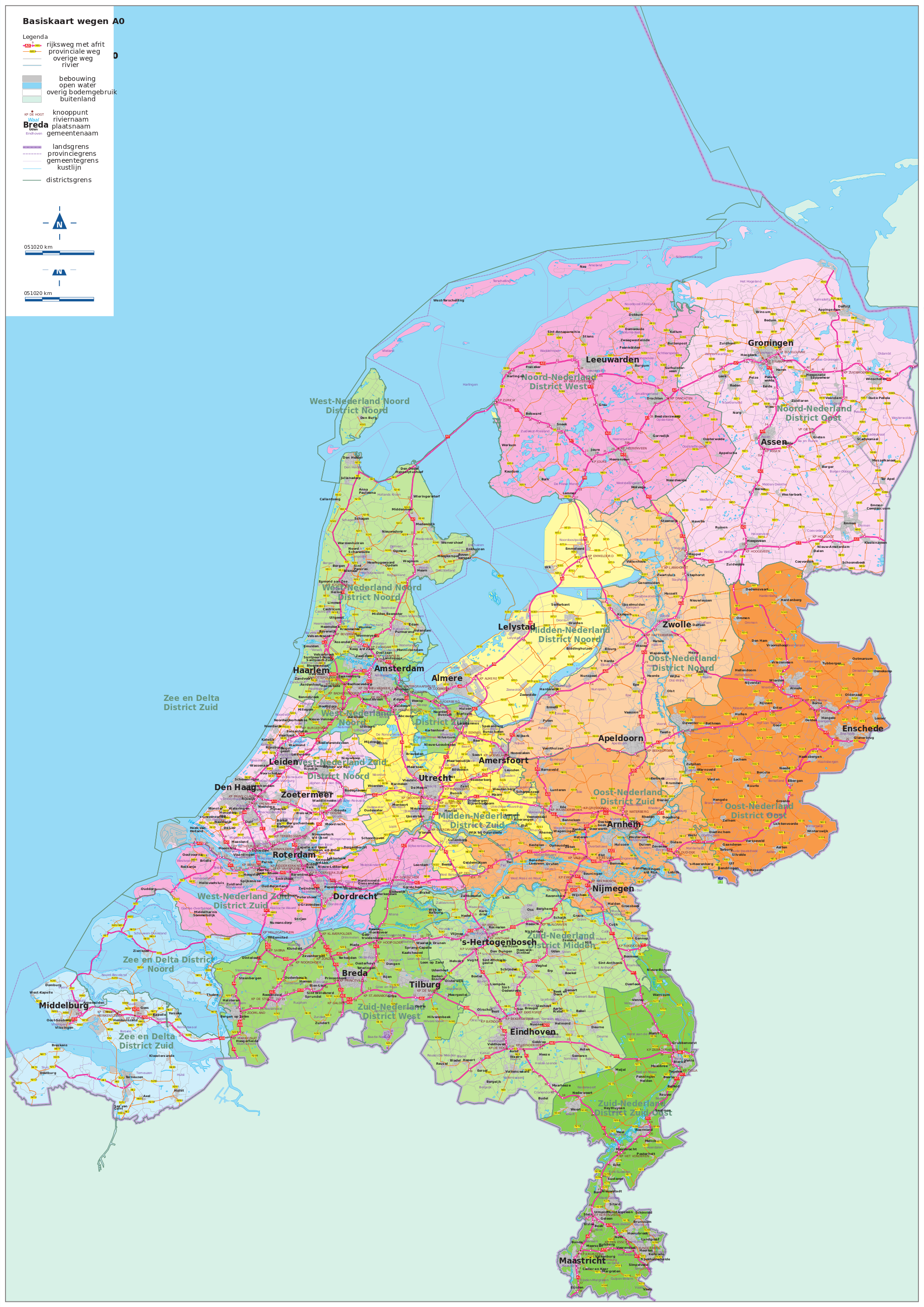
| Description | Wegenkaart Nederland 2021 - official road map of the Netherlands from Rijkswaterstaat (Dutch national road authority) |
|---|---|
| Author | Rijkswaterstaat Centrale Informatievoorziening (source) |
| Source | [1] (converted from PDF to SVG) |
| Date | 2021-10-19 |
| Permission | Geen beperkingen (source) |
Licensing
![]()
![]()
This file is made available under the Creative Commons CC0 1.0 Universal Public Domain Dedication.
The person who associated a work with this deed has dedicated the work to the public domain by waiving all of his or her rights to the work worldwide under copyright law, including all related and neighboring rights, to the extent allowed by law. You can copy, modify, distribute and perform the work, even for commercial purposes, all without asking permission.
File history
Click on a date/time to view the file as it appeared at that time.
| Date/Time | Thumbnail | Dimensions | User | Comment | |
|---|---|---|---|---|---|
| current | 20:48, 11 October 2022 | | 3,179 × 4,494 (51.68 MB) | JeroenvanderGun (talk | contribs) | {{Information | description=''Wegenkaart Nederland 2021'' - official road map of the Netherlands from Rijkswaterstaat (Dutch national road authority) | source=[https://downloads.rijkswaterstaatdata.nl/wegenkaart/geogegevens/pdf/versie%202021/Basiskaart_Wegen_A0_20211019.pdf] | date=2021-10-19 | author=Rijkswaterstaat Centrale Informatievoorziening [https://downloads.rijkswaterstaatdata.nl/wegenkaart/productinfo/metainfo/wegenkaart_2021.xml (source)] | permission=[http://creativecommons.org/pu... |
You cannot overwrite this file.
File usage
The following page uses this file: